Situation Summary
Russia faces an intensifying campaign of Ukrainian drone strikes across western and southern regions, with strikes on energy infrastructure, military logistics nodes, and maritime assets occurring daily as of June 17–18, 2026. Moscow remains the highest-risk location (99.4 composite score), driven by repeated air-defense activity and airspace closures following reported Ukrainian long-range drone approaches. Regional stability is further strained by reports of Russian military force deployments and ongoing small-arms engagement with UK forces, signaling operational tempo expansion. The threat trajectory remains elevated with no indicators of de-escalation.
Key Developments
- Moscow & Moscow Oblast, June 17: Airspace temporarily closed and civil flights diverted after Ukrainian drones approached the capital; air-defense activity and explosions reported in Moscow city area and surrounding regions.
- Sochi International Airport, Krasnodar Krai, June 17: Extensive flight disruptions and passenger stranding after Ukrainian drone activity triggered air-defense responses and civil aviation restrictions affecting hundreds of travelers.
- Tamannaftogas Terminal, Temryuk, Krasnodar Krai, June 16–17: Ukrainian drone strikes ignited at least five oil product storage tanks and damaged loading infrastructure at the Black Sea oil and gas terminal; Ukraine's SSU claimed responsibility.
- Kursk City, Kursk Oblast, June 17: Multiple Ukrainian kamikaze drones struck energy infrastructure on city outskirts, triggering fires and localized power interruptions; emergency services deployed.
- Bryansk Oblast (Navlya area), June 17: Ukrainian drone strikes targeted suspected Russian long-range drone launch and logistics sites, with fires and explosions documented by local residents.
- Shatalovo Military Airfield, Smolensk Oblast, June 17: Explosions reported near the known Russian long-range strike drone launch facility following Ukrainian targeting; air-defense activation confirmed.
- Black Sea "Shadow Fleet" Tanker, June 16–17 night: Ukrainian forces struck a Russian sanctions-evasion oil tanker, forcing maritime rerouting and disruption of tanker movements from southern Russian ports.
- Kapustin Yar, Astrakhan Oblast, June 17: Intelligence reports indicate preparations for possible Oreshnik intermediate-range ballistic missile launch toward Ukraine within 24–48 hours; elevated air-travel and regional security risk.
Highest-Risk Areas
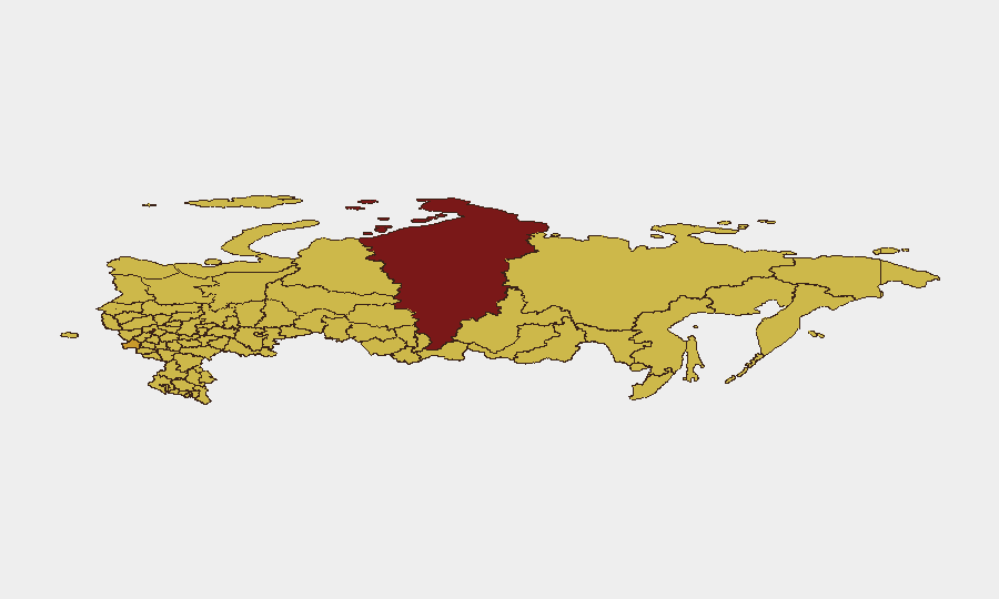
Moscow dominates the risk landscape (99.4), reflecting its status as the capital and repeated target of Ukrainian drone operations; Moscow Oblast shares exposure to airspace disruptions and air-defense activity. Krasnodar Krai (70.9) and Krasnoyarsk Krai (92.9) rank second and third nationally, driven by energy infrastructure targeting, airport disruptions, and maritime strikes along the Black Sea. Bryansk Oblast (71) and western oblasts (Tula, Smolensk) face ongoing drone strikes on military logistics and airfield infrastructure. These regions experience cascading effects: airspace closures disrupt civil aviation and supply chains; energy strikes degrade power and fuel distribution; maritime disruptions strain sanctions-evasion networks. Proximity to Ukraine, concentration of military assets, and energy/logistics infrastructure make these zones persistent targets.
How GeoBit Would Assist
Intel Sweep & OSINT fusion across Telegram, X, and Ukrainian/Russian military channels provide 24-hour situational updates on drone strikes, airspace status, and infrastructure damage. Persistent AOI monitoring with alerting on Moscow, Krasnodar Krai, and Bryansk Oblast would detect airspace closures, military movements, and energy disruptions in near-real time, enabling rapid duty-of-care alerts to personnel. Conflict & military mapping combined with maritime & aviation tracking would flag IRBM launch preparations, shadow fleet activity, and airport operational status, informing route planning and travel advisories.
7-Day Outlook
Ukrainian drone strike frequency and geographic dispersal (Moscow to Black Sea to Astrakhan) suggest sustained operational intensity over the next week. Anticipated Oreshnik launches and continued infrastructure targeting will likely sustain airspace volatility, flight disruptions, and power outages in high-risk regions. Corporate teams should expect ongoing travel delays, logistics interruptions, and localized infrastructure failures, particularly in Moscow, Krasnodar, and western oblasts.
Highest-Risk Areas — Ranked
| # | State / Region | Risk |
|---|---|---|
| 1 | Moscow | 99.4 |
| 2 | Krasnoyarsk Krai | 92.9 |
| 3 | Bryansk Oblast | 71 |
| 4 | Volgograd Oblast | 70.9 |
| 5 | Krasnodar Krai | 70.9 |
| 6 | Tula Oblast | 70.6 |
| 7 | Chuvashia | 70.4 |
| 8 | Saint Petersburg | 70.2 |
| 9 | Republic of North Ossetia – Alania | 70.2 |
| 10 | Leningrad Oblast | 70 |
| 11 | Tatarstan | 70 |
| 12 | Samara Oblast | 70 |
Sources
Previous Daily Briefs
A new Russia brief is written every day — each with its own risk map and downloadable CSV. Here's the last week; use the calendar to go further back.
📅 Browse every day by calendar →
Highlighted days have a brief. Tap a day for that day's map & analysis, or “csv” for that day's dataset ($5).