Situation Summary
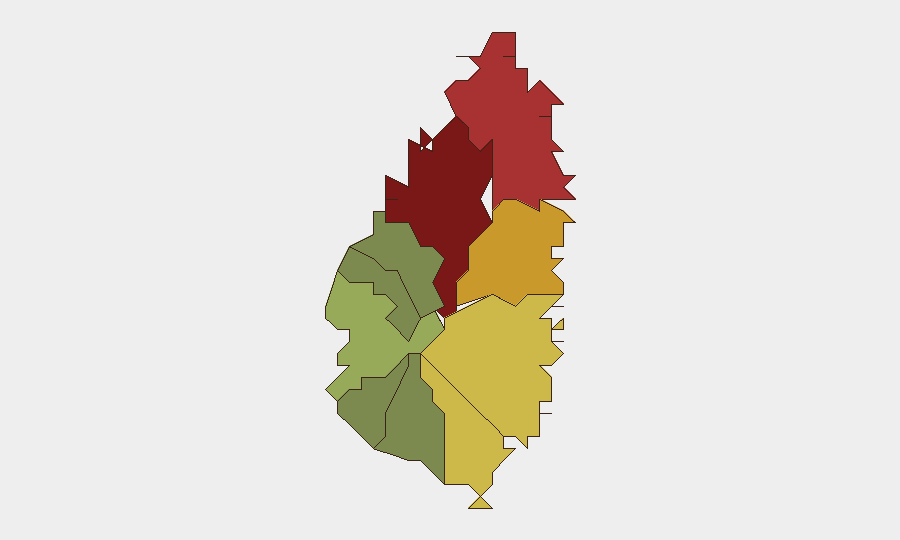
Saint Lucia remains under a Level 2 U.S. State Department travel advisory (issued 10 July 2026) due to armed robbery, assault, burglary, and theft targeting residents and visitors. No new security incidents have been corroborated in the past 24–48 hours; the threat environment reflects persistent opportunistic and street crime concentrated in urban areas, particularly Castries and Gros Islet. The sub-national risk profile shows a steep gradient, with the capital and northern tourist zones accounting for the majority of elevated risk, while southern and western parishes remain materially lower-risk.
Key Developments
- No verified security or crime incidents recorded in Saint Lucia during the past 24–48 hours (as of 28 July 2026, 00:00–48:00 UTC). Current web and social-media monitoring, including X/Twitter and regional crime-reporting networks, show no multi-source corroboration of new events meeting incident criteria.
- Maritime theft risk remains active. A dinghy theft from a visiting yacht in Rodney Bay (23–24 July) underscores ongoing opportunistic maritime petty crime targeting vessels at anchor, particularly during nighttime hours. No new incidents reported in the past 24 hours, but the pattern reflects persistent risk to the charter and tourism fleet.
- Fatal marine collision investigation ongoing. The 18 July collision between *Ocean Angel* and *Mango Tours* off Anse Cochon (four dead, 14 injured) remains under investigation by the Royal Saint Lucia Police Force Marine Unit. No updates released in the past 24 hours; closure timeline unknown.
Highest-Risk Areas
Castries (risk 95) and Gros Islet (risk 78) drive the island's composite threat score and account for the majority of reported crime. Castries, the capital and primary commercial hub, faces elevated risk of armed robbery, burglary, and street crime; Gros Islet, home to Rodney Bay resort zone, sees opportunistic theft and assault concentrated around nightlife and tourist accommodation areas. Dennery, Vieux Fort, and Micoud (risk 72, 68, 65 respectively) represent a secondary tier of moderate-to-elevated risk. Southern parishes (Canaries, Anse La Raye, Choiseul) and Soufrière remain substantially lower-risk, reflecting lighter tourist density and lower urbanization.
How GeoBit Would Assist
Intel Sweep and OSINT Fusion would enable continuous multi-language monitoring of X/Twitter, Telegram, and regional crime-reporting networks to detect emerging incidents in real time and cross-corroborate reports before they reach mainstream media. AOI Monitoring & Early Warning with persistent geofencing on high-risk parishes (Castries, Gros Islet, Vieux Fort) and tourist accommodation clusters would deliver immediate alerting to duty-of-care teams when corroborated incidents occur. Routing & Network Analysis would support secure itinerary planning for personnel transiting Castries, airport transfers from Vieux Fort Hewanorra, and night-movement avoidance in Rodney Bay.
7-Day Outlook
No significant escalation in the security environment is forecast over the next seven days. The Level 2 advisory and updated Tourism Authority guidance remain the principal risk-management drivers; organizations should maintain baseline protocols for personnel movement, accommodation security audits, and cash/valuables handling. Seasonal tourism patterns and the absence of scheduled political or civil events suggest stable conditions, though opportunistic crime remains endemic to urban zones.
Highest-Risk Areas — Ranked
| # | State / Region | Risk |
|---|---|---|
| 1 | Castries | 95 |
| 2 | Gros Islet | 78 |
| 3 | Dennery | 72 |
| 4 | Vieux Fort | 68 |
| 5 | Micoud | 65 |
| 6 | Soufrière | 42 |
| 7 | Laborie | 38 |
| 8 | Choiseul | 35 |
| 9 | Anse La Raye | 28 |
| 10 | Canaries | 12 |
Sources
Previous Daily Briefs
A new Saint Lucia brief is written every day — each with its own risk map and downloadable CSV. Here's the last week; use the calendar to go further back.
📅 Browse every day by calendar →
Highlighted days have a brief. Tap a day for that day's map & analysis, or “csv” for that day's dataset ($5).
Atlas — our AI intelligence desk — emails them this snapshot personally. Nothing else, no list.