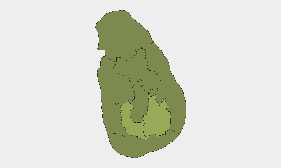
Situation Summary
Sri Lanka remains at moderate overall threat level (rank #52 globally; composite score 37) with no verified major incidents in the past 24–48 hours. Institutional friction—including civil-society demands for accountability on alleged custodial abuses, parliamentary scrutiny, and ongoing IMF engagement—continues to generate policy-level pressure and public signaling rather than acute violence or infrastructure disruption. Geographic volatility is concentrated in Uva and Western Provinces, where structural economic and governance tensions are highest; Colombo and surrounding areas remain subject to frequent demonstrations and checkpoint activity.
Key Developments
No verified major security incidents (attacks, significant protests, or infrastructure failures) have been corroborated in open-source monitoring for the 24–48 hours ending 30 June 2026.
Signal-level activity recorded by GeoBit event feeds (demands directed at UN and government bodies, media disapproval, and reported hunger-strike activity on 27 June) lacks specific location, scale, or real-time confirmation and therefore cannot be converted into actionable incident bullets. Travel-advisory standing guidance from Canada and the UK notes frequent demonstrations in Colombo and military/checkpoint presence, but these reflect ongoing conditions rather than new developments. Civil-society reporting continues to highlight allegations of custodial mistreatment under counter-terrorism legislation and calls for accountability; these represent longer-running legal and human-rights processes, not dated security events in the last 48 hours.
Highest-Risk Areas
Uva Province (composite risk 55.8) and Sabaragamuwa Province (40.8) are the primary drivers of sub-national volatility, followed by Western Province (37.8)—which includes Colombo and is the center of government, media, and demonstration activity. Uva's elevated risk reflects economic marginalization and resource-access grievances; Sabaragamuwa and Western Provinces show elevated institutional friction and public-sector labor/accountability pressures. Northern Province (37.1) retains structural tension related to post-conflict recovery and governance. The remaining provinces (Central, Southern, North Central, North Western, Eastern) sit below 30 on the composite scale, indicating lower acute risk but persistent underlying vulnerabilities.
How GeoBit Would Assist
Security teams with personnel or assets in Sri Lanka should employ AOI Monitoring & Early Warning on Colombo, Kandy (Central Province), and Jaffna to detect short-notice protest activity or checkpoint changes; Intel Sweep and multi-language OSINT to track civil-society and media messaging around accountability debates and labor actions; and Conflict & Military tracking to monitor military deployment patterns and checkpoint operations, particularly in Uva and Western Provinces. GIS & Spatial Analysis can support alternative routing and journey planning around high-risk areas during periods of demonstration activity. Real-time X/Twitter and Telegram OSINT enables rapid detection of localized incidents and public sentiment shifts.
7-Day Outlook
Near-term trajectory is toward continued institutional signaling and policy debate without imminent large-scale violence or infrastructure disruption. Risk of localized, short-notice demonstrations in Colombo and provincial centers (especially Uva) remains elevated; teams should anticipate continued checkpoint presence and possible road closures near government and military sites. Any escalation in accountability mechanisms or IMF-related austerity announcements may trigger uptick in organized public action, particularly in economically stressed areas.
Highest-Risk Areas — Ranked
| # | State / Region | Risk |
|---|---|---|
| 1 | Uva Province | 55.8 |
| 2 | Sabaragamuwa Province | 40.8 |
| 3 | Western Province | 37.8 |
| 4 | Northern Province | 37.1 |
| 5 | North Central Province | 28.8 |
| 6 | Central Province | 27.3 |
| 7 | Southern Province | 27.3 |
| 8 | North Western Province | 25.8 |
| 9 | Eastern Province | 25.8 |
Sources
Previous Daily Briefs
A new Sri Lanka brief is written every day — each with its own risk map and downloadable CSV. Here's the last week; use the calendar to go further back.
📅 Browse every day by calendar →
Highlighted days have a brief. Tap a day for that day's map & analysis, or “csv” for that day's dataset ($5).