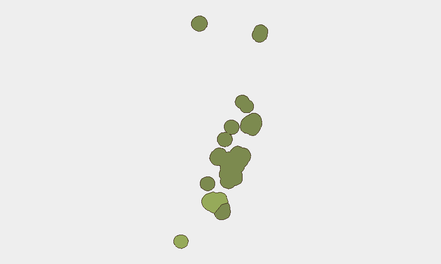
Situation Summary
Tonga remains a low-threat environment with no verified security incidents, civil unrest, armed conflict, or major crime events in the past 24–48 hours. The nation's composite threat score of 2 reflects its overall stability, though localized criminal activity—particularly in the capital region—warrants baseline monitoring. No travel advisories, infrastructure failures, or political destabilization are currently reported.
Key Developments
- Nukuʻalofa (Central Police Station) — *Ongoing as of 28 Jul 2026* — Two escapees from Central Police Station remain at large; no new apprehensions or related incidents have been reported in the last 24–48 hours.
- Mataika, Tongatapu — *27 Jul 2026* — Three men were arrested and charged in connection with a shooting outside a residence that left a 31-year-old man seriously injured; investigation into the underlying dispute is ongoing.
- South of Tonga — *Timestamp unclear* — A magnitude 5.0 earthquake was recorded south of Tonga; impact on the main islands has not been reported in available open-source coverage.
- National Level — *28 Jul 2026* — Multi-source OSINT monitoring confirmed no new security, civil-unrest, armed-conflict, or major-crime incidents nationwide in the prior 24–48 hours.
Highest-Risk Areas
Tongatapu dominates the sub-national risk landscape (score 45), driven primarily by concentrated urban crime in and around Nukuʻalofa, the capital and economic center where most corporate and expatriate personnel are based. The recent shooting arrest and ongoing police manhunt reflect underlying patterns of interpersonal and property-related violence in the capital. Vavaʻu (risk 28) and Haʻapai (risk 22) carry moderate residual risk; the outer islands ʻEua and Ongo Niua remain lower-threat. Risk concentrates in population centers and is primarily criminal rather than political or conflict-driven.
How GeoBit Would Assist
Security teams with personnel or assets in Tonga should deploy AOI Monitoring & Early Warning to track Nukuʻalofa and surrounding Tongatapu for emerging crime clusters or civil-unrest signals; OSINT Sweep (X/Twitter, Telegram, local news feeds, and multi-language search) to capture real-time incident reporting and police activity; and Network & Actor Analysis to map known criminal organizations and repeat offenders. Risk & Threat Assessment provides structured quarterly re-baselining as the security picture evolves.
7-Day Outlook
No acute deterioration is anticipated in the next seven days. Routine criminal activity in Tongatapu will likely persist at current baseline levels; resolution of the police escape and ongoing assault investigation will be monitored. Personnel in the capital should maintain standard duty-of-care protocols (situational awareness, secure transport, restricted movement after dark in high-crime neighborhoods) and remain alert to any escalation in gang-related or property crime.
Highest-Risk Areas — Ranked
| # | State / Region | Risk |
|---|---|---|
| 1 | Tongatapu | 45 |
| 2 | Vavaʻu | 28 |
| 3 | Haʻapai | 22 |
| 4 | ʻEua | 18 |
| 5 | Ongo Niua | 12 |
Sources
Previous Daily Briefs
A new Tonga brief is written every day — each with its own risk map and downloadable CSV. Here's the last week; use the calendar to go further back.
📅 Browse every day by calendar →
Highlighted days have a brief. Tap a day for that day's map & analysis, or “csv” for that day's dataset ($5).
Atlas — our AI intelligence desk — emails them this snapshot personally. Nothing else, no list.