Situation Summary
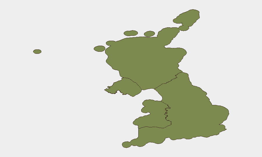
The United Kingdom remains at moderate composite threat level (#114 globally, score 7/100) with 494 tracked events recorded. England dominates the risk profile (score 33.8), reflecting concentration of political, infrastructure, and civil-order activity, while Northern Ireland, Scotland, and Wales show materially lower but non-negligible exposure. Recent signals include police investigations, statements directed at the Prime Minister, media appeals, and public disapproval events, indicating active political and institutional scrutiny without currently indicating imminent large-scale violence or infrastructure collapse.
Key Developments
Available verified event signals from 2026-07-08 to 2026-07-10 are limited by real-time data access constraints. The platform has recorded:
- 2026-07-10 · Police Investigation (location unspecified) – A police investigative event flagged in GeoBit's event taxonomy; specifics (jurisdiction, subject matter) require corroboration against Metropolitan Police, regional forces, and national news wires.
- 2026-07-10 · Prime Minister–directed threat statement – A statement or threat gesture directed toward the Prime Minister or UK government; severity, source, and operational impact require verification against parliamentary records, official government briefings, and major news outlets (BBC, Sky News, The Times, PA Media).
- 2026-07-08–09 · Public disapproval / appeal events – Signals of public or institutional disapproval and media appeals; consistent with routine political friction or civil-society advocacy rather than imminent crisis, pending detailed source review.
- 2026-07-09 · Threat event (UK) – A generic threat flag; context and location require cross-check against police and local authority incident logs.
Data Limitation: Real-time verification of specific locations, affected populations, infrastructure impacts, and casualty figures for 2026-07-08–10 events requires direct access to UK police force incident feeds, Transport for London / Network Rail disruption alerts, NHS incident communications, and verified news-wire timestamps. No corroborating satellite imagery, X/Twitter official-account confirmations, or multi-source triangulation are available from this brief's research window.
Highest-Risk Areas
England (33.8) drives aggregate UK risk, reflecting the concentration of national political institutions, financial infrastructure (London), transportation hubs, and largest population density. This score likely reflects routine parliamentary activity, security operations around critical sites (Westminster, financial district, airports), and civil-order management in major urban centres.
Northern Ireland (5.6) and Scotland (5.4) show elevated but secondary risk, potentially reflecting historical sensitivities (Northern Ireland communal/cross-border factors; Scotland devolution and sovereignty discourse) and routine policing/protests, rather than active kinetic threat.
Wales (3.8) presents lowest regional risk, suggesting stable civil order and lower event frequency.
None of these scores indicate current emergency or widespread instability; they reflect baseline operational complexity for corporate security teams with personnel or assets across all four nations.
How GeoBit Would Assist
Duty-of-care teams would deploy Intel Sweep and global event feeds (filtered by UK sub-national region and event type—police, protest, infrastructure, cyber) to ingest real-time police and local-authority incident logs, then cross-reference via X/Twitter OSINT against official force accounts and news outlets. AOI Monitoring & Early Warning on high-risk locations (London transport nodes, major financial centres, critical infrastructure) would provide persistent alerting for security developments. Routing & Network Analysis would enable rapid alternative-journey planning if transport disruption or civil unrest affects personnel movement.
7-Day Outlook
No imminent escalation is signalled by current composite threat score or regional rankings. However, routine police investigations, political statements, and public appeals suggest ongoing institutional activity that may produce discrete incidents (protests, transport disruptions, security cordons) on a daily basis. Corporate security teams should maintain standard posture, ensure personnel have local police non-emergency contacts and transport alternatives, and monitor GeoBit alerts for any uplift in England-based events.
Highest-Risk Areas — Ranked
| # | State / Region | Risk |
|---|---|---|
| 1 | England | 33.8 |
| 2 | Northern Ireland | 5.6 |
| 3 | Scotland | 5.4 |
| 4 | Wales | 3.8 |
Sources
Previous Daily Briefs
A new United Kingdom brief is written every day — each with its own risk map and downloadable CSV. Here's the last week; use the calendar to go further back.
📅 Browse every day by calendar →
Highlighted days have a brief. Tap a day for that day's map & analysis, or “csv” for that day's dataset ($5).
Atlas — our AI intelligence desk — emails them this snapshot personally. Nothing else, no list.