Situation Summary
Uruguay remains one of the world's lowest-threat environments (global rank #157, composite score 5), with no active armed conflict, minimal political instability, or widespread civil unrest. Recent event signals (arrests, public statements, disapproval incidents) suggest routine administrative and political activity rather than emergent security crises. The country's risk profile is heavily concentrated in Durazno department, which accounts for the majority of tracked threat indicators; most other regions register negligible scores.
Key Developments
- Montevideo, 24 June 2026: Ministry of the Interior launched a city-wide autonomous drone "first responder" program integrated with the ShotSpotter gunshot-detection system. The initiative, developed with Timerix S.A. and FlytBase, will dispatch drones to provide live aerial video to police during critical incidents, signaling a technology-forward approach to urban public safety.
- National level, 26 June 2026: Presidential public statement and concurrent Ministry statement recorded in event signals; specific content and context not corroborated in available open reporting. Both appear consistent with routine government communication rather than crisis response.
- National level, 26 June 2026: Arrest/detain event recorded; no specific location, scale, or charge detail available from verified sources within the 24–48-hour window.
- National level, 24 June 2026: Arrest/detain event at or involving a prison facility; insufficient detail in available reporting to assess scope or security implications.
- Background context (2026-06-25): Event signals reference disapproval, small arms combat in "Lorraine," and conventional military force involving Treasury Secretary and Russia. These signals are geographically and institutionally inconsistent with Uruguay's domestic threat landscape and likely reflect external regional or global events captured incidentally in signal processing.
Note: Open-source reporting does not currently corroborate specific, time-stamped security incidents (protests, violent crime, infrastructure failures, or public order disruptions) within the last 48 hours beyond the drone program announcement.
Highest-Risk Areas
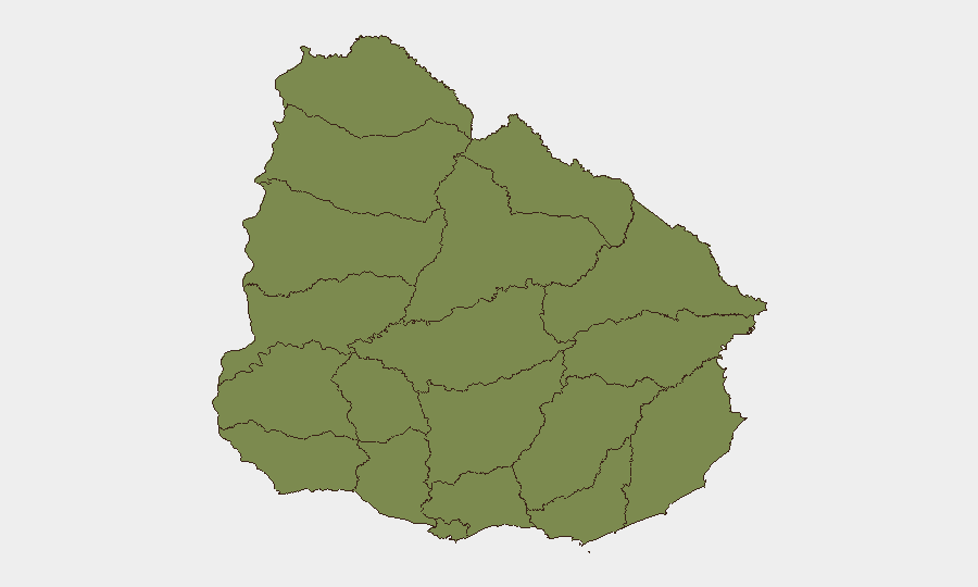
Durazno department is the sole significant risk concentration, with a composite score of 31.9—roughly five times higher than all other departments. Colonia registers the second-highest score (6.6), though still markedly lower than Durazno. The remaining ten tracked departments (Río Negro, Artigas, Salto, Paysandú, Rivera, Tacuarembó, Soriano, Flores, San José, Florida) all score below 2.0 and are effectively at baseline risk.
The disproportionate Durazno spike warrants targeted monitoring, though context on the specific drivers (organized crime, drug trafficking, gang activity, or administrative events) is not detailed in available signals. Colonia's secondary elevation may reflect border-adjacent vulnerabilities or cross-river smuggling activity, common to western riverside departments.
How GeoBit Would Assist
Security teams in Uruguay should deploy AOI Monitoring & Early Warning focused on Durazno and Colonia to establish persistent baseline activity and alert on sudden anomalies. Intel Sweep with multi-language OSINT fusion, X/Twitter and Telegram monitoring, and entity extraction would provide real-time visibility into political messaging, protest organization, and criminal-network communications. GIS & Spatial Analysis layered with conflict and crime search capabilities would help contextualize the Durazno risk elevation and identify specific neighborhoods or infrastructure requiring enhanced due-diligence protocols.
7-Day Outlook
No near-term deterioration is anticipated. The overall threat environment remains stable, and event signals suggest normal administrative activity. The new drone-based public safety program in Montevideo may marginally improve incident response times in the capital, reducing dwell time for critical emergencies. Continued monitoring of Durazno's underlying risk drivers is prudent, but no escalation is forecast absent new corroborating signals.
Highest-Risk Areas — Ranked
| # | State / Region | Risk |
|---|---|---|
| 1 | Durazno | 31.9 |
| 2 | Colonia | 6.6 |
| 3 | Río Negro | 3.5 |
| 4 | Artigas | 1.9 |
| 5 | Salto | 1.9 |
| 6 | Paysandú | 1.9 |
| 7 | Rivera | 1.9 |
| 8 | Tacuarembó | 1.9 |
| 9 | Soriano | 1.9 |
| 10 | Flores | 1.9 |
| 11 | San José | 1.9 |
| 12 | Florida | 1.9 |
Sources
Previous Daily Briefs
A new Uruguay brief is written every day — each with its own risk map and downloadable CSV. Here's the last week; use the calendar to go further back.
📅 Browse every day by calendar →
Highlighted days have a brief. Tap a day for that day's map & analysis, or “csv” for that day's dataset ($5).