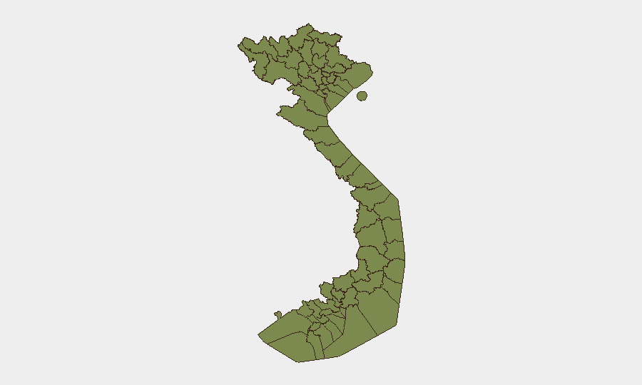
Situation Summary
Vietnam remains a composite-threat Level 6 (rank #123 globally) with 138 tracked events, characterized by localized natural-disaster impacts, routine law-enforcement actions, and monitored political sensitivities rather than active large-scale conflict or civil unrest. The security environment is regionally fragmented, with northern mountainous provinces experiencing acute flood-related humanitarian risk while urban centers manage conventional crime and online fraud schemes. Current trajectory reflects seasonal flood pressures in vulnerable northern regions and continued state monitoring of political messaging, without indication of escalating instability.
Key Developments
- Lai Châu Province (Mường Than commune, Bản Chít) — 17–18 July 2026
Flash flooding and river surges killed at least 5 people with 7 confirmed missing; provincial authorities declared a state of emergency with ongoing landslide and flood-surge warnings affecting mountainous settlements.
- Lai Châu Province (unspecified villages) — 18 July 2026
Search-and-rescue operations underway following flash-flood incidents that killed at least 4 with 4 missing; authorities warn of continued high water and precipitation risk in northern upland zones.
- Tuyên Quang Province — 18 July 2026
Emergency detention order ("giữ người trong trường hợp khẩn cấp") executed for teacher Nguyễn Hà Duy; case being handled by security agencies as a law-enforcement matter with limited public detail.
- Nghệ An Province — 18 July 2026
Criminal-investigation police took action against individuals involved in armed youth-group clash on roadway; classified as serious public-order incident.
- Lâm Đồng Province (Đà Lạt City) — 18 July 2026
Arrest of suspect Phạm Duy Trung concluded 72-hour investigation into daytime street robbery (phone snatching) on 14 July; routine street-crime case.
- Vietnam (national level) — 17–18 July 2026
Central authorities and state media issued politically sensitive public statements regarding Israel alongside messaging to domestic activist groups; heightened monitoring of potential demonstrations, no large-scale unrest confirmed.
- Vietnam (multi-location, online) — 18 July 2026
Security warnings issued of fraud targeting travelers via fake hotel websites and social-media pages impersonating legitimate lodging providers; multiple tourists reported as recent victims.
Highest-Risk Areas
Tuyên Quang (risk 34.3) and Huế (risk 29.4) drive the composite provincial threat ranking, with Tuyên Quang reflecting both detention/security actions and baseline instability indicators, while Huế's elevated score reflects historical and political sensitivities. Ho Chi Minh City (16.5) and Hà Nội (14.1) represent urban centers with routine crime, fraud, and civil-order management rather than conflict activity. Northern mountainous provinces (Lai Châu, Lào Cai, Hà Giang, Cao Bằng, Bắc Kạn, Điện Biên, Yên Bái) cluster at 4.3, currently driven by acute seasonal flood and landslide risk rather than security events.
How GeoBit Would Assist
Corporate security teams with Vietnam operations should deploy AOI Monitoring & Early Warning on Tuyên Quang, Lai Châu, and Huế to track emerging political, law-enforcement, and natural-hazard signals in real time. Conflict & Military tracking, Network & Actor Analysis, and multi-language OSINT (X, Telegram, Vietnamese media) enable detection of activist mobilization or regime-stability shifts before public escalation. Routing & Network Analysis supports alternative travel planning around flood-affected northern provinces and high-crime urban zones.
7-Day Outlook
Northern flood-risk zones will likely remain under active emergency response through late July as monsoon patterns persist; humanitarian impacts and road/infrastructure disruption should be expected. Political messaging around Israel and activist monitoring will continue at elevated baseline without clear indicators of organized unrest. Routine urban crime (robbery, fraud) and youth-group incidents will remain the dominant security features in populated centers.
Highest-Risk Areas — Ranked
| # | State / Region | Risk |
|---|---|---|
| 1 | Tuyên Quang Province | 34.3 |
| 2 | Huế | 29.4 |
| 3 | Ho Chi Minh City | 16.5 |
| 4 | Hà Nội | 14.1 |
| 5 | Tiền Giang Province | 4.9 |
| 6 | Lai Châu Province | 4.3 |
| 7 | Lào Cai Province | 4.3 |
| 8 | Hà Giang Province | 4.3 |
| 9 | Cao Bằng Province | 4.3 |
| 10 | Bắc Kạn Province | 4.3 |
| 11 | Điện Biên Province | 4.3 |
| 12 | Yên Bái Province | 4.3 |
Sources
Previous Daily Briefs
A new Vietnam brief is written every day — each with its own risk map and downloadable CSV. Here's the last week; use the calendar to go further back.
📅 Browse every day by calendar →
Highlighted days have a brief. Tap a day for that day's map & analysis, or “csv” for that day's dataset ($5).
Atlas — our AI intelligence desk — emails them this snapshot personally. Nothing else, no list.