Situation Summary
Zimbabwe remains at composite threat rank #111 globally with a score of 4.0, reflecting endemic political tension, economic strain, and urban crime concentrated in Harare, offset by relative stability in most provinces. Open-source monitoring over the last 24–48 hours has recorded no verifiable acute incidents—no new protests, clashes, arrests, or infrastructure disruptions—and local law-enforcement messaging emphasizes routine public-order posture. Underlying risks (chronic crime, political friction ahead of planned July 31 protests against Constitutional Amendment Act No. 3) remain elevated but currently stable. The security environment is neither deteriorating nor improving materially in the immediate term.
Key Developments
- Nationwide, 2026-07-29 to 2026-07-30: Zimbabwe Police and government agencies issued public statements confirming "business as usual" across the country and reaffirming law-enforcement readiness. No corroborated new arrests, clashes, or unrest incidents have been recorded in official or independent feeds during this window.
- Harare, ongoing into late July: Multiple open-source intelligence feeds continue to track government warnings and security-force positioning around planned July 31 constitutional-amendment protests. No fresh protest activity or clashes have been confirmed in the last 24–48 hours; prior crackdowns and activist intimidation pre-date this reporting window.
- National media environment, 2026-07-28 to 2026-07-30: Extensive public statements by government, civil-society figures, and international media outlets (including Al Jazeera) on political and governance issues have been amplified across social platforms. Sentiment analysis indicates elevated political tension, but no direct correlation to new street-level security incidents in the last two days.
- General crime and economic backdrop: Harare continues to report chronic petty and organized crime, carjacking, and robbery, consistent with baseline risk. No spike in reported incidents or new organized-crime violence has been recorded in the most recent 24–48-hour window.
- Regional stability: Provinces ranked 2–10 in risk (Manicaland through Mashonaland Central) show no acute developments. Manicaland Province, the second-highest risk zone (7.1), remains under routine monitoring with no fresh incidents reported.
Highest-Risk Areas
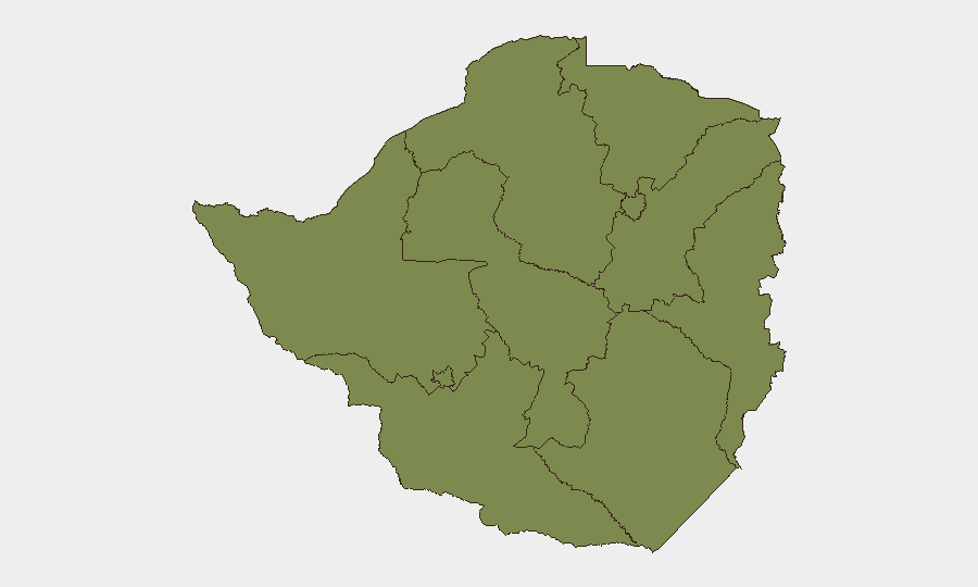
Harare dominates the risk profile at 31.4—a factor of four above the second-ranked province—driven by population density, urban crime, political-party activity, and informal-settlement vulnerabilities. Manicaland Province (7.1) follows at a significant distance, reflecting cross-border trafficking and localized resource-competition dynamics. The remaining eight provinces cluster at risk scores between 1.4 and 4.3, with Masvingo (4.3) and Mastonaland East (2.8) as secondary concern areas. Risk outside Harare is dispersed and lower in both intensity and volatility.
How GeoBit Would Assist
Security teams managing personnel or assets in Zimbabwe should employ AOI Monitoring & Early Warning on Harare and Manicaleland Province to detect protest mobilization, police positioning, or civil unrest in real time ahead of July 31. Intel Sweep and multi-language OSINT fusion (Twitter, Telegram, local media, radio SIGINT) provide continuous sentiment and incident corroboration, filtering routine political speech from actionable threats. Routing & Network Analysis enables alternative-route planning for staff movements if civil unrest materializes or infrastructure is disrupted.
7-Day Outlook
The July 31 constitutional-amendment protests represent the primary near-term flashpoint; government messaging and security-force posture suggest official intent to manage demonstrations, but risk of clashes or mass arrests remains. If protests proceed without major incident, the threat trajectory is likely to remain stable through early August. Continued monitoring of activist networks, police communications, and social-media sentiment is essential to detect any rapid escalation.
Highest-Risk Areas — Ranked
| # | State / Region | Risk |
|---|---|---|
| 1 | Harare | 31.4 |
| 2 | Manicaland Province | 7.1 |
| 3 | Masvingo Province | 4.3 |
| 4 | Mashonaland East Province | 2.8 |
| 5 | Mashonaland West Province | 1.4 |
| 6 | Matabeleland South Province | 1.4 |
| 7 | Matabeleland North Province | 1.4 |
| 8 | Midlands Province | 1.4 |
| 9 | Bulawayo Province | 1.4 |
| 10 | Mashonaland Central Province | 1.4 |
Sources
Previous Daily Briefs
A new Zimbabwe brief is written every day — each with its own risk map and downloadable CSV. Here's the last week; use the calendar to go further back.
📅 Browse every day by calendar →
Highlighted days have a brief. Tap a day for that day's map & analysis, or “csv” for that day's dataset ($5).
Atlas — our AI intelligence desk — emails them this snapshot personally. Nothing else, no list.