Situation Summary
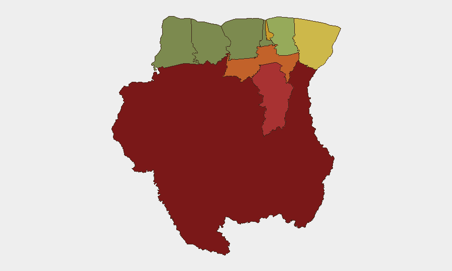
Suriname faces elevated but fragmented security pressures, with interior regions dominated by illegal mining activity, armed private actors, and government enforcement gaps, while urban centers experience localized violent crime. The arrest of 14 armed Chinese nationals in a remote mining zone on 21 July and the subsequent release of 16 men from police custody on 22 July signal both active state response and ongoing uncertainty over the legality and control of armed private security in lawless areas. The national composite threat score of 15 reflects persistent rather than acute threat; however, sub-national disparities are acute, with Sipaliwini, Brokopondo, and Para districts registering scores of 92, 78, and 74 respectively, driven by uncontrolled mineral extraction, territorial competition, and weak state presence.
Key Developments
- Brokopondo district, Sara Creek area (21 July, afternoon/evening): Joint National Army and Suriname Police Force operation arrested 14 Chinese nationals operating in military-style formation with Chinese flag insignia in an illegal gold-mining zone; multiple firearms and ammunition seized; the group's employing company's firearm permit has been revoked.
- Paramaribo, Public Prosecutor's Office (22 July): 16 men transferred from Sara Creek to Paramaribo were released from police custody; seized weapons retained; criminal investigation into firearms-law violations remains active, indicating prosecutorial uncertainty over command authority and operational scope.
- Nickerie district, Pisang Kapokweg (20 July, evening): 58-year-old male arrested after assault with sharp object; injuries to 34-year-old woman and 14-year-old boy; case under investigation; incident highlights localized violent crime in western districts outside primary mining zones.
- Multiple public and parliamentary statements (22 July): Government, Parliament, and Parliament opposition issued statements; one framed as rejection; exact content and implications under clarification, though timing suggests coordinated response to armed-actor incident and/or broader security posture review.
- Small-arms combat incidents (20 July, dual reports): Two separate small-arms engagements recorded involving Suriname forces and unidentified counterparts (one labeled "Antwerp," one "Male"); incidents remain unverified and geolocation unclear, requiring urgent clarification.
Highest-Risk Areas
Sipaliwini (92), Brokopondo (78), and Para (74) together account for the vast majority of Suriname's security risk and are driven by illegal small-scale and artisanal gold mining, armed private security contractors, irregular military actors, and state-capacity deficits in the interior rainforest. Paramaribo (71), the capital and economic center, experiences urban crime and institutional friction between law enforcement and judiciary, as evidenced by the rapid custody release on 22 July. Border districts Marowijne (68) and Commewijne (42) face secondary pressure from smuggling networks and spillover from interior zones. Western and northern coastal districts (Nickerie, Coronie, Saramacca, Wanica) remain lower-risk but are not immune to petty violence or narcotics transit.
How GeoBit Would Assist
Teams with personnel or assets in Suriname should employ AOI Monitoring & Early Warning on Sipaliwini and Brokopondo to track armed-actor movements and operational tempo in real time; Network & Actor Analysis to map the Chinese nationals' corporate affiliates, permit holders, and security subcontractors; and GIS & Spatial Analysis to identify transport corridors and mining cluster geographies. Intel Sweep and multi-language OSINT (including local government statements and business-registry cross-checks) would clarify the custody releases and permit revocation rationale and help distinguish legitimate security operations from illicit armed groups.
7-Day Outlook
Armed-actor incidents and law-enforcement enforcement actions are likely to continue in interior mining zones, with arrests and prosecutorial reviews creating short-term operational uncertainty for legitimate mining and security contractors. Paramaribo's political response to the 21–22 July events may result in new security regulations or permit audits. Urban crime and petty violence in coastal districts will remain endemic; no escalation to generalized violence or state collapse is forecast.
Highest-Risk Areas — Ranked
| # | State / Region | Risk |
|---|---|---|
| 1 | Sipaliwini | 92 |
| 2 | Brokopondo | 78 |
| 3 | Para | 74 |
| 4 | Paramaribo | 71 |
| 5 | Marowijne | 68 |
| 6 | Commewijne | 42 |
| 7 | Wanica | 38 |
| 8 | Saramacca | 29 |
| 9 | Coronie | 12 |
| 10 | Nickerie | 8 |
Sources
Previous Daily Briefs
A new Suriname brief is written every day — each with its own risk map and downloadable CSV. Here's the last week; use the calendar to go further back.
📅 Browse every day by calendar →
Highlighted days have a brief. Tap a day for that day's map & analysis, or “csv” for that day's dataset ($5).
Atlas — our AI intelligence desk — emails them this snapshot personally. Nothing else, no list.