Situation Summary
Albania remains a low-threat environment (global composite rank #null; score 14/100) with civil unrest localized to Tirana's legislative district rather than systemic instability. On 27 July 2026, Parliament convened under heightened security amid renewed protests centered on coastal resort policy, with police deploying irritant spray and physical cordons but no escalation to tear gas or water cannons. No terrorism, insurgency, or large-scale violent-crime incidents were reported in the past 24 hours; critical infrastructure remains unaffected and open to traffic and travel outside central Tirana.
Key Developments
- Tirana, Parliament perimeter – 27 July afternoon/evening (2026). Hundreds of demonstrators gathered outside Parliament on Elbasan Street and surrounding boulevards to protest "Flamingo" resort policy; clashes with riot police resulted in brief use of pepper spray and irritant spray, with eggs thrown by protesters but no serious injuries reported as of evening.
- Tirana, Parliament forecourt – 27 July. State Police deployed reinforced riot units and positioned water-cannon trucks as a precautionary measure; official statements confirmed that only irritant spray and physical barriers were deployed, not tear gas or water cannons, indicating controlled escalation protocols.
- Tirana, citywide – 26–27 July overnight. National police 24-hour bulletin reported routine arrests (sexual assault, wanted persons, traffic, drug offenses) but no major violent crime or terrorism incidents; suggests background law-enforcement activity without systemic public-order breakdown.
- Velipojë, Shkodër County – 26–27 July. An 18-year-old was formally arrested on charges of violent sexual assault following procedural detention; localized criminal-justice activity with no wider public-order implications.
- National airports, ports, borders – last 24–48 hours. No disruptions to air, maritime, or road infrastructure reported by State Police or national news; travel corridors remain open except for localized congestion near Parliament in central Tirana.
- Parliament legislative session – 27 July. Proceedings continued under tight security without evacuation or suspension, indicating authorities maintained control and political continuity despite protest pressure.
Highest-Risk Areas
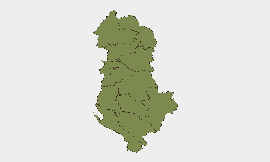
Berat County is the sole outlier in Albania's sub-national landscape, with a composite risk score of 31.3—more than four times higher than any other region. All remaining counties cluster at or below 6.3, with most at 1.3 (Durrës, Shkodër, Kukës, Lezhë, Tirana, Elbasan, Fier, Korçë, Gjirokastër). The spike in Berat warrants focused monitoring to determine whether it reflects organized crime, trafficking, clan violence, or infrastructure vulnerability; Dibër and Vlorë at 6.3 also merit secondary attention. For personnel and assets, Tirana's present political unrest is tactical and localized; strategic risk concentration is in Berat County.
How GeoBit Would Assist
Security teams should employ AOI (Area-of-Interest) Monitoring & Early Warning to track Berat County for emerging signals and escalation patterns; couple this with Intel Sweep and multi-language OSINT (X, Telegram, local media) to detect precursors to larger unrest. GIS & Spatial Analysis can map safe routing and checkpoint locations around Parliament for duty-of-care logistics, while Network & Actor Analysis can identify protest organizers and opposition factions to anticipate flashpoint timing and scale.
7-Day Outlook
Parliament's ability to convene without interruption and police restraint in using only irritant spray suggest institutional control remains intact. Expect continued periodic demonstrations tied to coastal-policy grievances over the next 5–7 days, with risk of renewed clashes near Parliament if parliamentary votes proceed; however, no indication of coordinated political crisis or security-sector fracture. Berat County warrants persistent intelligence surveillance to rule out secondary instability.
Highest-Risk Areas — Ranked
| # | State / Region | Risk |
|---|---|---|
| 1 | Berat County | 31.3 |
| 2 | Dibër County | 6.3 |
| 3 | Vlorë County | 6.3 |
| 4 | Durrës County | 1.3 |
| 5 | Shkodër County | 1.3 |
| 6 | Kukës County | 1.3 |
| 7 | Lezhë County | 1.3 |
| 8 | Tirana County | 1.3 |
| 9 | Elbasan County | 1.3 |
| 10 | Fier County | 1.3 |
| 11 | Korçë County | 1.3 |
| 12 | Gjirokastër County | 1.3 |
Sources
Previous Daily Briefs
A new Albania brief is written every day — each with its own risk map and downloadable CSV. Here's the last week; use the calendar to go further back.
📅 Browse every day by calendar →
Highlighted days have a brief. Tap a day for that day's map & analysis, or “csv” for that day's dataset ($5).
Atlas — our AI intelligence desk — emails them this snapshot personally. Nothing else, no list.