Situation Summary
Angola remains a stable, mid-range security environment (global rank #52) with composite threat score of 46/100. The past 48 hours have yielded no confirmed armed clashes, mass civil unrest, or acute political instability; routine crime and localized incidents may occur but are unverified in current reporting. The most operationally significant near-term hazard is widespread wildfire activity affecting rural logistics and transportation corridors rather than acute security threats. The concurrent ACHOD 2026 African Chiefs of Defense Conference in Luanda has introduced heightened security presence but no associated incidents.
Key Developments
- Luanda, 30 June 2026 – Opening of ACHOD 2026 military conference with 35+ African and partner-nation delegations; increased security perimeter around government venues and potential movement restrictions in central Luanda through conference duration.
- Rural provinces (12 locations), 29–30 June 2026 – Satellite-detected wildfire activity across multiple provinces impacting road networks and mining-logistics corridors; no confirmed casualties or critical infrastructure loss but likely commercial route diversions in operation.
- Angola nationwide, 29–30 June 2026 – Open-source and social-media monitoring (X/Twitter, local news consolidation) confirms absence of verified armed clashes, kidnappings, or large-scale protest activity in the past 48 hours; chronic border-region vulnerabilities persist but no new discrete incident confirmed.
- Police action, 2 July 2026 – Single alert of arrest/detention event involving Angolan police (limited detail in current reporting); insufficient corroboration for operational assessment.
- Cunene and Cuando Cubango border zones, 29–30 June 2026 – Southern and southeastern border security posture remains structurally elevated due to regional trafficking and cross-border movement dynamics, but no specific new incident confirmed in this reporting window.
Highest-Risk Areas
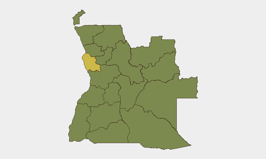
Luanda Province (61.8) substantially outranks all other regions and drives the national composite score, reflecting its concentration of political institutions, economic activity, and urban crime exposure. The eastern and northeastern mining provinces—Lunda Norte, Lunda Sul, and Cabinda—cluster at 31.8 risk, where activity encompasses artisanal-mining competition, transnational smuggling networks, and limited state authority in remote areas. Border provinces (Zaire, Bengo, Cuanza Norte, Moxico) share similar risk profiles, reflecting trafficking vulnerability and seasonal security volatility. Luanda requires heightened situational awareness for corporate and expatriate operations; eastern provinces warrant supply-chain and personnel-movement planning that accounts for logistical fragmentation and informal-economy volatility.
How GeoBit Would Assist
Corporate security teams should employ AOI Monitoring & Early Warning on high-risk provinces (Luanda, Lunda Norte, Cabinda, Cunene) to detect emerging civil unrest, movement restrictions, or border incidents in real time. Routing & Network Analysis capabilities enable alternative journey planning around wildfire-affected transport corridors and identify safe transit windows during the conference period. OSINT fusion (X/Twitter, local-media consolidation, multi-language search, entity extraction) provides continuous 24–48-hour correlation of security, crime, and logistical signals, reducing dependency on delayed official advisories.
7-Day Outlook
Wildfire activity is expected to persist through early July absent significant rainfall; logistics and personnel movement in rural provinces will remain subject to air-quality and route-availability constraints. The ACHOD conference (estimated 2–4 July) will maintain heightened police and military presence in Luanda, potentially affecting commercial traffic and expatriate movement in the capital. No acute political or conflict escalation is forecast, but border-region and eastern-province monitoring should remain active given structural trafficking and informal-economy vulnerabilities.
Highest-Risk Areas — Ranked
| # | State / Region | Risk |
|---|---|---|
| 1 | Luanda Province | 61.8 |
| 2 | Lunda Norte Province | 31.8 |
| 3 | Lunda Sul Province | 31.8 |
| 4 | Cabinda Province | 31.8 |
| 5 | Zaire Province | 31.8 |
| 6 | Bengo Province | 31.8 |
| 7 | Uíge Province | 31.8 |
| 8 | Cuanza Norte Province | 31.8 |
| 9 | Cuanza Sul Province | 31.8 |
| 10 | Malanje Province | 31.8 |
| 11 | Bié Province | 31.8 |
| 12 | Moxico Province | 31.8 |
Sources
Previous Daily Briefs
A new Angola brief is written every day — each with its own risk map and downloadable CSV. Here's the last week; use the calendar to go further back.
📅 Browse every day by calendar →
Highlighted days have a brief. Tap a day for that day's map & analysis, or “csv” for that day's dataset ($5).