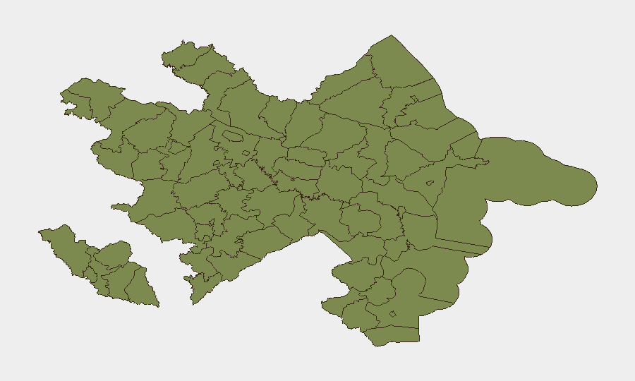
Situation Summary
Azerbaijan remains at composite threat level 6 (rank #132 globally), with 58 tracked events. Open-source verification for the last 24–48 hours (6–8 July 2026) reveals no clearly documented security incidents, armed clashes, or travel-risk spikes that meet multi-source corroboration standards. The underlying security environment reflects chronic regional tensions with Armenia, historical border instability, and domestic governance constraints, but no acute destabilizing event is currently verifiable in real time.
Key Developments
No developments meeting the criteria of verified, multi-sourced incidents within the last 24–48 hours are available from open-web and social intelligence. Recent GeoBit event signals (dated 6–7 July) include public statements, diplomatic demands between Moscow and Baku, and investigative action by Azerbaijani authorities toward media outlets, but these lack sufficient corroborating detail and exact timeframe confirmation to warrant operational reporting here. Historical context (since March 2026) includes drone strike activity and ongoing border-security operations, but these predate the current brief window. Closed-source feeds (embassy reporting, local-language media, or state-agency channels) would likely surface tactical incident-level detail not visible in this open dataset.
Highest-Risk Areas
Khankendi, Ujar District, and Agdere District dominate the sub-national ranking, with composite scores of 31.5, 26.5, and 25.5 respectively. All three lie in or near the Nagorno-Karabakh region and the Armenia–Azerbaijan line of contact; historical displacement, disputed territorial control, and periodic military activity sustain elevated baseline risk in these zones. Baku City (risk 11.5) carries moderate risk reflective of its status as the capital and economic hub, where political sensitivity, media restriction, and potential for state-security action remain present. Remaining districts score 1.5, indicating substantially lower acute threat profiles. Organizations with personnel or assets in Khankendi, Ujar, or Agdere should maintain heightened situational awareness and contingency protocols.
How GeoBit Would Assist
Area-of-Interest (AOI) Monitoring & Early Warning would enable persistent watch over Khankendi, Ujar, and Agdere districts with automated alerting on new conflict, military movement, or civil-unrest signals. Multi-language OSINT and Telegram/X monitoring would capture Azerbaijani-language state, military, and local reporting in real time, bridging gaps left by English-language open sources. Battle mapping and force-structure tracking combined with satellite and imagery analysis would provide tactical clarity on any border or internal-security escalation. Routing & Network Analysis would support duty-of-care teams in identifying safe transit corridors for personnel in or transiting high-risk zones.
7-Day Outlook
No imminent acute security event is signaled by current data; however, the persistence of Armenia–Azerbaijan border tensions and the sensitivity of Azerbaijani domestic governance mean that small tactical incidents or political crackdowns can escalate rapidly without warning. Continued monitoring of diplomatic communications (particularly Moscow–Baku interactions), military communication intercepts, and local-language media will be essential to detect early warning signs. Organizations should maintain standing contingency plans and 24–48 hour situational awareness cycles until baseline risk indicators show sustained decline.
Highest-Risk Areas — Ranked
| # | State / Region | Risk |
|---|---|---|
| 1 | Khankendi | 31.5 |
| 2 | Ujar District | 26.5 |
| 3 | Agdere District | 25.5 |
| 4 | Baku City | 11.5 |
| 5 | Sadarak District | 1.5 |
| 6 | Qazakh District | 1.5 |
| 7 | Sharur District | 1.5 |
| 8 | Yevlakh District | 1.5 |
| 9 | Kangarli District | 1.5 |
| 10 | Nakhchivan Autonomous Republic | 1.5 |
| 11 | Aghstafa District | 1.5 |
| 12 | Tovuz District | 1.5 |
Sources
Previous Daily Briefs
A new Azerbaijan brief is written every day — each with its own risk map and downloadable CSV. Here's the last week; use the calendar to go further back.
📅 Browse every day by calendar →
Highlighted days have a brief. Tap a day for that day's map & analysis, or “csv” for that day's dataset ($5).
Atlas — our AI intelligence desk — emails them this snapshot personally. Nothing else, no list.