Situation Summary
The Bahamas remains a low-threat jurisdiction globally (rank #178, composite score 2), with no credible security incidents reported in the past 24–48 hours. Baseline crime—maritime interdiction, street violence, and property crime—persists at historical levels, concentrated in Nassau and Freeport. The country's security posture shows no acute deterioration, though underlying vulnerabilities in law enforcement capacity and informal settlement tensions remain endemic.
Key Developments
No discrete security incidents have been identified in The Bahamas during the 24–48 hours preceding 01 August 2026, 13:00 UTC. Routine government and administrative activity continues. For operational context, recent maritime and violent-crime incidents (fatal shooting in Chippingham, drug interdictions, stabbings in Palm Beach) occurred 26–27 July 2026 and remain under local law enforcement investigation, but do not represent new developments within the reporting window.
Highest-Risk Areas
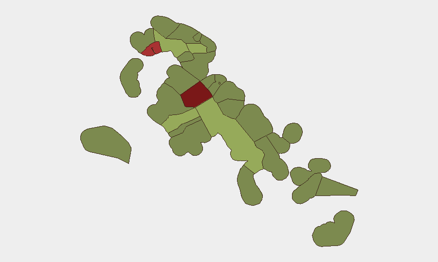
New Providence (risk score 92) and the City of Freeport (78) drive the archipelago's threat profile, accounting for the majority of organized crime, gang-related violence, and drug trafficking activity. Central Abaco (52) and Central Andros (48) carry secondary risk, primarily associated with informal maritime activity and human-smuggling corridors. Risk concentration reflects population density, port activity, and proximity to trafficking routes; the Family Islands and outer settlements (Mangrove Cay, Cat Island) remain lower-risk but possess limited law enforcement presence and emergency-response infrastructure, creating duty-of-care exposure for personnel operating in isolated locations.
How GeoBit Would Assist
Intel Sweep & OSINT Fusion across social media (X, Telegram), local news, and maritime-tracking feeds would provide early warning of trafficking activity, gang tensions, or port disruptions affecting asset movement. AOI Monitoring with alerting on Nassau, Freeport, and family-island airfields would flag sudden security incidents, civil unrest, or infrastructure failures in real time. Maritime & Aviation Tracking, combined with Routing & Network Analysis, enables corporate teams to identify safe corridors and alternative departure routes should conditions degrade rapidly in high-risk ports or settlements.
7-Day Outlook
No acute security catalyst is forecast for the next seven days. Seasonal maritime activity and routine criminal enforcement will likely continue at baseline levels. Teams with personnel or assets in New Providence and Freeport should maintain standard duty-of-care protocols (staff movement awareness, emergency contact drills, communication redundancy) and monitor local government and police advisories for any change in law enforcement posture or port operations.
Highest-Risk Areas — Ranked
| # | State / Region | Risk |
|---|---|---|
| 1 | New Providence | 92 |
| 2 | City of Freeport | 78 |
| 3 | Central Abaco | 52 |
| 4 | Central Andros | 48 |
| 5 | Exuma | 45 |
| 6 | East Grand Bahama | 42 |
| 7 | South Andros | 38 |
| 8 | North Abaco | 35 |
| 9 | North Eleuthera | 33 |
| 10 | South Abaco | 32 |
| 11 | Cat Island | 30 |
| 12 | Mangrove Cay | 28 |
Sources
Previous Daily Briefs
A new Bahamas brief is written every day — each with its own risk map and downloadable CSV. Here's the last week; use the calendar to go further back.
📅 Browse every day by calendar →
Highlighted days have a brief. Tap a day for that day's map & analysis, or “csv” for that day's dataset ($5).
Atlas — our AI intelligence desk — emails them this snapshot personally. Nothing else, no list.