Situation Summary
Bahrain is experiencing an acute military confrontation with Iran, marked by sustained Iranian missile and drone attacks over 48 hours (July 22–23, 2026) and repeated activation of nationwide air-raid sirens. Bahraini air defenses have intercepted multiple incoming strikes, but debris from interceptions has caused civilian casualties and property damage in Manama and Hamad Town. The threat environment remains elevated with ongoing U.S.–Iran exchanges of fire in the region and no clear de-escalation signal; all four governorates carry uniform composite risk scores of 1.3, indicating kingdom-wide exposure.
Key Developments
- Nationwide air-raid sirens (July 22–23, 2026). Bahrain's Ministry of Interior activated the siren network at least seven times in under 48 hours across Manama, residential areas, and public spaces in response to Iranian missile and drone threats, with official guidance to shelter-in-place and avoid spread of unverified information.
- Interception of Iranian missiles and drones (July 22, 2026). Bahrain Defence Force reported destruction of multiple Iranian aerial munitions over Bahraini airspace and approaches to Manama on July 22, attributing the attacks to Iran's "systematic aggression."
- Civilian casualties and property damage (Hamad Town and Manama, July 22–23, 2026). Debris from intercepted drones set vehicles ablaze and damaged homes; at least one child was injured by falling shrapnel, confirming risk of collateral harm in populated areas.
- Warning of unexploded ordnance (July 22–23, 2026). Bahraini military and Interior Ministry advised citizens kingdom-wide to avoid suspicious objects and debris, indicating uncleared hazards in open and urban environments.
- Alleged strike on critical data infrastructure (July 22, 2026). Iranian military sources claimed an attack on Amazon data infrastructure in Bahrain purportedly linked to U.S. Army communications and facilities at Sheikh Isa Air Base; confirmation from Bahraini or U.S. authorities remains pending.
- Sustained U.S.–Iran exchanges of fire (July 23, 2026). Regional reporting indicates continued military engagement involving Bahrain's air defenses as part of broader regional confrontation, with sirens sounding again on July 23.
- Official communications via social media (July 22–23, 2026). The Interior Ministry used X/Twitter to confirm siren activations and threat status, indicating real-time reliance on digital channels for risk alerts.
Highest-Risk Areas
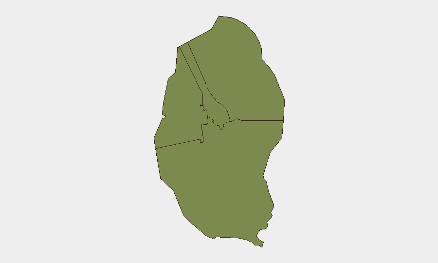
All four governorates (Northern, Capital, Southern, and Muharraq) register identical composite risk scores of 1.3, reflecting kingdom-wide exposure to aerial threats. The Capital Governorate, encompassing Manama and surrounding urban centers, and Muharraq, home to critical port and aviation infrastructure, face the highest concentration of civilian and strategic assets. Confirmed debris impact in Hamad Town and Manama underscores that risk is not theoretical; Northern and Southern governorates remain exposed to fallout and ongoing strikes given Bahrain's compact geography and lack of natural distance buffers.
How GeoBit Would Assist
Security teams should deploy AOI Monitoring & Early Warning on key facilities and residential clusters to detect siren activations, debris impacts, and UXO hazards in real-time. OSINT feeds and X/Twitter OSINT provide continuous tracking of Interior Ministry alerts and regional military claims, enabling rapid dissemination of shelter-in-place or evacuation guidance. GIS & Spatial Analysis combined with Satellite & Imagery analysis can map confirmed strike zones, debris fields, and cordoned areas to route personnel safely and identify infrastructure vulnerabilities (e.g., Sheikh Isa Air Base proximity).
7-Day Outlook
The threat trajectory remains elevated with no official cessation announced as of July 25. Expect continued Iranian threats and Bahraini air-defense activity, further siren activations, and possible additional debris impacts in urban areas. Personnel and asset mobility will remain constrained by shelter-in-place directives and emergency response activity; non-essential travel should be deferred pending de-escalation signals or all-clear guidance from Bahraini authorities.
Highest-Risk Areas — Ranked
| # | State / Region | Risk |
|---|---|---|
| 1 | Northern Governorate | 1.3 |
| 2 | Capital Governorate | 1.3 |
| 3 | Southern Governorate | 1.3 |
| 4 | Muharraq Governorate | 1.3 |
Sources
Previous Daily Briefs
A new Bahrain brief is written every day — each with its own risk map and downloadable CSV. Here's the last week; use the calendar to go further back.
📅 Browse every day by calendar →
Highlighted days have a brief. Tap a day for that day's map & analysis, or “csv” for that day's dataset ($5).
Atlas — our AI intelligence desk — emails them this snapshot personally. Nothing else, no list.