Situation Summary
Bosnia and Herzegovina remains in a stable security posture with no multi-source confirmed major incidents, civil unrest, or political instability during 20–21 July 2026. Open-source reporting shows only routine crime, traffic accidents, and low-level public-order infractions across monitored regions. The composite threat score (4) and absence of tracked discrete events reflect a baseline operating environment characterized by petty crime and procedural law-enforcement activity rather than organized violence or destabilizing events.
Key Developments
- Brčko District, 19 July: A VW Golf III struck a female pedestrian on Ulica R. Dž. Čauševića; victim sustained serious but non-life-threatening injuries and was transported to JZU Brčko hospital. No indication of targeting or political motive; classified as routine traffic accident.
- Brčko District, 17–20 July: Police recorded three public-order violations, including arrests of two individuals (born 1984, 1991) for aggressive behavior and obstruction of official duties; a third individual (born 1995) cited for disturbing the peace. Characterized as typical weekend disturbances with no evidence of coordinated unrest.
- Brčko District, 17–20 July: Two criminal offenses (theft and property damage) documented under Brčko District Criminal Code. No organized crime violence or community targeting indicated in available reporting.
- Zenica, 15 July: Criminal police arrested a male (born 1990) following court-ordered search; 43.1 g of substance resembling narcotics recovered from apartment and vehicle. Suspect criminally processed for unauthorized production and trafficking; no collateral violence or public-order spillover reported.
- Zenica–Doboj Canton, 15 July: Police documented 19 public-order disturbances across multiple municipalities with standard interventions applied; several traffic accidents with material damage only. No coordinated protests or organized disorder reported.
- Sarajevo, 21 July: Capital's composite risk profile remains moderate (28/100); petty crime (pickpocketing in tourist areas) identified as primary concern. Violent crime against tourists remains uncommon; no active disaster alerts or new security incidents flagged.
- National advisory status, 21 July: Government travel advisory unchanged, maintaining recommendation to exercise high degree of caution. Persistent landmine risk in rural/remote areas noted as baseline concern; no new deterioration or incident escalation reported in last 48 hours.
Highest-Risk Areas
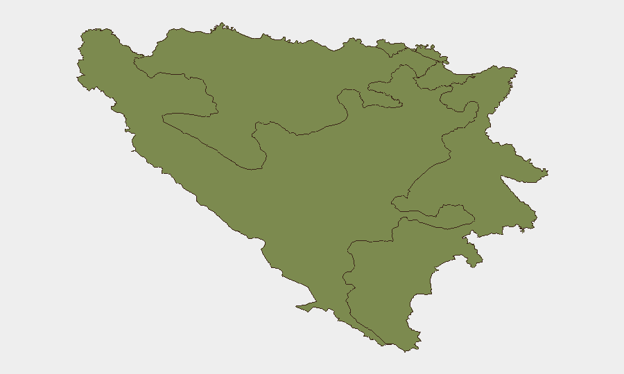
The Federation of Bosnia and Herzegovina, Republika Srpska, and Brčko District all register equal composite risk scores (1.3), indicating evenly distributed baseline vulnerability across administrative divisions. Brčko District has generated the most recent incident reporting density, though events remain minor (traffic accidents, public-order infractions, routine crime). Risk concentration reflects endemic petty crime and low-level disorder typical of post-conflict transition economies rather than organized violence or communal instability.
How GeoBit Would Assist
Security teams monitoring Bosnia and Herzegovina should deploy Intel Sweep and OSINT fusion to consolidate fragmented local police bulletins and media reporting into early-warning signals before incidents escalate to broader unrest. AOI Monitoring & Early Warning on Brčko District, Zenica, and Sarajevo would provide persistent watch with alerting thresholds for organized crime, public-order clustering, or political mobilization. Risk & Threat Assessment workflows would enable continuous baseline calibration and detection of deviation from current stable posture.
7-Day Outlook
No indicators suggest imminent escalation in Bosnia and Herzegovina during the coming week. Routine crime and traffic-accident frequency are expected to persist at current levels, with summer season potentially increasing both petty theft in tourist areas and vehicle-accident rates. Monitoring should remain calibrated to detect any organized crime violence, cross-entity political tension, or public-order clustering that would signal deviation from baseline stability.
Highest-Risk Areas — Ranked
| # | State / Region | Risk |
|---|---|---|
| 1 | Federation of Bosnia and Herzegovina | 1.3 |
| 2 | Republika Srpska | 1.3 |
| 3 | Brčko District | 1.3 |
Sources
Previous Daily Briefs
A new Bosnia and Herzegovina brief is written every day — each with its own risk map and downloadable CSV. Here's the last week; use the calendar to go further back.
📅 Browse every day by calendar →
Highlighted days have a brief. Tap a day for that day's map & analysis, or “csv” for that day's dataset ($5).
Atlas — our AI intelligence desk — emails them this snapshot personally. Nothing else, no list.