Situation Summary
Canada maintains a composite threat score of 2.9 (rank #61 globally), indicating moderate baseline security risk with volatile sub-national hotspots. Event signals from 2026-06-26 to 2026-06-28 reflect fragmented but elevated tensions across civil, criminal, and international dimensions—including police-neighbourhood armed confrontation, judicial intimidation, transnational unconventional violence, and high-profile cyber breach. Ontario, British Columbia, and Quebec together account for the majority of tracked threat activity and drive the national aggregate.
Key Developments
- Data breach (national impact) — Canada Computers, 2026-06-27: Unauthorized system access exposed personal and payment card data for 1,284 customers on retail platform. Investigation ongoing; financial and reputational harm likely; downstream fraud and identity-theft risk elevated.
- Small arms incident (Ontario neighbourhood) — 2026-06-27: Armed confrontation between police and residents; incident type classified as small-arms combat. Location and casualty details from event signal only; investigation status unknown.
- Judicial intimidation (national) — 2026-06-27: Unconventional violence directed at judge by unidentified Canadian actor; threat level and judicial response status require clarification.
- Transnational unconventional attack (national impact) — 2026-06-27: Tehran-attributed unconventional violence against American national(s) on Canadian soil; suggests either targeting of US persons within Canada or proxy action within Canadian jurisdiction. Escalation risk if pattern repeats.
- Political-level diplomatic tension (national) — 2026-06-28: Canadian politician issued disapproval statement toward American counterpart/entity. Rhetorical but signals bilateral strain; impact on cross-border business continuity and security cooperation to be monitored.
- Activist military action (national) — 2026-06-26: Activist group employed conventional military force (type and location not specified in signal). Suggests organized capability beyond typical protest activity.
- Government investigation into residents — 2026-06-26: CANADA vs RESIDENTS investigate event; no clarification on jurisdiction or scope; warrants monitoring for civil-liberties implications or counter-intelligence operation.
Highest-Risk Areas
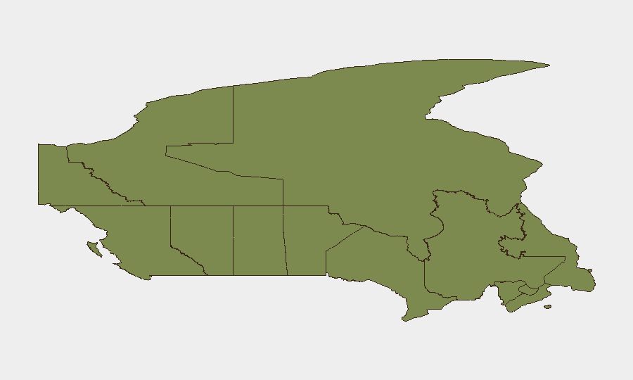
Ontario (risk 32), British Columbia (risk 30.2), and Quebec (risk 29.5) account for approximately 91 of the top 95 points in sub-national risk—a sharp concentration. Ontario's dominance reflects a combination of urban density, critical infrastructure density, and recent armed and cyber incidents. BC and Quebec show elevated threat signals aligned with activist mobilization, transnational linkages, and cross-border pressure points. Alberta (12.3) and Nunavut (11.8) represent secondary hotspots; Alberta likely driven by civil-unrest events, Nunavut by isolation and limited governance. Southern and Atlantic provinces remain substantially lower-risk but should not be assumed stable if national political or transnational tensions escalate.
How GeoBit Would Assist
Security teams should employ Intel Sweep and multi-language OSINT fusion to corroborate and contextualize event signals in real time, particularly the Tehran-attributed unconventional violence and activist military claims. X/Twitter OSINT, entity extraction, and network analysis would map actor relationships, rhetorical networks, and organizational links across the Ontario–BC–Quebec corridor. AOI monitoring with persistent alerting on critical infrastructure, judicial buildings, and cross-border ports would provide 24–48-hour early warning of escalation; GIS and spatial analysis would support secure routing and asset placement decisions in high-risk zones.
7-Day Outlook
Escalation risk is moderate but asymmetric: transnational unconventional violence and judicial intimidation suggest organized non-state and potentially state-adjacent actors are operating within Canadian jurisdiction with reduced friction. Cyber-operational risk remains elevated post-Canada Computers breach. Political tension and activist mobilization could intersect with summer travel and event seasons; border and port facilities warrant elevated vigilance over the next week.
Highest-Risk Areas — Ranked
| # | State / Region | Risk |
|---|---|---|
| 1 | Ontario | 32 |
| 2 | British Columbia | 30.2 |
| 3 | Quebec | 29.5 |
| 4 | Alberta | 12.3 |
| 5 | Nunavut | 11.8 |
| 6 | Manitoba | 3.8 |
| 7 | New Brunswick | 3.5 |
| 8 | Prince Edward Island | 3.3 |
| 9 | Saskatchewan | 3 |
| 10 | Newfoundland and Labrador | 2.9 |
| 11 | Northwest Territories | 2.2 |
| 12 | Yukon | 2 |
Sources
Previous Daily Briefs
A new Canada brief is written every day — each with its own risk map and downloadable CSV. Here's the last week; use the calendar to go further back.
📅 Browse every day by calendar →
Highlighted days have a brief. Tap a day for that day's map & analysis, or “csv” for that day's dataset ($5).