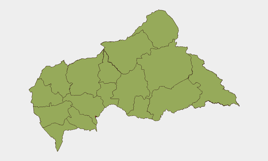
Situation Summary
Central African Republic remains a high-volatility operating environment (global rank #33, composite threat 67) characterized by fragmented armed group activity, weak state capacity, and cyclical institutional instability. Bangui carries disproportionate risk (76.8) due to concentration of state functions, security services, and political pressure. Event signals from the past 48 hours—including Central Bank administrative sanctions, Catholic institutional disapproval, and investigative action by church leadership—suggest emerging friction within governance and civil institutions rather than a sudden security escalation. The security picture remains diffuse and deteriorating incrementally rather than acutely destabilizing.
Key Developments
- Bangui, 19–20 June 2026: Central Bank issued administrative sanctions and made public statements; concurrent disapproval signals from Catholic leadership and a bishop-led investigation indicate institutional discord over governance or economic policy. Specific triggering issues remain unclear from available reporting.
- Bangui, 18–19 June 2026: Central Bank Governor made public statements; Central Bank and business sector conflict emerged (rejection of a Central Bank position by business actors). This suggests tension over monetary policy, banking regulation, or financial sector oversight.
- Cross-border / regional, 18 June 2026: Reports of unconventional violence involving Congo and public statements from Congolese military actors; separate disapproval of the CAR President by Congo signals diplomatic or security friction. Exact location and nature of incident require clarification.
- National / humanitarian context, 18 June 2026: Nursing sector issued public statement (context unclear—possible health crisis, labor dispute, or institutional concern).
- Zémio–Mboki road corridor, 13 June 2026 (outside strict 24–48h window, but recent): A 10-person humanitarian team was intercepted by armed men between Tamboura and Zébérou, highlighting persistent armed group activity in the southeastern corridor and risk to NGO/aid operations.
- Bangui, 19 June 2026: Security service interrogations of individuals alleged to have engaged in destabilization plotting (names: Sani Yalo, Pascal Bida Koyagbélé) indicate elevated state security concern and possible detention risk for political or security-related figures.
Highest-Risk Areas
Bangui dominates the risk landscape (76.8 vs. 54.3 for the next-ranked Ouaka), reflecting its role as the capital, seat of state institutions, and concentration of security services and political actors. The remaining 11 provinces cluster at lower but uniform risk (46.8), indicating geographically distributed armed-group presence, weak governance penetration, and humanitarian access constraints across the hinterland. Ouaka province (54.3) merits secondary focus due to ongoing militia and bandit activity. The eastern and southeastern border regions (Haut-Mbomou, Mbomou, Haute-Kotto) and the northern corridor (Bamingui-Bangoran, Vakaga) remain persistent zones of armed-group sanctuary and cross-border movement.
How GeoBit Would Assist
Security teams operating in CAR should employ Intel Sweep and X/Telegram OSINT to monitor emerging institutional friction (Central Bank, religious leadership, political actors) for early signals of state fragmentation or coup risk. AOI Monitoring & Early Warning with persistent watch on Bangui's security-service movements and on high-risk provincial corridors (Zémio–Mboki road, northern routes) provides decision-ready alerting on armed-group activity and humanitarian access closure. Network & Actor Analysis on Congolese military signals and cross-border activity helps contextualize regional security dynamics affecting CAR stability.
7-Day Outlook
Institutional tensions evident in Central Bank and church leadership signals are unlikely to resolve quickly; monitor for escalation to street-level protest or security-service response. Armed-group activity in peripheral provinces will persist; humanitarian and commercial transport remain at moderate-to-high risk. No imminent coup or large-scale military event is signaled, but baseline volatility in Bangui and insecurity in the hinterland will remain operational constraints.
Highest-Risk Areas — Ranked
| # | State / Region | Risk |
|---|---|---|
| 1 | Bangui | 76.8 |
| 2 | Ouaka | 54.3 |
| 3 | Bamingui-Bangoran | 46.8 |
| 4 | Vakaga | 46.8 |
| 5 | Haute-Kotto | 46.8 |
| 6 | Haut-Mbomou | 46.8 |
| 7 | Mbomou | 46.8 |
| 8 | Nana-Mambéré | 46.8 |
| 9 | Ouham-Pendé | 46.8 |
| 10 | Mambéré-Kadéï | 46.8 |
| 11 | Sangha-Mbaéré | 46.8 |
| 12 | Ouham | 46.8 |
Sources
Previous Daily Briefs
A new Central African Republic brief is written every day — each with its own risk map and downloadable CSV. Here's the last week; use the calendar to go further back.
📅 Browse every day by calendar →
Highlighted days have a brief. Tap a day for that day's map & analysis, or “csv” for that day's dataset ($5).