Situation Summary
Chile remains a relatively low-threat environment globally (rank #96, composite score 10), but is currently experiencing a significant operational disruption driven entirely by severe weather rather than security incidents. A constitutional state of catastrophe declared 20 July across Coquimbo and Huasco provinces continues to dominate the risk landscape, with widespread flooding, landslides, power outages, and road closures affecting approximately 100,000 residents. No major civil unrest, political violence, or crime spikes have been confirmed in the last 24–48 hours; current duty-of-care exposure is concentrated in infrastructure continuity and personnel mobility rather than personal security threats.
Key Developments
- Coquimbo & Huasco (Atacama) – State of catastrophe ongoing. President Kast's constitutional declaration (20 July) remains in effect; at least ten deaths have been confirmed nationally, with continued flooding and landslide risk limiting road access across both regions as of 23 July.
- Carmen de Andacollo mine (Coquimbo Region) – Partial operational suspension. Teck Resources reports reduced operations and road-access closure due to extreme rain; tailings facility remains within safety limits, but resumption timeline depends on water-level recession (reported 17 July, status current as of 23 July).
- Quilpué (Valparaíso Region) – Voluntary evacuations for landslide risk. Authorities continue voluntary evacuation orders in affected communes (originally issued 16 July); heavy rains ongoing into current period elevate localized mobility and displacement risk.
- Arauco Commune (Biobío Region) – Severe flooding and red-alert river status. Pichilo River remains under red alert; residential infrastructure destruction and displacement confirmed, with confirmed local mobility disruption but no mass unrest reported (16–21 July, status current).
- National level – Preventive state of emergency and travel restrictions active. Multi-region emergency declaration remains in place as of 23 July; authorities continue travel advisories focused on transport disruption and energy-supply vulnerability from ongoing weather impacts.
- Legislative reconstruction bill approved (22 July). Chile's lower house approved President Kast's major reconstruction and economic reform bill; no associated protests or security incidents reported.
- No new civil unrest or political violence confirmed (last 48 hours). Multi-source monitoring confirms absence of mass protests, riots, political instability, or violent incidents; risk profile remains weather-driven and infrastructure-focused.
Highest-Risk Areas
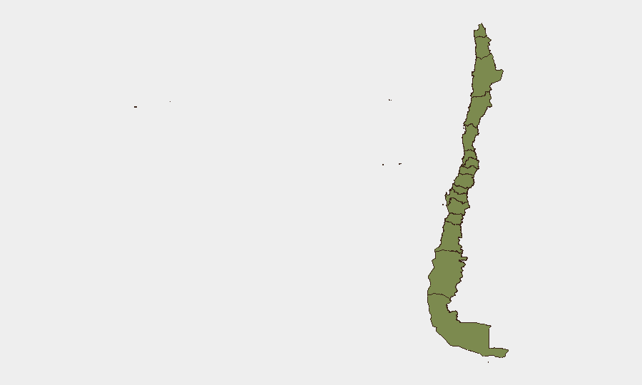
Santiago Metropolitan Region dominates the sub-national ranking (31.4), reflecting both population concentration and infrastructure criticality; however, current acute weather risk is concentrated in Coquimbo (7.1) and Valparaíso (2.8), where flooding, road closures, and evacuation orders directly affect operational continuity. The remaining regions show minimal individual scores but share exposure to the national frontal system. For corporate teams, Santiago remains the primary concern for systemic disruption (transport, power, supply chains), while Coquimbo and Valparaíso present immediate personnel-safety and asset-access challenges through at least late July.
How GeoBit Would Assist
Security teams should deploy AOI Monitoring & Early Warning on Coquimbo, Valparaíso, and Biobío communes to track road closures, evacuation zones, and infrastructure restoration in real time. GIS & Spatial Analysis combined with Satellite & Imagery analysis enables rapid assessment of flooding extent, landslide zones, and alternative routing for personnel or supply movement. Routing & Network Analysis supports contingency journey planning around damaged infrastructure and evacuation perimeters.
7-Day Outlook
Heavy rain is forecast to ease by late 24 July, reducing immediate flood and landslide risk, though water-level recession and infrastructure repair will extend operational disruption into early August. No escalation of civil unrest, political instability, or security incidents is anticipated; focus should remain on mobility resilience and supply-chain continuity monitoring as weather clears and restoration efforts accelerate.
Highest-Risk Areas — Ranked
| # | State / Region | Risk |
|---|---|---|
| 1 | Santiago Metropolitan Region | 31.4 |
| 2 | Coquimbo Region | 7.1 |
| 3 | Valparaiso Region | 2.8 |
| 4 | Maule Region | 2.8 |
| 5 | Araucania Region | 2.8 |
| 6 | Antofagasta Region | 1.4 |
| 7 | Atacama Region | 1.4 |
| 8 | Aysen del General Carlos Ibanez del Campo Region | 1.4 |
| 9 | Los Lagos Region | 1.4 |
| 10 | Magallanes and Chilean Antarctica Region | 1.4 |
| 11 | O'Higgins Region | 1.4 |
| 12 | Nuble Region | 1.4 |
Sources
Previous Daily Briefs
A new Chile brief is written every day — each with its own risk map and downloadable CSV. Here's the last week; use the calendar to go further back.
📅 Browse every day by calendar →
Highlighted days have a brief. Tap a day for that day's map & analysis, or “csv” for that day's dataset ($5).
Atlas — our AI intelligence desk — emails them this snapshot personally. Nothing else, no list.