Situation Summary
Colombia is experiencing elevated political and security tension ahead of the 21 June 2026 presidential elections, with nationwide military mobilization and official public statements signaling heightened state vigilance. The country remains at composite threat rank #36 globally (59/100), with 398 tracked events; however, live open-source reporting for the past 24–48 hours is limited and does not yet reveal specific, geolocated violent incidents during this critical electoral window. Current risk is concentrated in border and rural departments—notably Nariño, the Capital District, and Santander—where armed-group activity and criminal networks intersect with governance weakness.
Key Developments
- Nationwide – 21 June 2026 – Election Security Lockdown: Colombian authorities implemented nationwide security restrictions from 20 June (Saturday) through 22 June (Monday), including closure of land and sea borders from 06:00 on 21 June, alcohol-sales bans, and restrictions on large gatherings. This is a preventive measure tied to presidential voting.
- Nationwide – 21 June 2026 – Military Mobilization: Police and military forces received deployment orders concurrent with election-day security posture. Official government and military public statements confirm heightened operational readiness.
- Bogotá – 20 June 2026 – Official Rejection of Electoral Dispute Allegations: Colombian authorities and the Foreign Ministry issued public rejections of unspecified claims or publications; concurrent disapproval was expressed toward unnamed political figures, signaling official denial of alleged irregularities or external interference narratives.
- Diplomatic Tension – 20 June 2026 – Regional Friction: The Colombian Foreign Ministry rejected a position or statement attributed to Argentina, and separate official statements addressed alleged threats involving Sri Lankan nationals and incidents involving worshippers in Colombo (venue unclear from signal data).
- Investigation Signal – 19–21 June 2026 – Ongoing Official Inquiries: Multiple "investigate" signals suggest official bodies are examining unspecified matters, possibly linked to electoral security, alleged threats, or incidents involving foreign nationals.
Caveat: Open-source reporting for 20–21 June 2026 does not yet contain confirmed, multi-source reports of specific bombings, ambushes, kidnappings, road blockades, or clashes in Colombia during this 48-hour window. Election-related security measures and official statements dominate available signals; no discrete violent incidents have been independently verified for the past two days.
Highest-Risk Areas
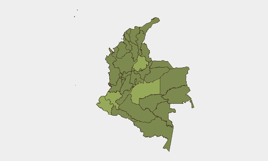
Nariño Department (57.1) and the Capital District (54.4) drive Colombia's subnational risk profile. Nariño's proximity to Ecuador, porous borders, and historical coca-production zones make it a haven for armed groups and trafficking networks; the Capital District faces concentrated urban crime, protest activity, and political tension, especially around elections. Santander (51.2), Meta (49.5), and Cauca (44.2) complete the high-risk tier, each combining remote terrain, weak institutional presence, or indigenous/rural populations vulnerable to armed-group coercion. The clustering of risk in border and southern departments reflects narcotrafficking supply chains, ELN and dissident FARC presence, and competition for territorial control.
How GeoBit Would Assist
A security team protecting personnel or assets in Colombia would use GeoBit's AOI Monitoring & Early Warning to track persistent threats in high-risk departments (Nariño, Santander, Capital District) with real-time alerting on armed-group movements, roadblocks, or clashes. Intel Sweep, election monitoring, and X/Telegram OSINT enable rapid detection of protest escalation, kidnapping threats, or cartel communications around electoral events. GIS & Spatial Analysis and alternative-route planning support duty-of-care teams in rerouting personnel and assets away from active conflict zones or checkpoints during periods of heightened tension.
7-Day Outlook
Election day (21 June) and the 48-hour security cordon are expected to hold without major incident, though police and military presence will remain visible and restrictive. Post-election (22–28 June), risk trajectory depends on electoral outcome acceptance; disputed results or violent opposition mobilization could trigger protests, roadblocks, and armed-group opportunism, particularly in Nariño and rural Cauca. Monitoring of official statements, protest announcements, and armed-group communications will be critical to early warning.
Highest-Risk Areas — Ranked
| # | State / Region | Risk |
|---|---|---|
| 1 | Nariño | 57.1 |
| 2 | Capital District | 54.4 |
| 3 | Santander Department | 51.2 |
| 4 | Meta Department | 49.5 |
| 5 | Cauca | 44.2 |
| 6 | Norte de Santander Department | 38.9 |
| 7 | Sucre Department | 37.3 |
| 8 | Atlántico Department | 36.1 |
| 9 | Casanare Department | 33.2 |
| 10 | Antioquia Department | 29.1 |
| 11 | Cundinamarca Department | 29.1 |
| 12 | Amazonas | 28.9 |
Sources
Previous Daily Briefs
A new Colombia brief is written every day — each with its own risk map and downloadable CSV. Here's the last week; use the calendar to go further back.
📅 Browse every day by calendar →
Highlighted days have a brief. Tap a day for that day's map & analysis, or “csv” for that day's dataset ($5).