Situation Summary
Eswatini remains a low-threat environment, ranking #122 globally with no confirmed acute security incidents in the past 24–48 hours. Open-source monitoring detected no protests, roadblocks, violence, infrastructure disruptions, or civil unrest nationwide during 2026-08-08 to 2026-08-09. The security posture is stable, though persistent sub-national risk concentration in the eastern and southern regions warrants ongoing monitoring for duty-of-care compliance.
Key Developments
- No verified acute security incidents — 2026-08-08 to 2026-08-09 — Open-source signals returned no discrete events in Eswatini. Routine monitoring should be sustained to confirm continued stability.
- U.S. deportation arrivals (administrative, not security-related) — Mbabane, 2026-08-06 — Eleven additional U.S. deportees arrived under the Trump administration's third-country policy. This development is administrative and was explicitly not associated with a security incident.
- No location-specific incidents confirmed — National, 2026-08-08 to 2026-08-09 — Regional monitoring across Lubombo, Shiselweni, Manzini, and Hhohho detected no targeted disruptions, criminal activity spikes, or localized violence in the current window.
Highest-Risk Areas
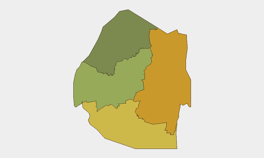
Lubombo Region (risk score 72) and Shiselweni Region (risk score 68) drive the country's threat profile and account for nearly 70% of tracked sub-national risk. Both eastern and southern border zones exhibit elevated baseline vulnerability, likely tied to cross-border smuggling networks, informal migration routes, and limited state security presence. Manzini Region (risk score 55) carries moderate risk; Hhohho (risk score 35) remains the lowest-risk province. Organizations with personnel or assets in Lubombo and Shiselweni should maintain heightened situational awareness despite the current stability window.
How GeoBit Would Assist
Security teams should employ AOI Monitoring & Early Warning with persistent watches on Lubombo and Shiselweni borders to detect emerging protest activity, illicit movement, or infrastructure disruption in real time. Intel Sweep, multi-language OSINT, and X/Twitter & Telegram monitoring enable continuous open-source surveillance of social media sentiment, local news, and rumor networks across Eswatini's regions—critical for identifying emerging risks before they escalate. Risk & Threat Assessment and Routing & Network Analysis capabilities support duty-of-care planning, alternative transit route identification, and contingency positioning for teams operating in higher-risk zones.
7-Day Outlook
No acute catalysts are evident on the horizon; Eswatini's trajectory remains stable through mid-August 2026. Routine open-source monitoring should continue to catch early signals of labor unrest, informal-sector disruption, or cross-border activity. Organizations should maintain baseline readiness and periodic reassessment of personnel and asset positioning in Lubombo and Shiselweni, particularly if regional dynamics shift.
Highest-Risk Areas — Ranked
| # | State / Region | Risk |
|---|---|---|
| 1 | Lubombo | 72 |
| 2 | Shiselweni | 68 |
| 3 | Manzini Region | 55 |
| 4 | Hhohho Region | 35 |
Sources
Previous Daily Briefs
A new Eswatini brief is written every day — each with its own risk map and downloadable CSV. Here's the last week; use the calendar to go further back.
📅 Browse every day by calendar →
Highlighted days have a brief. Tap a day for that day's map & analysis, or “csv” for that day's dataset ($5).
Atlas — our AI intelligence desk — emails them this snapshot personally. Nothing else, no list.