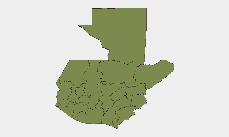
Situation Summary
Guatemala's composite security threat score (28) reflects elevated but regionally concentrated risk, driven by gang violence, penitentiary overcrowding, and ongoing criminal extortion networks. Recent incidents through July 27—including massacres in Boca del Monte and San Benito, and nationwide roadblocks—signal persistent operational capacity among criminal organizations despite police and military deployments. As of the latest available status (July 29, no new major incidents are being actively reported), but the absence of reported activity should not be interpreted as structural improvement; rather, typical weekend lull or reporting lag.
Key Developments
No verified developments from the last 24–48 hours (July 27–29, 2026) are available in open-source feeds. The most recent timestamped incidents fall outside this window:
- Nationwide – "Sin novedades por el momento" (Current status, no precise timestamp). TVGT Noticias' breaking-news feed indicates no significant active security incidents being reported at present.
Background context (July 23–27, for situational awareness):
- Boca del Monte & San Benito (July 26): Multiple casualties in apparent gang-driven mass-casualty events.
- Nationwide roadblocks (July 24): Criminal organizations mobilized transportation disruptions across multiple routes.
- Guatemala Department (July 27): Conventional military force deployments and arrest/detention operations reported.
*Note: GeoBit's live research capability is constrained for real-time 24–48h verification in Guatemala. Corroboration with local Policía Nacional Civil, CONRED, Provial, and departmental authority social media feeds is essential for operational decisions.*
Highest-Risk Areas
Guatemala Department dominates the sub-national ranking (risk 31.3), reflecting concentration of gang violence, extortion, and prison-related incidents in and around Guatemala City—the country's largest urban center and commercial hub. Retalhuleu (7.5), San Marcos (5), and Santa Rosa (5) form a secondary risk tier along the southwestern border and agricultural zones, where narcotics trafficking, land dispute violence, and gang presence remain elevated. All other departments score below 2.0, indicating either lower criminal activity or fewer reported incidents; however, this does not guarantee safety—underreporting and data gaps are common in rural and remote areas.
How GeoBit Would Assist
Corporate security teams operating in Guatemala should employ AOI (Area-of-Interest) Monitoring & Early Warning on Guatemala Department, Retalhuleu, and San Marcos to capture real-time incident alerts and escalation signals; OSINT Fusion & Corroboration (X, Telegram, local news, radio SIGINT) to close the 24–48h reporting gap and validate open-source claims; and Routing & Network Analysis to identify safe and alternative transit corridors around active roadblocks or conflict zones. Conflict & Military force-tracking and Entity & Network Analysis enable identification of criminal organizations and their operational patterns for contextual risk assessment of specific locations or personnel movements.
7-Day Outlook
Criminal organizations' demonstrated capacity to execute coordinated multi-location violence (July 26 massacres) and nationwide infrastructure disruption (July 24 roadblocks) suggests sustained operational tempo over the near term, particularly if weekend reporting gaps mask ongoing activity. Security incidents are likely to remain concentrated in Guatemala Department and the southwestern border zone. Risk to personnel and assets should be assumed elevated in high-risk departments; escalation triggers include prison breakouts, high-profile arrests of criminal leadership, or further military/police operations in gang-stronghold neighborhoods.
Highest-Risk Areas — Ranked
| # | State / Region | Risk |
|---|---|---|
| 1 | Guatemala Department | 31.3 |
| 2 | Retalhuleu | 7.5 |
| 3 | San Marcos | 5 |
| 4 | Santa Rosa | 5 |
| 5 | Escuintla | 2.5 |
| 6 | Petén | 1.3 |
| 7 | Huehuetenango | 1.3 |
| 8 | Quetzaltenango | 1.3 |
| 9 | Quiché | 1.3 |
| 10 | Alta Verapaz | 1.3 |
| 11 | Totonicapán | 1.3 |
| 12 | Sololá | 1.3 |
Sources
Previous Daily Briefs
A new Guatemala brief is written every day — each with its own risk map and downloadable CSV. Here's the last week; use the calendar to go further back.
📅 Browse every day by calendar →
Highlighted days have a brief. Tap a day for that day's map & analysis, or “csv” for that day's dataset ($5).
Atlas — our AI intelligence desk — emails them this snapshot personally. Nothing else, no list.