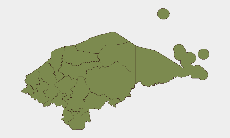
Situation Summary
Honduras maintains a composite threat score of 19 (global rank #55), reflecting moderate but volatile conditions across its sub-national territories. The past 48 hours have seen convergence of environmental stress (drought and flooding), civil unrest driven by fiscal policy, extortion targeting educational infrastructure, and routine seismic activity—none individually acute, but collectively indicating systemic fragility. The security environment remains containable but requires active monitoring, particularly in Colón and Francisco Morazán departments.
Key Developments
- El Progreso, Yoro (July 21, 2026): Municipal government reversed a proposed 300% vehicle tax increase after multi-day resident protests, crediting overpayments against other municipal fees. This fiscal-policy reversal signals successful civil pressure but confirms underlying grievance vulnerability in municipalities.
- National drought alert escalation (July 21–22, 2026): Honduras's emergency agency (Copeco) elevated yellow drought alerts across 75 dry-corridor municipalities due to El Niño rainfall deficits; simultaneous distribution of 30,000+ food sacks to 15,229 families across 12 municipalities indicates acute food-security stress in rural areas.
- Tegucigalpa region seismic event (July 21, 2026, 00:35): A 3.1-magnitude earthquake struck 64 km north of Tegucigalpa with no reported casualties or damage, though officials warn most informal housing stock remains vulnerable to stronger seismic events.
- School extortion campaign (July 22, 2026): Criminal groups are conducting active extortion operations against schools and teachers nationwide, forcing private-school closures and displacing 550+ educators—representing direct threat to educational infrastructure and staff safety.
- National power disruption (July 22, 2026, 07:00–17:00): ENEE announced planned cuts across multiple zones for distribution-network maintenance, affecting business continuity and mobility planning in affected districts.
- Puerto Lempira flooding emergency (recent, within 48 hours): Copeco maintains active alerts for Gracias a Dios due to heavy rains and inundation; Puerto Lempira reported in emergency status, limiting local mobility and access.
Highest-Risk Areas
Colón department dominates the risk ranking (31.4 composite score), driven by crime, trafficking, and governance-capacity constraints along the Caribbean corridor. Francisco Morazán (21.4)—containing Tegucigalpa and surrounding urban zones—reflects population density, gang activity, and police-operational intensity. The remaining nine departments cluster at 1.4, indicating either lower event frequency or localized rather than systemic threat. Corporate assets and personnel in Colón and San Pedro Sula (Cortés) should assume elevated baseline risk; Francisco Morazán warrants heightened situational awareness around government operations and urban crime.
How GeoBit Would Assist
Intel Sweep and OSINT fusion would consolidate scattered reports of extortion targeting schools, criminal-group activity, and police operations into coherent threat-actor mapping. AOI Monitoring & Early Warning on Colón, Gracias a Dios (flooding zones), and drought-stressed municipalities would provide persistent alerting on deteriorating conditions affecting supply chains and personnel movement. Routing & Network Analysis would support duty-of-care teams in planning alternative travel and logistics given power disruptions and flooding, while Risk & Threat Assessment would quantify exposure to extortion and supply-chain disruption in real time.
7-Day Outlook
Environmental stress (drought and flooding) will remain elevated through late July, sustaining food-security pressure and potential displacement in rural areas. School extortion campaigns are likely to persist absent significant law-enforcement response, posing ongoing risk to educational continuity and staff retention. No major escalation in violent crime or political instability is currently signaled, but fragmentation of municipal-level governance (as evidenced by the Yoro tax reversal) may create localized security vacuums.
Highest-Risk Areas — Ranked
| # | State / Region | Risk |
|---|---|---|
| 1 | Colón | 31.4 |
| 2 | Francisco Morazán | 21.4 |
| 3 | El Paraíso | 1.4 |
| 4 | Copán | 1.4 |
| 5 | Ocotepeque | 1.4 |
| 6 | Cortés | 1.4 |
| 7 | Yoro | 1.4 |
| 8 | Santa Bárbara | 1.4 |
| 9 | Lempira | 1.4 |
| 10 | Intibucá | 1.4 |
| 11 | Comayagua | 1.4 |
| 12 | La Paz | 1.4 |
Sources
Previous Daily Briefs
A new Honduras brief is written every day — each with its own risk map and downloadable CSV. Here's the last week; use the calendar to go further back.
📅 Browse every day by calendar →
Highlighted days have a brief. Tap a day for that day's map & analysis, or “csv” for that day's dataset ($5).
Atlas — our AI intelligence desk — emails them this snapshot personally. Nothing else, no list.