Situation Summary
Malta remains a low-threat environment globally (rank #160, composite score 5) with no discrete security events tracked in the current window. However, sub-national risk concentration in urban coastal zones—particularly Valletta, Sliema, and Saint Julian's—reflects organized crime, financial crime, and port-related vulnerabilities. The security posture is stable; near-term trajectory depends on sustained port security and continued judicial progress on high-profile financial crime cases.
Key Developments
- Malta International Airport / Valletta airspace, 2026-08-11 to 2026-08-12 — Ash from Sicily's Mount Etna drifted into Maltese airspace, forcing 19+ flight cancellations and delays at Malta International Airport on 11 August, with disruption extending into 12 August. This event illustrates Malta's exposure to transnational environmental hazards and transit-node vulnerability despite low crime risk.
Highest-Risk Areas
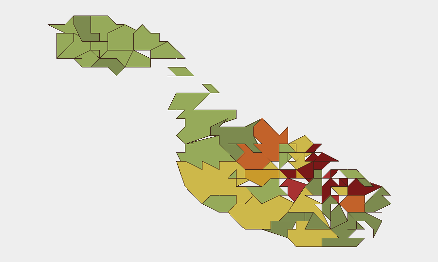
The risk ranking reflects Malta's compact geography and dense port economy. Valletta (risk 95), Sliema (risk 92), and Saint Julian's (risk 90)—all waterfront or tourist/financial hubs—drive the composite score. This concentration reflects established organized crime networks, financial crime linked to EU and Schengen vulnerabilities, and trafficking (narcotics, human) routed through the port and airport. Hamrun, Msida, and Birkirkara (inland, risk 84–87) show elevated scores tied to residential crime and drug distribution. Risk is localized rather than systemic; the rest of Malta shows materially lower exposure.
How GeoBit Would Assist
Intel Sweep and OSINT fusion would monitor organized crime networks, financial crime actors, and port-activity anomalies across Valletta and Sliema in real time, correlating X, Telegram, and local-language sources to surface early indicators of trafficking or violence. AOI Monitoring & Early Warning on the port, airport, and tourist zones would provide persistent watch with automated alerting on vessel movements, crowd events, and border-crossing surges. Network & Actor Analysis would map criminal and financial networks to identify which actors pose direct risk to corporate assets in high-risk zones, enabling duty-of-care teams to tailor presence and security protocols.
7-Day Outlook
No imminent security escalation is forecast. The Etna ash disruption is expected to clear as wind patterns shift; travel disruption should normalize within 48–72 hours. Operational security in Valletta and coastal zones should remain standard; elevated sub-national risk scores reflect chronic exposure to organized crime and port trafficking, not acute instability or civil unrest. Monitoring for judicial developments in ongoing financial crime trials (context: Yorgen Fenech case ongoing since 2017) remains prudent for reputational and sanctions risk.
Highest-Risk Areas — Ranked
| # | State / Region | Risk |
|---|---|---|
| 1 | Valletta | 95 |
| 2 | Sliema | 92 |
| 3 | Saint Julian's | 90 |
| 4 | Gżira | 88 |
| 5 | Hamrun | 87 |
| 6 | Paola | 86 |
| 7 | Msida | 85 |
| 8 | Birkirkara | 84 |
| 9 | Birgu | 83 |
| 10 | Senglea | 82 |
| 11 | Cospicua | 81 |
| 12 | Żabbar | 80 |
Sources
Previous Daily Briefs
A new Malta brief is written every day — each with its own risk map and downloadable CSV. Here's the last week; use the calendar to go further back.
📅 Browse every day by calendar →
Highlighted days have a brief. Tap a day for that day's map & analysis, or “csv” for that day's dataset ($5).
Atlas — our AI intelligence desk — emails them this snapshot personally. Nothing else, no list.