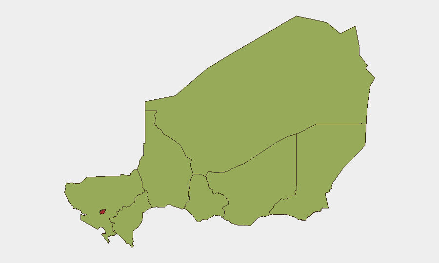
Situation Summary
Niger remains a moderate global security concern (rank #24, composite score 71) with 27 tracked threat events, characterized by persistent jihadist activity, cross-border pressure, and localized instability. The most significant recent incident—a coordinated assault on Niamey's Diori Hamani International Airport and Air Base 101 on 18 June—resulted in 13 deaths (11 security force, 2 civilian) and at least 22 attackers neutralized, signaling sustained militant capability to strike high-value infrastructure in the capital. Diplomatic tensions with neighboring Benin and the United Kingdom have surfaced in the past 48 hours alongside domestic governance criticism, reflecting broader regional strain. The security situation remains volatile but currently contained in the capital; however, risk concentration in Niamey (79.7) and secondary flashpoints in Agadez, Tahoua, Zinder, and Diffa require sustained monitoring.
Key Developments
- Niamey – Diori Hamani International Airport & Air Base 101 – 18 June 2026
Armed assailants executed a pre-dawn coordinated attack with explosions and sustained gunfire lasting over two hours; Nigerien security forces repelled the assault and regained full control by midday.
- Niamey – Post-attack security response – 18 June 2026
Perimeter sweeps around the airport and joint Burkina Faso–Mali–Niger force headquarters neutralized multiple gunmen; at least one attacker was detained following civilian assistance in identifying suspects.
- Niamey – Civilian engagement in security operations – 18 June 2026
Local residents armed with improvised weapons participated in searches for assailants near the airport; social media documented civilians detaining a suspect before official forces intervened.
- Niamey – Informal settlement demolitions (security context) – 18 June 2026
Authorities linked recent demolition of thousands of makeshift homes bordering Diori Hamani International Airport to counterterrorism efforts, citing jihadist infiltration of informal areas as an ongoing risk.
- Diplomatic friction – 20–21 June 2026
United Kingdom issued disapproval statement (20 June); Benin registered disapproval toward Niger (21 June); unspecified threats and government rejection statements toward Nigerian entities emerged (21–22 June).
- Normalization in Niamey – 18 June 2026
Commercial and civilian activity resumed under heightened security posture by midday; airport operations stabilized.
Highest-Risk Areas
Niamey dominates the risk profile (79.7), driven by the airport assault, critical infrastructure vulnerability, and concentration of government and military assets. The secondary tier—Agadez (54.7), Tahoua (50.3), Zinder, Diffa, Tillabéri, Dosso, and Maradi (all 49.7)—reflects distributed jihadist presence, porous borders with Mali and Burkina Faso, and limited state capacity outside the capital. Risk clustering in Agadez reflects trafficking routes and militant sanctuary; southern and central regions (Tahoua, Zinder, Maradi) face resource competition and cross-border spillover. Niamey's elevated score reflects both recent attack intensity and strategic value as the national capital.
How GeoBit Would Assist
Security teams should deploy AOI Monitoring & Early Warning on Niamey's airport perimeter, key government installations, and secondary cities (Agadez, Tahoua, Zinder) to detect pre-attack positioning and militant movement. Network & Actor Analysis combined with Intel Sweep (X/Telegram OSINT, multi-language feeds) would identify emerging threat narratives, cross-border coordination signals, and diplomatic escalation drivers. Conflict & Military battle-mapping and Routing & Network Analysis support situational awareness of militant logistics, alternative transport corridors, and force posture around diplomatic incidents.
7-Day Outlook
The airport attack signals capability to penetrate security cordons around high-value targets; security force posture will likely remain elevated in Niamey and along border regions for the near term. Regional diplomatic friction (UK, Benin statements) may complicate coordination on counterterrorism; watch for secondary protests or civil unrest in Niamey. Risk of follow-on militant activity in secondary cities or along supply routes remains elevated; no immediate de-escalation indicators are evident.
Highest-Risk Areas — Ranked
| # | State / Region | Risk |
|---|---|---|
| 1 | Niamey | 79.7 |
| 2 | Agadez Region | 54.7 |
| 3 | Tahoua Region | 50.3 |
| 4 | Zinder Region | 49.7 |
| 5 | Diffa Region | 49.7 |
| 6 | Tillabéri Region | 49.7 |
| 7 | Dosso Region | 49.7 |
| 8 | Maradi Region | 49.7 |
Previous Daily Briefs
A new Niger brief is written every day — each with its own risk map and downloadable CSV. Here's the last week; use the calendar to go further back.
📅 Browse every day by calendar →
Highlighted days have a brief. Tap a day for that day's map & analysis, or “csv” for that day's dataset ($5).