Situation Summary
Palau remains in a low-threat, operationally stable state with no verified security incidents, civil unrest, crime spikes, or infrastructure disruptions reported in the last 24–48 hours. Two diplomatic public statements involving Australia and Indonesia were issued on 2026-07-26, though these reflect routine diplomatic messaging rather than acute security events. The overall security environment is characterized as stable, with baseline conditions unchanged across the archipelago.
Key Developments
- Palau vs. Australia & Indonesia – Public Statements, 2026-07-26
Palau issued diplomatic public statements on 2026-07-26 involving Australia and Indonesia. These are ministerial-level communications rather than indicative of conflict, unrest, or travel restrictions; they reflect standard regional diplomatic engagement.
- No Verified Incidents – Last 24–48 Hours
Open-source reporting, local media feeds, regional security outlets, and travel-advisory platforms document no new security, crime, civil unrest, or infrastructure events across Palau since 2026-07-25.
- Legislative Action (Background Context, Not Current Incident)
The Palau Senate approved a new broad criminal fraud offense on 2026-07-20; this is a legal change, not evidence of a fraud outbreak or security incident spike.
- Infrastructure Status – Baseline
Internet and telecom connectivity remain stable following the June 27 Guam fiber cut (now resolved). No new infrastructure disruptions are reported.
Highest-Risk Areas
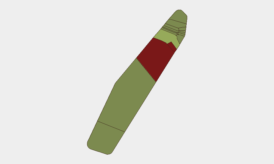
Peleliu (risk 92) and Angaur (risk 88) rank significantly above all other states, driving Palau's composite threat profile. Both are sparsely populated outer islands with historical significance, limited official presence, and minimal routine security reporting—creating assessment gaps rather than confirmed active threats. Koror (risk 45), the capital and commercial hub, carries moderate risk reflecting its role as the population and economic center; Melekeok and Airai follow with lower scores. The stark disparity between Peleliu/Angaur and the rest suggests these rankings reflect structural factors (geographic remoteness, monitoring gaps, historical context) rather than current incident activity. Personnel and asset concentration in Koror aligns with moderate rather than acute risk.
How GeoBit Would Assist
Corporate security teams with staff or assets in Palau would deploy AOI Monitoring & Early Warning on Koror and other populated centers to detect civil unrest, infrastructure failures, or security incidents in real time. Intel Sweep and multi-language OSINT fusion would provide continuous corroboration of diplomatic statements and regional developments affecting Palau's political stability. Routing & Network Analysis would enable contingency planning for travel and supply-chain continuity, particularly if outer-island operations are planned.
7-Day Outlook
Palau's security posture is expected to remain stable over the next seven days absent new diplomatic escalation or external shocks. Routine monitoring of diplomatic channels and regional maritime activity (particularly around disputed waters) should continue as a baseline precaution, though no specific threat indicators are currently elevated.
Highest-Risk Areas — Ranked
| # | State / Region | Risk |
|---|---|---|
| 1 | Peleliu | 92 |
| 2 | Angaur | 88 |
| 3 | Koror | 45 |
| 4 | Melekeok | 35 |
| 5 | Airai | 32 |
| 6 | Ngatpang | 28 |
| 7 | Ngeremlengui | 26 |
| 8 | Ngaraard | 25 |
| 9 | Ngardmau | 24 |
| 10 | Aimeliik | 23 |
| 11 | Ngiwal | 22 |
| 12 | Ngchesar | 21 |
Sources
Previous Daily Briefs
A new Palau brief is written every day — each with its own risk map and downloadable CSV. Here's the last week; use the calendar to go further back.
📅 Browse every day by calendar →
Highlighted days have a brief. Tap a day for that day's map & analysis, or “csv” for that day's dataset ($5).
Atlas — our AI intelligence desk — emails them this snapshot personally. Nothing else, no list.