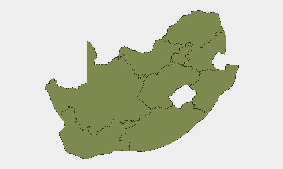
Situation Summary
South Africa's threat environment remains moderate globally (rank #69, composite score 16) but is driven by concentrated, acute risks in Gauteng, which accounts for nearly two-thirds of the nation's tracked security events. The past 48 hours have seen escalating anti-immigrant unrest (Eastern Cape), a high-profile arrest in a major theft case (Gauteng), confirmed deaths during illegal-mining enforcement operations (Gauteng/Mpumalanga), and emerging extortion threats linked to protest activity (Western Cape). The trajectory suggests continued volatility around informal-economy conflicts, organized crime, and security-force operations in mining areas.
Key Developments
- Jeffreys Bay, Eastern Cape, 17 July 2026: Anti-immigrant protests escalated into looting of at least 23 foreign-owned spaza shops; 69 arrested for public violence, three injured. Foreign-owned informal businesses remain closed as a precaution as of 18 July.
- Kensington, Johannesburg (Gauteng), 17 July 2026 (night): Suspended Ekurhuleni Metropolitan Police Deputy Chief Julius Mkhwanazi arrested as the fifth suspect in a R14.9 million precious-stones heist; held at Germiston Police Station pending Monday court appearance.
- Abandoned mine west of Johannesburg, Gauteng, 17 July 2026 (morning): Two SANDF soldiers died after falling into an open vertical mine shaft during an illegal-mining enforcement operation (Operation Prosper); circumstances under investigation by the Ministry of Police.
- Barberton–Mbombela route, Mpumalanga, 18 July 2026: Minibus taxi overturned, killing three passengers; four critically injured and six with minor injuries. Incident highlights ongoing road-safety risks on this inter-provincial corridor.
- Cape Town, Western Cape, 17 July 2026: Organizers of recent protests targeting illegal foreign-owned informal businesses report escalating threats from alleged extortion gangs; protest leaders fear campaign "could turn violent" as criminal networks seek to capitalize on civil unrest.
- National level (Gauteng West Rand focus), 17 July 2026: Ministry of Police publicly acknowledged SANDF deaths in illegal-mining operations, underscoring active, high-risk joint security deployments against zama-zama activity and indicating sustained enforcement intensity in mining areas.
Highest-Risk Areas
Gauteng dominates the sub-national risk profile (score 34.5), driven by organized crime (theft, precious-stones heists, police corruption), illegal mining enforcement, and informal-economy disputes. Western Cape (14.6) is increasingly unstable due to protest-linked extortion threats and gang interference in civil unrest. North West and Free State (both 9.3) carry moderate risks linked to informal-business conflicts and mining-adjacent criminality. KwaZulu-Natal (7.7), despite historical volatility, currently shows lower tracked activity. Eastern Cape's anti-immigrant unrest signals emerging localized instability that bears monitoring for spread to other provinces.
How GeoBit Would Assist
Security teams should deploy AOI Monitoring & Early Warning on high-risk nodes in Gauteng (mining sites, police stations, commercial districts) and Western Cape (protest hotspots, informal-business clusters) to detect escalation signals before violence spreads. OSINT Sweep (X/Telegram/YouTube intelligence, sentiment analysis) can track emerging extortion networks and protest-organizer communications in real time. Routing & Network Analysis enables duty-of-care teams to model safe transit corridors around Jeffreys Bay, the Barberton–Mbombela road, and Gauteng mining enforcement zones.
7-Day Outlook
Anti-immigrant unrest is likely to remain localized to Eastern Cape in the near term, but copycat incidents cannot be ruled out in other provinces with high foreign-owned informal-business density (Western Cape, Gauteng). Illegal-mining enforcement will continue at elevated tempo, with attendant operational risk to security forces and civilians. Extortion-gang activity exploiting protest momentum is expected to intensify in Cape Town, potentially triggering secondary civil unrest or criminal violence by mid-to-late July.
Highest-Risk Areas — Ranked
| # | State / Region | Risk |
|---|---|---|
| 1 | Gauteng | 34.5 |
| 2 | Western Cape | 14.6 |
| 3 | North West | 9.3 |
| 4 | Free State | 9.3 |
| 5 | KwaZulu-Natal | 7.7 |
| 6 | Eastern Cape | 5 |
| 7 | Mpumalanga | 5 |
| 8 | Limpopo | 4.7 |
| 9 | Northern Cape | 4.5 |
Sources
Previous Daily Briefs
A new South Africa brief is written every day — each with its own risk map and downloadable CSV. Here's the last week; use the calendar to go further back.
📅 Browse every day by calendar →
Highlighted days have a brief. Tap a day for that day's map & analysis, or “csv” for that day's dataset ($5).
Atlas — our AI intelligence desk — emails them this snapshot personally. Nothing else, no list.