Situation Summary
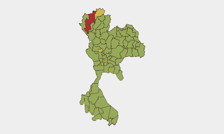
Thailand remains a composite Tier 2 security environment (global rank #17, score 69) with fragmented but persistent risks spanning civil unrest, cross-border military activity, and infrastructure incidents. The most acute concentrations are in the northern provinces—Chiang Mai (score 78) and Chai Nat (69.3)—where border dynamics with Myanmar and localized armed engagements have generated elevated threat signals over the past 48 hours. Recent events indicate no systemic collapse, but recurring small-arms incidents, civilian casualties from infrastructure failures, and cross-border spillover warrant sustained monitoring.
Key Developments
- Chiang Mai Province, 2026-07-20: Small-arms combat reported between local forces and Border Patrol; concurrent Conventional Military Force activity by Border Patrol signals active armed engagement in the province's highest-risk zone.
- Bangkok, Lat Phrao district, 2026-07-18: Nightclub fire (Rong Beer Na Lat Phrao) killed 27 persons and injured 18; preliminary findings attribute the incident to electrical overload and locked emergency exits, creating significant reputational and safety-standard questions for hospitality sector operators.
- Lamphun Province, 2026-07-20: Arrest/Detain action by police and reported unconventional violence incident; details remain limited but signal active law-enforcement operations in the second-highest northern risk zone.
- Tak Province, Mae Sot border area, 2026-07-18: Thai-side villages sustained stray munitions following Myanmar military airstrikes near Myawaddy; Thai police conducted explosive-remnant clearance, confirming cross-border spillover of active conflict.
- Bangkok, Huai Khwang area, recent (last 24h): Police raid on illegal pub linked to drug distribution; 11 suspects arrested, narcotics and assets seized, indicating persistent organized-crime enforcement activity in the capital.
- Northeast provinces (Mekong River zone), recent (last 24h): Authorities issued flood alert for five provinces following Nam Theun 1 dam discharge increase (Laos); predicted 1.3-metre Mekong rise poses secondary humanitarian and displacement risk.
- Government & Media friction, 2026-07-18–20: Public statements from Government, Chamber, and media outlets (Reuters, others); Government threats recorded; civilian-occupation-of-territory signal logged. Escalating rhetorical tension with unknown underlying dispute.
Highest-Risk Areas
Chiang Mai Province (78) and Chai Nat (69.3) dominate the risk landscape, driven by active armed engagements at the Myanmar border, military/police force deployments, and history of insurgent activity. Bangkok (62.4), despite being the capital, registers elevated risk tied to infrastructure failures (fire safety), organized crime, and occasional civil unrest; its dense expatriate and corporate population amplifies duty-of-care obligations. The northern corridor (Chiang Rai, Lamphun, Phetchabun, Kanchanaburi) reflects chronic border instability, trafficking, and Myanmar conflict overspill. Rayong (55.5) introduces industrial and port-security dimensions.
How GeoBit Would Assist
Security teams should deploy AOI (Area-of-Interest) Monitoring & Early Warning on Chiang Mai, Chai Nat, and Mae Sot border crossings to receive real-time alerts on military activity, armed engagements, and cross-border incidents. Intel Sweep (multi-language OSINT, X/Twitter, Telegram, local-news fusion) enables continuous tracking of government statements, civil unrest rhetoric, and organized-crime enforcement actions. Conflict & Military mapping and GIS & Spatial Analysis support route-risk assessment for supply chains, staff travel, and asset-location planning around the northern conflict zones and Bangkok infrastructure vulnerabilities.
7-Day Outlook
Northern border activity is likely to remain elevated given Myanmar's ongoing military operations; no immediate de-escalation signals are evident. Bangkok and the northeast face secondary risks from seasonal flooding and organized-crime enforcement. Government-media/civil-society friction warrants close monitoring for cascade effects into protest or restrictions affecting business operations.
Highest-Risk Areas — Ranked
| # | State / Region | Risk |
|---|---|---|
| 1 | Chiang Mai Province | 78 |
| 2 | Chai Nat Province | 69.3 |
| 3 | Bangkok | 62.4 |
| 4 | Chiang Rai Province | 61.8 |
| 5 | Rayong Province | 55.5 |
| 6 | Lamphun Province | 54.9 |
| 7 | Phetchabun Province | 50.5 |
| 8 | Kanchanaburi Province | 50.5 |
| 9 | Chaiyaphum Province | 49.9 |
| 10 | Trat Province | 48.6 |
| 11 | Bueng Kan Province | 48 |
| 12 | Nong Khai Province | 48 |
Sources
Previous Daily Briefs
A new Thailand brief is written every day — each with its own risk map and downloadable CSV. Here's the last week; use the calendar to go further back.
📅 Browse every day by calendar →
Highlighted days have a brief. Tap a day for that day's map & analysis, or “csv” for that day's dataset ($5).
Atlas — our AI intelligence desk — emails them this snapshot personally. Nothing else, no list.