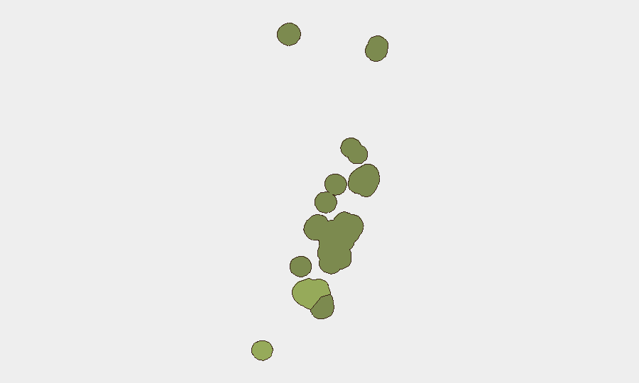
Situation Summary
Tonga remains a low-threat environment with no verified security incidents, civil unrest, major crime spikes, or infrastructure failures reported in the last 24–48 hours. Moderate offshore earthquakes (M 4.3–5.1) were recorded in late July but have ceased; no tsunami warnings or coastal impacts have materialized. The country's composite threat score of 2 reflects a stable security posture with no acute triggers for corporate risk escalation at present.
Key Developments
- No verified incidents (Tonga, country-wide, 3–4 August 2026): Open-source monitoring across news wires, regional outlets, social media, and Tonga-specific feeds reports zero protests, violent crime spikes, political instability, or travel disruptions in the last 24–48 hours.
- Seismic activity subsided (offshore waters, late July–early August 2026): A series of moderate earthquakes in the preceding week has not produced new events in the last 48 hours; no tsunami warnings or reported coastal damage.
- No travel advisory changes (3–4 August 2026): National security briefs confirm low-threat status with no changes to existing travel guidance or duty-of-care posture.
Highest-Risk Areas
Tongatapu (risk score 45) dominates the sub-national landscape and drives the majority of tracked risk, reflecting its role as the capital and economic center; the 27 July Mataika shooting and subsequent arrests remain the most recent significant incident but falls outside the current 24–48-hour window. Vavaʻu (28) and Haʻapai (22) present secondary concerns, likely reflecting lower incident reporting density and geographic dispersion rather than fundamentally different threat profiles. The remaining islands—ʻEua (18) and Ongo Niua (12)—carry baseline risk typical of remote, less-monitored island populations. No current data suggests active escalation in any region.
How GeoBit Would Assist
For ongoing Tonga monitoring, corporate security teams would deploy AOI (Area-of-Interest) Monitoring & Early Warning on Tongatapu and secondary population centers to detect emerging protests, civil unrest, or crime signals in real time. OSINT Fusion (X/Twitter, Telegram, YouTube, local news feeds, and multi-language search) combined with Sentiment & Temporal Analysis would provide early detection of political or social friction before it manifests as acute risk. Maritime & Aviation Tracking paired with GIS & Spatial Analysis would support situational awareness of cyclone, earthquake, or tsunami threats affecting personnel or supply chains.
7-Day Outlook
No new security incidents are anticipated in the immediate 7-day horizon. Seismic activity may continue at low levels but poses minimal acute travel or operational risk absent major underwater earthquakes. Monitoring should remain routine and passive unless regional or parliamentary developments (e.g., further debate on capital punishment) generate downstream civil-unrest signals—an unlikely but non-zero scenario requiring persistent OSINT watch rather than immediate escalation.
Highest-Risk Areas — Ranked
| # | State / Region | Risk |
|---|---|---|
| 1 | Tongatapu | 45 |
| 2 | Vavaʻu | 28 |
| 3 | Haʻapai | 22 |
| 4 | ʻEua | 18 |
| 5 | Ongo Niua | 12 |
Sources
Previous Daily Briefs
A new Tonga brief is written every day — each with its own risk map and downloadable CSV. Here's the last week; use the calendar to go further back.
📅 Browse every day by calendar →
Highlighted days have a brief. Tap a day for that day's map & analysis, or “csv” for that day's dataset ($5).
Atlas — our AI intelligence desk — emails them this snapshot personally. Nothing else, no list.