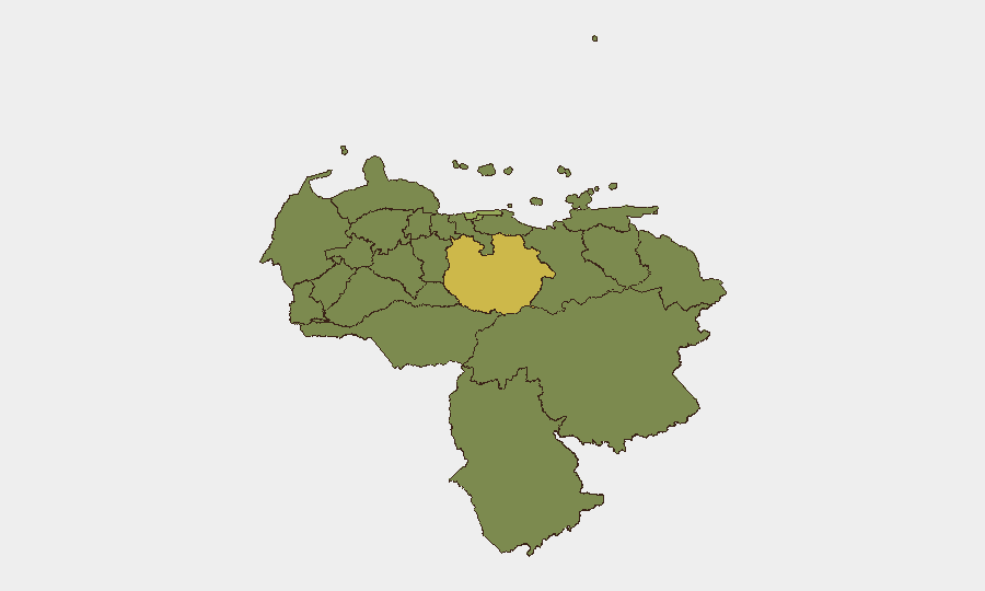
Situation Summary
Venezuela faces a compounding security crisis following major earthquakes (M7.2 and M7.5) on 24 June that have killed at least 1,719 people, injured over 5,000, and displaced approximately 15,800, with 7.9 million requiring humanitarian support. Aftershock activity (600+ recorded events, including a 4.6 magnitude event on 30 June) continues to threaten infrastructure and rescue operations. The combination of disaster-response strain, military access restrictions to affected zones, and existing civil instability has elevated risk across northern and coastal states, particularly Guarico (63.3), Vargas (51.8), and the Federal District (51.3).
Key Developments
- La Guaira State, 30 June 2026 – A 4.6 magnitude aftershock struck northern Venezuela as part of an ongoing seismic sequence of over 600 aftershocks since 24 June, compounding structural damage and landslide risk in coastal urban areas.
- Simón Bolívar International Airport (Maiquetía), 30 June 2026 – The major international gateway near Caracas remains closed; inter-urban train services are suspended nationwide, severely restricting mobility and emergency-response logistics.
- La Guaira city, 30 June 2026 – A five-day search-and-rescue operation for a security guard trapped under workplace rubble continues, concentrating emergency services, heavy machinery, and security cordons in a dense urban zone and increasing local access constraints.
- Earthquake-affected coastal zones (Carabobo/Falcón corridor), 30 June 2026 – Military units have imposed civilian access restrictions to devastated areas; media reports indicate growing anger and thousands of residents attempting unauthorized entry to conduct rescue operations, raising risk of clashes and looting.
- Caracas and affected northern/western states, 30 June 2026 – National state of emergency remains in force; humanitarian strain from 15,800 displaced persons and 7.9 million in need of support is driving risk of crime, civil unrest around aid distribution, and pressure on urban reception centers.
- Venezuela–Guyana border regions, 30 June 2026 – Travel advisories highlight ongoing volatility linked to the Guayana Esequiba territorial dispute, compounding security risk in border states alongside earthquake-related disruption.
- Caracas vicinity, 30 June 2026 – A U.S. military C-17 transport with specialized search-and-rescue teams departed overnight en route to Venezuela for relief operations; local and regional commentary notes heightened sensitivity to foreign military presence amid existing political tensions.
Highest-Risk Areas
Guarico State (63.3) leads the national risk ranking, followed by Vargas (51.8)—a coastal state directly affected by the 24 June earthquakes and ongoing aftershocks—and the Federal District (51.3), home to Caracas and the epicenter of humanitarian and security strain. Carabobo State (38.8) is also significantly elevated due to its coastal position and earthquake damage. Risk is driven by the convergence of active seismic hazard, collapsed infrastructure, military-imposed access restrictions, displaced populations, and pre-existing crime and political instability; coastal and northern zones face the highest immediate threat.
How GeoBit Would Assist
Organizations with personnel or assets in Venezuela should employ AOI Monitoring & Early Warning to track aftershock activity, infrastructure damage, and displacement flows in real time across Guarico, Vargas, and Carabobo States. Satellite & Imagery analysis can assess damage extent, access corridor viability, and security-force positioning. Routing & Network Analysis can identify alternative transport and evacuation corridors given airport closure and restricted zones, while conflict and civil-unrest event feeds enable early detection of military confrontations or looting near cordoned disaster areas.
7-Day Outlook
Aftershock activity is expected to continue through early July, with secondary structural failures, landslides, and service disruptions probable. Risk of civil unrest will remain elevated as displacement pressures mount and military cordons prevent informal rescue access. Airport closure and transport restrictions will persist, limiting options for personnel evacuation or supply chains; contingency planning and real-time geolocation monitoring are essential.
Highest-Risk Areas — Ranked
| # | State / Region | Risk |
|---|---|---|
| 1 | Guarico State | 63.3 |
| 2 | Vargas State | 51.8 |
| 3 | Federal District | 51.3 |
| 4 | Carabobo State | 38.8 |
| 5 | Miranda State | 35.4 |
| 6 | Anzoategui State | 35.1 |
| 7 | Zulia State | 33.8 |
| 8 | Barinas State | 33.8 |
| 9 | Apure State | 33.6 |
| 10 | Tachira State | 33.6 |
| 11 | Falcon State | 33.5 |
| 12 | Aragua State | 33.5 |
Sources
Previous Daily Briefs
A new Venezuela brief is written every day — each with its own risk map and downloadable CSV. Here's the last week; use the calendar to go further back.
📅 Browse every day by calendar →
Highlighted days have a brief. Tap a day for that day's map & analysis, or “csv” for that day's dataset ($5).