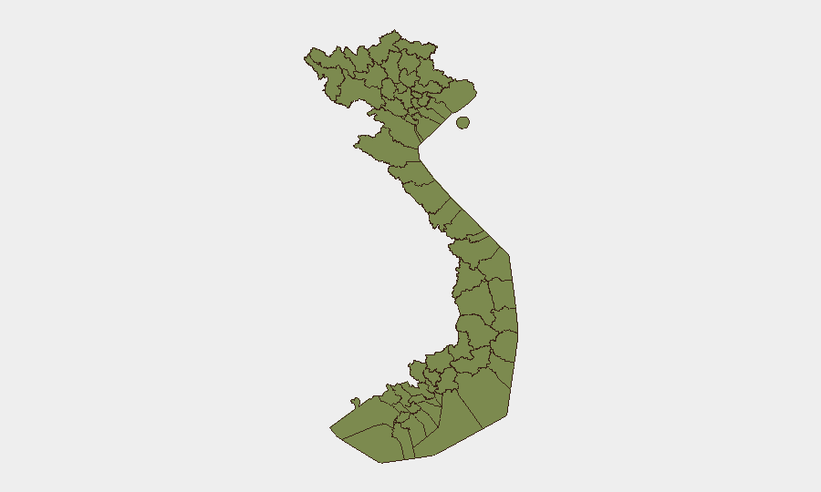
Situation Summary
Vietnam remains a composite threat score 6 globally (#121)—a low-risk operating environment for most corporate activity. However, natural disaster risk has spiked in northern mountainous zones due to severe monsoon flooding since 17 July, with four confirmed deaths and four missing in Lai Châu Province alone. Concurrently, law-enforcement activity across multiple provinces (Hà Tĩnh, Nghệ An, Quảng Ngãi, Đắk Lắk, Ho Chi Minh City, Cần Thơ) reflects routine criminal and financial investigations; no indication of systemic instability or protest-driven unrest has emerged in the last 48 hours.
Key Developments
- Lai Châu Province (Mường Than commune), 17 July 2026:
Flash floods and landslides in Bản Chít killed at least four people, left four missing, and injured seven; provincial emergency declared with police, military, and rescue teams deployed across flood zones. Northern mountainous region affected broadly, with over 1,000 police officers mobilized for rescue and traffic control.
- Quảng Ngãi Province, 17 July 2026:
3.0-magnitude earthquake struck offshore; no casualties reported, but authorities monitoring local infrastructure and assessing landslide risk in adjacent mountainous areas.
- Ho Chi Minh City, ongoing (updates in last 48h):
Police detained two men (Trần Thanh Lâm, Dương Quốc Thái) for alleged public-order disturbances; continued questioning reflects routine law-enforcement operations.
- Hà Tĩnh Province, last 48h:
Police dismantled two transnational money-laundering rings, arresting 47 suspects and seizing evidence; investigation ongoing with multi-agency coordination.
- Nghệ An and Quảng Ngãi Provinces, 18–19 July 2026:
Law enforcement broke up large-scale online football betting networks, arresting 13 suspects in Nghệ An and temporarily detaining 7 in Quảng Ngãi.
- Cần Thơ City, mid-July (investigation ongoing):
Police investigating smash-and-grab theft at Miên Vĩnh Phát gold shop; local retailers advised to tighten security protocols.
- Đắk Lắk Province, 16–18 July 2026:
Active field verification of suspected illegal gold-mining activity in remote areas; environmental and land-use compliance checks underway.
Highest-Risk Areas
Tuyên Quang Province (34.3) and Huế (26.3) dominate the sub-national risk ranking and warrant disproportionate security attention. Both carry composite scores significantly above the national average; Tuyên Quang's elevation reflects a pattern of accumulated security incidents in the northern mountainous belt. Ho Chi Minh City (16.5) and Hà Nội (14.1), despite their size and economic importance, show lower composite scores due to functional policing and infrastructure resilience. Lai Châu Province (11.6)—currently experiencing active flood response—remains in the elevated-risk category; teams with personnel or supply chains in the north should monitor travel corridors and logistics during the monsoon season (through September).
How GeoBit Would Assist
Intel Sweep and multi-language OSINT fusion across government announcements, local media, and provincial police channels enable real-time tracking of flood-response operations, arrest activity, and infrastructure impacts without reliance on international news delays. AOI Monitoring & Early Warning pinned to Tuyên Quang, Huế, Lai Châu, and Ho Chi Minh City supply persistent alerts on escalating incidents, crowd activity, or enforcement action affecting supply routes or personnel safety. GIS & Spatial Analysis combined with satellite imagery assesses road and bridge damage, water-system integrity, and landslide zones in northern provinces—critical for logistics planners and duty-of-care teams managing asset movement.
7-Day Outlook
Monsoon rains are forecast to persist in the north through late July, sustaining flood and landslide risk in Lai Châu, Tuyên Quang, and adjacent provinces; road closures and supply-chain delays should be anticipated. Routine law-enforcement operations (arrests, betting rings, money-laundering investigations) will likely continue; no escalation to organized unrest or political instability is anticipated. Corporate teams should prioritize flood-impact contingency planning for northern operations and logistics hubs.
Highest-Risk Areas — Ranked
| # | State / Region | Risk |
|---|---|---|
| 1 | Tuyên Quang Province | 34.3 |
| 2 | Huế | 26.3 |
| 3 | Ho Chi Minh City | 16.5 |
| 4 | Hà Nội | 14.1 |
| 5 | Lai Châu Province | 11.6 |
| 6 | Tiền Giang Province | 4.9 |
| 7 | Lào Cai Province | 4.3 |
| 8 | Hà Giang Province | 4.3 |
| 9 | Cao Bằng Province | 4.3 |
| 10 | Bắc Kạn Province | 4.3 |
| 11 | Điện Biên Province | 4.3 |
| 12 | Yên Bái Province | 4.3 |
Sources
Previous Daily Briefs
A new Vietnam brief is written every day — each with its own risk map and downloadable CSV. Here's the last week; use the calendar to go further back.
📅 Browse every day by calendar →
Highlighted days have a brief. Tap a day for that day's map & analysis, or “csv” for that day's dataset ($5).
Atlas — our AI intelligence desk — emails them this snapshot personally. Nothing else, no list.