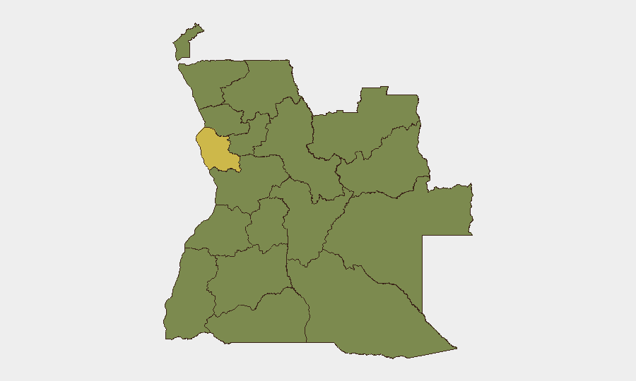
Situation Summary
Angola remains at moderate global risk (rank #47, composite score 46) with no acute security incidents reported in the last 24–48 hours. The country is hosting the 2026 African Chiefs of Defense Conference in Luanda, a scheduled diplomatic event that has introduced heightened security presence and possible localized traffic disruptions in the capital but poses no inherent threat. Wildfire activity across multiple provinces continues but remains a secondary environmental rather than security concern. The overall risk trajectory is stable, with Luanda Province driving a disproportionate share of the national composite risk score.
Key Developments
- Luanda – African Chiefs of Defense Conference (ongoing, 3–4 July 2026)
High-level military and defense leadership from multiple African states and U.S. Africa Command are convening in Luanda. This scheduled event implies elevated security cordons, possible short-notice street closures, and tighter access control around government and diplomatic venues in central Luanda through at least 4 July.
- Luanda – AFRICOM regional security briefing (3–4 July 2026)
U.S. State Department–hosted media briefing tied to the defense conference featured AFRICOM commander commentary on counter-terrorism operations in Nigeria and the Lake Chad Basin. No new threats to Angola were indicated, but the briefing underscores the country's strategic role in regional security dialogue.
- Multiple provinces – ongoing wildfire activity (recent)
Active wildfires have been reported across Angola including Luanda Province and several northern and eastern regions. While not security incidents, wildfires can affect visibility, air quality, and movement on secondary roads; they may also trigger localized evacuations or strain emergency services in affected areas.
- No reported armed incidents, civil unrest, or crime events in last 24–48 hours
Open-source monitoring and news feeds show no corroborated reports of armed clashes, terrorist attacks, mass protests, major crime incidents affecting foreigners, or sudden infrastructure failures in Angola within the reporting window.
Highest-Risk Areas
Luanda Province is the dominant risk driver, with a composite score of 61.8—nearly double that of any other region—reflecting the concentration of government, diplomatic, commercial, and population density in the capital. The remaining eleven provinces cluster at risk score 31.8, suggesting more uniform but lower baseline risk outside the capital. Security teams should treat Luanda as the primary focus for monitoring and contingency planning, particularly during high-profile events such as the ongoing defense conference. Northern provinces (Lunda Norte, Cabinda, Zaire, Uíge) warrant secondary attention given historical cross-border activity and resource competition, though no acute incidents are currently reported.
How GeoBit Would Assist
Security and risk teams can deploy AOI Monitoring & Early Warning to maintain persistent watch on Luanda and secondary high-risk provinces, with alerting configured for armed incidents, civil unrest, or infrastructure disruptions. Intel Sweep and multi-language OSINT capabilities enable continuous scanning of local news, social media, and government announcements to detect emerging civil unrest, crime, or political instability before they escalate. Routing & Network Analysis supports contingency planning and alternative movement corridors around the capital during events that generate traffic or access restrictions.
7-Day Outlook
The near-term trajectory remains stable, with the defense conference likely to conclude by 5 July, after which Luanda security posture should normalize. Wildfire activity may persist in northern and eastern provinces depending on weather patterns, but poses no direct security threat. No indicators suggest imminent conflict, civil unrest, or policy changes over the next week.
Highest-Risk Areas — Ranked
| # | State / Region | Risk |
|---|---|---|
| 1 | Luanda Province | 61.8 |
| 2 | Lunda Norte Province | 31.8 |
| 3 | Lunda Sul Province | 31.8 |
| 4 | Cabinda Province | 31.8 |
| 5 | Zaire Province | 31.8 |
| 6 | Bengo Province | 31.8 |
| 7 | Uíge Province | 31.8 |
| 8 | Cuanza Norte Province | 31.8 |
| 9 | Cuanza Sul Province | 31.8 |
| 10 | Malanje Province | 31.8 |
| 11 | Bié Province | 31.8 |
| 12 | Moxico Province | 31.8 |
Previous Daily Briefs
A new Angola brief is written every day — each with its own risk map and downloadable CSV. Here's the last week; use the calendar to go further back.
📅 Browse every day by calendar →
Highlighted days have a brief. Tap a day for that day's map & analysis, or “csv” for that day's dataset ($5).