Situation Summary
Antigua and Barbuda remains a low-threat jurisdiction globally (rank #184; composite score 2), but is experiencing a localized firearm-violence spike concentrated in the capital, St. John's, that has prompted elevated government and law-enforcement response. Since early August, multiple shootings have resulted in fatalities and hospitalizations; authorities have launched enhanced investigative operations and announced policy measures including expanded police armament and a comprehensive criminal-justice review. The security environment is characterized by reactive state mobilization rather than systemic instability, with no verified major incidents reported in the last 24–48 hours beyond ongoing homicide investigation activity.
Key Developments
- St. John's, All Saints Road – murder investigation formally launched (Aug 15, 2026). Police announced a formal murder probe into the July 14 shooting death of 39-year-old Omari Philip, offering a cash reward for information on two armed suspects who fired multiple rounds from a white Toyota Axio. The Aug 15 announcement reflects heightened investigative activity and continued police focus on St. John's homicides.
- Nationwide – government accelerates police armament policy (Aug 14–16, 2026). Officials stated that more police officers will be armed as part of a direct response to the current escalation in gun violence. This policy shift is expected to increase visible police presence and armed-officer deployments, potentially affecting law-enforcement interactions and public perception of security posture.
- Nationwide – Prime Minister formally proposes criminal-justice review (Aug 13–14, 2026). Prime Minister Gaston Browne announced an independent committee to review firearm sentencing, serious violent offences, and repeat-offender protocols. The announcement underscores official recognition that homicide rates remain elevated relative to 2019 baselines and signals intent to strengthen prosecution and sentencing frameworks.
- No new verified shootings or major incidents in the 24–48 hours preceding Aug 16. Open-source reporting does not document additional confirmed shootings, protests, infrastructure disruptions, or mass-casualty events on Aug 15–16. This represents a pause in the incident tempo observed Aug 6–10, though the underlying threat driver (gun violence in St. John's) remains unresolved.
Highest-Risk Areas
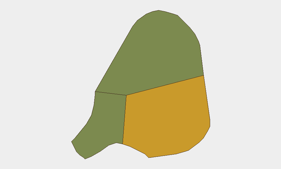
Antigua (risk score 72) dominates sub-national threat rankings and concentrates the vast majority of firearm-violence incidents, particularly in St. John's and surrounding neighborhoods. Barbuda (risk 18) and Redonda (risk 8) present significantly lower risk profiles. The St. John's spike is driven by a combination of gang-related activity, disputes over territory or resources, and limited immediate capacity for law-enforcement prevention; Barbuda's lower score reflects both lower population density and reduced gang presence.
How GeoBit Would Assist
Corporate security and duty-of-care teams should leverage AOI Monitoring & Early Warning to establish persistent watch over St. John's and key commercial/residential clusters, with automated alerting on police activity and reported incidents. Intel Sweep and multi-source OSINT fusion (including local news, police statements, and social-media sentiment analysis) can corroborate incident reports and track government policy changes in real time. Routing & Network Analysis enables identification of safer transit corridors and alternative movement patterns for personnel transiting high-risk areas.
7-Day Outlook
Near-term trajectory is likely characterized by continued heightened police visibility and enforcement activity, with no imminent expectation of large-scale escalation or resolution. The government's policy moves (armament, justice review) signal medium-term commitment to disruption; however, 7–10 day horizons typically do not reflect measurable impact on underlying violence drivers. Monitoring should remain focused on St. John's incident reporting and any spike in police-related shootings or public-order interventions.
Highest-Risk Areas — Ranked
| # | State / Region | Risk |
|---|---|---|
| 1 | Antigua | 72 |
| 2 | Barbuda | 18 |
| 3 | Redonda | 8 |
Sources
Previous Daily Briefs
A new Antigua and Barbuda brief is written every day — each with its own risk map and downloadable CSV. Here's the last week; use the calendar to go further back.
- August 14, 2026
- August 12, 2026
- August 10, 2026
- August 8, 2026
- August 6, 2026
- August 5, 2026
- August 4, 2026
📅 Browse every day by calendar →
Highlighted days have a brief. Tap a day for that day's map & analysis, or “csv” for that day's dataset ($5).
Atlas — our AI intelligence desk — emails them this snapshot personally. Nothing else, no list.