Situation Summary
Canada's composite threat score remains low globally (rank #69, score 2.1), but recent 24–48 hour signals indicate elevated tension in Ontario and British Columbia, driven by small-arms incidents, diplomatic friction with the U.S., and civil unrest tied to international geopolitical fault lines. Police–civilian armed confrontation, judicial threats, and financial-sector public statements on June 27–28 suggest fragmented, acute stress points rather than systemic instability. Trajectory remains volatile but localized; escalation risk is moderate if U.S.–Canada diplomatic friction or domestic protest activity accelerates.
Key Developments
- Toronto, Ontario | 2026-06-28 — U.S. consulate struck by gunfire; police declared a national security incident. No casualty count or shooter identification confirmed in available reporting.
- Ontario (location unspecified) | 2026-06-27 — Small-arms combat between police and neighborhood actors; motive and outcome details insufficient from current signals.
- Toronto/Ontario judicial context | 2026-06-27 — Criminal actor issued disapproval statement toward judge; separate signal indicates judge–state tension on unconventional violence. Context remains unclear.
- Calgary, Alberta | 2026-06-27 — Rejection action recorded; context (labor, civic, security-related) not specified in available data.
- National | 2026-06-27–28 — Royal Bank of Canada issued public statement and faced rejection signal; separate bank sector public statement noted. Link to current security incident unknown; may indicate financial-sector response to broader instability.
- Economist sector | 2026-06-27 — Threat issued against economist; motive unclear.
- Canada (national) | 2026-06-27 — Demonstration/rally organized by Canadian actors concerning Palestinian cause; scale and location unconfirmed.
- International linkage | 2026-06-27–28 — Politician–American disapproval signal and Tehran–American unconventional-violence signal suggest foreign pressure or transnational actor involvement; U.S. consulate incident may be connected.
Highest-Risk Areas
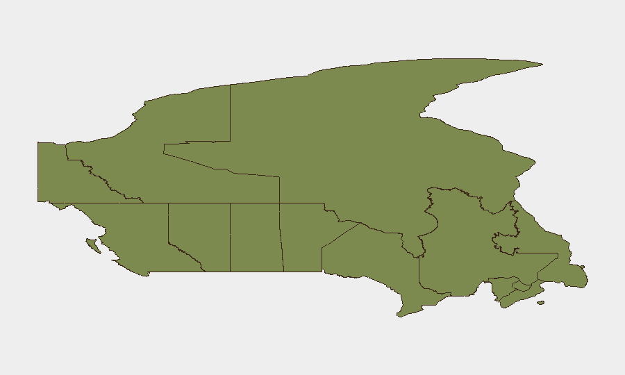
Ontario (score 31.5) and British Columbia (25.3) dominate the sub-national ranking and are driving national-level threat signals, with Toronto and surrounding regions showing armed conflict, judicial pressure, and diplomatic security incidents. Nunavut (20.5) and Quebec (20.3) round out the top tier; Nunavut's elevation is notable given its isolation and limited infrastructure, while Quebec's score likely reflects political or cross-border dynamics. All other provinces score below 5, indicating risk concentration in the central and western corridor. The Ontario spike, anchored by the June 28 consulate attack and June 27 police–civilian armed contact, is the primary driver of current concern.
How GeoBit Would Assist
Security teams covering Canadian personnel and assets should deploy Intel Sweep and X/Twitter OSINT to track emerging statements from U.S. consulate, Canadian law enforcement, and civil-unrest organizers in real time; Entity Extraction and Network Analysis to map connections between the Toronto incident, judicial threats, and financial-sector messaging; and AOI Monitoring & Early Warning for Toronto, Vancouver, and Calgary to generate persistent alerts on armed activity, diplomatic incidents, and protest mobilization before escalation. GIS & Spatial Analysis can correlate the location clusters of the six highest-risk provinces and flag concentration patterns for duty-of-care route and facility planning.
7-Day Outlook
The consulate shooting and concurrent judicial/criminal signals suggest acute tension, but no indicators yet point to sustained or organized uprising. Watch for U.S.–Canada diplomatic statements, police announcements, and further financial-sector messaging in the next 48–72 hours; if the consulate incident is linked to the June 27 neighborhood firefight or foreign-actor involvement (Tehran signal), escalation risk rises sharply. Baseline assumption: localized incidents and political friction; trajectory neutral to slightly elevated unless additional armed events or diplomatic breakdown occurs.
Highest-Risk Areas — Ranked
| # | State / Region | Risk |
|---|---|---|
| 1 | Ontario | 31.5 |
| 2 | British Columbia | 25.3 |
| 3 | Nunavut | 20.5 |
| 4 | Quebec | 20.3 |
| 5 | Alberta | 17.1 |
| 6 | Manitoba | 4.9 |
| 7 | New Brunswick | 3.8 |
| 8 | Prince Edward Island | 3 |
| 9 | Saskatchewan | 2.8 |
| 10 | Northwest Territories | 1.6 |
| 11 | Yukon | 1.5 |
| 12 | Newfoundland and Labrador | 1.5 |
Sources
Previous Daily Briefs
A new Canada brief is written every day — each with its own risk map and downloadable CSV. Here's the last week; use the calendar to go further back.
📅 Browse every day by calendar →
Highlighted days have a brief. Tap a day for that day's map & analysis, or “csv” for that day's dataset ($5).