Situation Summary
Central African Republic remains at elevated baseline risk (global rank #27, composite threat score 70) driven by persistent armed-group activity, crime, and kidnapping across most prefectures outside the capital. Bangui itself (risk 79.3) faces compounding political-security uncertainty as authorities undertake security-sector reshuffles amid allegations of destabilization plots and strengthening foreign military influence. Road corridors, particularly in eastern and southern prefectures, remain high-risk for armed interception and banditry. No major incident-level security events have been independently confirmed in open sources within the last 24–48 hours; however, sparse and delayed reporting from CAR means recent attacks or clashes may not yet be publicly visible.
Key Developments
No independently corroborated incident-level security events have been confirmed in Central African Republic within the last 24–48 hours as of 21 June 2026 04:00 UTC. Open-source reporting from CAR is characteristically slow to emerge and often lacks multi-source verification in the immediate aftermath of events.
Near-term context (last 5–7 days, for operational awareness):
- Bangui – Security-sector reshuffles and investigation activity, reported 19 June. Authorities have reinforced security services and are preparing personnel changes in key posts amid investigation of alleged destabilization plots; Russian military influence is noted as strengthening in parallel.
- Haut-Mbomou, Zémio–Mboki road – Armed interception of humanitarian staff, 13 June. Ten staff from an NGO were stopped by armed men on the Zémio–Mboki road; personnel were released after theft of belongings, illustrating ongoing banditry risk on secondary routes.
- Bangui – Judicial capacity-building workshop, 16–18 June. ICC and Central African judicial personnel conducted a joint workshop on serious-crime investigation, indirectly reflecting institutional security gaps and ongoing external support for judicial processes.
Highest-Risk Areas
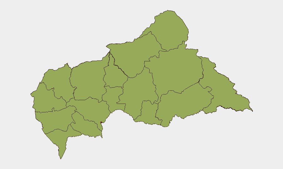
Bangui dominates the risk landscape at 79.3, reflecting concentrated political-security volatility, elite-level intrigue, and command-and-control uncertainty within national security institutions. The remaining eleven prefectures cluster at risk 49.3–56.8, driven by decentralized armed-group presence, limited state authority, banditry, and kidnapping. Ouaka (56.8) ranks second, likely reflecting proximity to ungoverned spaces and cross-border activity. Eastern and southern prefectures (Haut-Mbomou, Mbomou, Vakaga) are particularly vulnerable to armed interception on roads; western zones (Ouham, Nana-Mambéré) face similar but lower-intensity threats. The risk distribution suggests that while Bangui faces elite-level instability and checkpoint volatility, field operations and personnel transit outside the capital face consistent banditry and armed-group interference.
How GeoBit Would Assist
Security teams should employ AOI Monitoring & Early Warning on Bangui's political-security network and eastern road corridors (Zémio–Mboki, Bangassou routes) to detect emerging incidents and checkpoints before they affect operations. Network & Actor Analysis paired with Intel Sweep (X/Twitter OSINT, French-language local outlets, verified in-country sources) will surface real-time incident reporting and security-posture changes faster than international wire services. Routing & Network Analysis supports dynamic journey planning to avoid known armed-group concentrations and interception hotspots. Cross-referencing with Humanitarian & NGO data and MINUSCA situation reports ensures alignment with peer-organization incident patterns and checkpoint intelligence.
7-Day Outlook
Baseline armed-group and banditry risk will remain high across prefectures; no major escalation is indicated, but the sparse reporting environment means incidents may occur without immediate visibility. Bangui's political-security environment remains fluid, with potential for short-notice checkpoint increases or access restrictions tied to elite-level maneuvering. Road travel outside the capital should be assumed high-risk unless real-time intelligence confirms otherwise.
Highest-Risk Areas — Ranked
| # | State / Region | Risk |
|---|---|---|
| 1 | Bangui | 79.3 |
| 2 | Ouaka | 56.8 |
| 3 | Bamingui-Bangoran | 49.3 |
| 4 | Vakaga | 49.3 |
| 5 | Haute-Kotto | 49.3 |
| 6 | Haut-Mbomou | 49.3 |
| 7 | Mbomou | 49.3 |
| 8 | Nana-Mambéré | 49.3 |
| 9 | Ouham-Pendé | 49.3 |
| 10 | Mambéré-Kadéï | 49.3 |
| 11 | Sangha-Mbaéré | 49.3 |
| 12 | Ouham | 49.3 |
Sources
Previous Daily Briefs
A new Central African Republic brief is written every day — each with its own risk map and downloadable CSV. Here's the last week; use the calendar to go further back.
📅 Browse every day by calendar →
Highlighted days have a brief. Tap a day for that day's map & analysis, or “csv” for that day's dataset ($5).