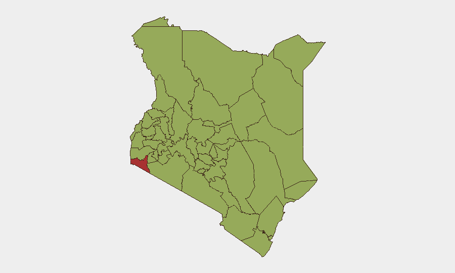
Situation Summary
Kenya's security profile remains fragmented, with acute localized threats dominating the current cycle. A fatal Al‑Shabaab attack in Mandera County (28 July) and concurrent fuel‑price transport protests across Nairobi and surrounding counties (27–29 July) have created dual pressure points—one terror-driven in the northeast border belt, one civil-unrest-driven in the capital and key transit corridors. Overall national composite threat score stands at 66/100 (rank #21 globally), but sub-national variance is acute: Migori County leads at 76.1, while Nairobi (58.2) and northeastern counties (Mandera, Wajir, Garissa) remain under persistent Al‑Shabaab and kidnapping risk.
Key Developments
- Mandera County, Quraqura‑Wante area (Lafey vicinity) – 28 July 2026, ~noon
Al‑Shabaab militants attacked a Special Operations Group (SOG) patrol near Wantey Dam; at least five personnel killed (four security officers, one civilian). Follow-up IED strike on reinforcement team destroyed an armoured vehicle with no additional reported casualties. Security operations and heightened patrols ongoing in border belt.
- Mandera County, Fino security camp – 24–25 July, high alert continuing through 29 July
Suspected Al‑Shabaab militants attacked Fino camp with heavy gunfire also reported in Arabia and Asharaf areas. Assailants were engaged and repelled; one student wounded. Mandera border belt remains under active security operations.
- Nairobi City – Thika Superhighway, Outer Ring Road, CBD, Roysambu, Githurai – 27–29 July 2026
Fuel‑price transport strike (matatu sector) escalated into violent clashes with anti-riot police. At least four deaths and hundreds of arrests reported. Heavy security deployment across all named corridors; sporadic clashes and motorist harassment ongoing, particularly near Ruiru Bypass and along Waiyaki Way.
- Kitengela town, Namanga Highway (Kajiado County) – 27–28 July 2026
Fuel‑strike unrest; suspected goons harassed motorists and commuters. Police deployed; location remains a focal point for fuel‑grievance-linked disorder.
- Multi‑county fuel‑price protests – 27–28 July 2026
Disorder spread beyond Nairobi into multiple counties; at least four deaths, dozens injured reported. Intermittent roadblocks and confrontations along inter‑county routes disrupting travel into and out of the capital.
Highest-Risk Areas
Migori County (76.1) remains the single highest-risk jurisdiction, reflecting chronic cross-border volatility and organized crime activity. Nairobi County (58.2) ranks second owing to terrorism risk, crime, and—currently—civil protest friction. The northeastern tier (Mandera, Wajir, Garissa—not in top 12 but tracked at scale) faces sustained Al‑Shabaab operational tempo and kidnapping-for-ransom networks; the Mandera attacks on 24–28 July underscore active militant capacity and intent. Isiolo and Turkana (47.8, 47.2) carry cross-border pastoralist-conflict and terrorism exposure. The fuel-strike unrest now active in Nairobi and Kajiado reflects an emerging secondary driver of localized instability independent of the border-terror threat.
How GeoBit Would Assist
Security teams monitoring Kenya should deploy AOI Monitoring & Early Warning on Mandera's border belt and Nairobi's protest-prone corridors (Thika, Outer Ring, CBD) to flag real-time protest/militant activity and roadblock deployment. Routing & Network Analysis would enable identification of alternative inter-county transit routes to bypass fuel-strike blockades on primary highways. Conflict & Military and Network & Actor Analysis capabilities support tracking Al‑Shabaab operational patterns, SOG positioning, and protest-actor identity to forecast next flashpoints.
7-Day Outlook
Mandera border operations are likely to remain active as security forces pursue recent attackers; additional Al‑Shabaab incidents possible within 7–14 days. Fuel-strike momentum may recede if transport unions and government reach negotiated settlement, but residual roadblock harassment and sporadic clashes should be expected along Nairobi–Kajiado–Namanga corridors through early August. Travel risk to the capital and northeast will remain elevated.
Highest-Risk Areas — Ranked
| # | State / Region | Risk |
|---|---|---|
| 1 | Migori County | 76.1 |
| 2 | Nairobi County | 58.2 |
| 3 | Embu | 51.3 |
| 4 | Isiolo | 47.8 |
| 5 | Kiambu | 47.8 |
| 6 | Turkana County | 47.2 |
| 7 | Homa Bay County | 46.6 |
| 8 | Murang'a County | 46.6 |
| 9 | Busia County | 46.1 |
| 10 | Kakamega County | 46.1 |
| 11 | Vihiga County | 46.1 |
| 12 | Nandi County | 46.1 |
Sources
Previous Daily Briefs
A new Kenya brief is written every day — each with its own risk map and downloadable CSV. Here's the last week; use the calendar to go further back.
📅 Browse every day by calendar →
Highlighted days have a brief. Tap a day for that day's map & analysis, or “csv” for that day's dataset ($5).
Atlas — our AI intelligence desk — emails them this snapshot personally. Nothing else, no list.