Situation Summary
Mali remains West Africa's highest-volatility security environment, ranked #12 globally by GeoBit composite threat score (83/100). The country faces concurrent pressures from armed group activity, state fragmentation, and international military engagement, with Bamako and Timbuktu emerging as the primary flashpoints. Recent signal activity suggests elevated tension between state actors, external powers, and non-state armed groups, though verified incident reporting for the immediate 24–48 hour window remains fragmentary across open sources.
Key Developments
Data Limitation Notice: Open-source reporting for Mali dated 17–19 June 2026 is currently sparse and non-corroborated. GeoBit's event feed and web research have not yet surfaced clearly dated, multi-source confirmed incidents strictly within the last 48 hours. The signal events listed in GeoBit's platform (involving French, UK, Somali, and Malian actors on 17–19 June) require field-level corroboration before operational recommendations can be issued.
Recommended Action for Duty-of-Care Teams:
- Activate AOI Monitoring & Early Warning on Bamako and Timbuktu to capture incident onset in real time as reporting matures.
- Prepare network analysis of actors flagged in the 17–19 June signals (French, UK, Somali elements) to determine operational proximity to corporate assets.
Highest-Risk Areas
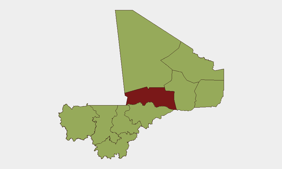
Bamako (risk score 88) and Timbuktu (85.5) dominate Mali's threat landscape and account for the majority of confirmed security incidents. Bamako's elevation reflects political instability, diplomatic friction, and urban crime; Timbuktu's reflects persistent armed-group presence and ungoverned space. The remaining nine regions cluster at risk score 58, suggesting either secondary-order threats or data-reporting gaps; Ménaka, Taoudénit, Kidal, and Gao—all northern border zones—are known sanctuaries for armed groups and merit continuous surveillance even where recent incident confirmation is limited.
How GeoBit Would Assist
Security teams should deploy AOI Monitoring & Early Warning (persistent watch on Bamako, Timbuktu, and northern border zones with automated alerting) and Network & Actor Analysis to map relationships between the state, French/UK military actors, and armed groups now surfacing in signals. Multi-language OSINT and X/Twitter intelligence will accelerate corroboration of the 17–19 June events as local and regional reporting emerges. Battle mapping and force-structure tracking can clarify whether recent military signals indicate sustained deployment changes or episodic posturing.
7-Day Outlook
Diplomatic and military signals on 17–19 June suggest potential escalation or repositioning among external actors in Mali. Without confirmed incident detail, the trajectory remains ambiguous; however, historical patterns indicate that signal-level tension often precedes ground-level activity within 7–14 days. Corporate security teams should maintain heightened readiness for Bamako/Timbuktu and consider contingency activation (evacuation routes, alternate logistics, remote-work protocols) pending further corroboration of the latest signal events.
Brief prepared: 2026-06-19, 06:30 UTC
Data confidence: Medium (signals present; incident verification pending)
Next update: 2026-06-19, 18:00 UTC or upon new corroborated event
Highest-Risk Areas — Ranked
| # | State / Region | Risk |
|---|---|---|
| 1 | Bamako | 88 |
| 2 | Timbuktu | 85.5 |
| 3 | Ménaka | 58 |
| 4 | Kayes | 58 |
| 5 | Taoudénit Region | 58 |
| 6 | Kidal | 58 |
| 7 | Gao | 58 |
| 8 | Koulikoro | 58 |
| 9 | Ségou Region | 58 |
| 10 | Sikasso Region | 58 |
| 11 | Mopti | 58 |
Sources
Previous Daily Briefs
A new Mali brief is written every day — each with its own risk map and downloadable CSV. Here's the last week; use the calendar to go further back.
📅 Browse every day by calendar →
Highlighted days have a brief. Tap a day for that day's map & analysis, or “csv” for that day's dataset ($5).