Situation Summary
Nepal remains a relatively moderate global security concern (rank #78, composite score 15) with 36 tracked threat events. The security environment is characterized by localized political friction, administrative tensions, and civil-society activism rather than widespread violence or instability. No verifiable acute security incidents or civil unrest have been reported in the last 24–48 hours via open-source channels, though baseline crime, road safety, and weather-related risks persist.
Key Developments
Open-source reporting for the last 24–48 hours does not reveal specific, multi-sourced incidents meeting operational alert thresholds. Recent GEOBIT event signals (through 2026-06-30) document administrative and political activity—parliamentary rejections, hospital-government statements, police investigations in Kathmandu, and banking inquiries—but these lack detailed incident reporting or confirmed escalation indicators from web-accessible sources at this time. Security teams should confirm Nepal-specific developments through direct local contacts and government liaison channels; absence of indexed web coverage does not confirm absence of local activity.
Highest-Risk Areas
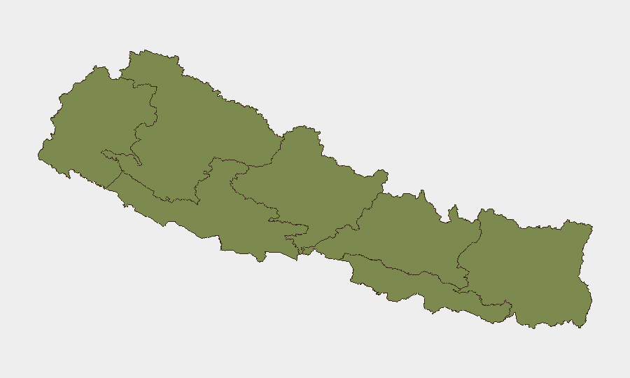
Bagamati Province (risk score 31.8) significantly outranks other regions and represents the primary concentration of tracked threat activity. This province includes Kathmandu and the capital region, where political, administrative, and civil-unrest risks cluster. Gandaki Province (16) and Sudurpashchim Province (13.2) present secondary risk zones; all other provinces score below 10. The steep risk gradient suggests that duty-of-care exposure in Nepal correlates heavily with Kathmandu Valley presence; provincial operations face materially lower incident probability.
How GeoBit Would Assist
Security teams should employ AOI Monitoring & Early Warning on Bagamati Province (specifically Kathmandu district) to detect emerging political demonstrations, transport disruptions, or civil unrest before they affect operations. OSINT Fusion (multi-language social-media search, X/Twitter feeds, local news aggregation) provides real-time tracking of political statements, labor actions, and administrative tensions that precede formal incidents. Routing & Network Analysis enables alternative journey planning for personnel and supply chains if protests, road closures, or administrative checkpoints emerge. Regular Intel Sweep across Nepal-focused feeds and Telegram channels will surface localized crime, security-force activity, or border incidents before they spread.
7-Day Outlook
Political and administrative frictions are likely to remain at baseline levels absent a major parliamentary or governmental trigger. Monsoon season weather impacts—flooding, landslides, road disruption—remain a concurrent duty-of-care factor, particularly in Gandaki and Sudurpashchim provinces. Monitor Kathmandu-area government statements and any escalation in hospital-government or police-investigation narratives for indicators of broader institutional stress; absence of web reporting does not signal institutional stability.
Next Update: 2026-07-02. For operational queries or AOI setup, contact GeoBit analyst on duty.
Highest-Risk Areas — Ranked
| # | State / Region | Risk |
|---|---|---|
| 1 | Bagamati Province | 31.8 |
| 2 | Gandaki Province | 16 |
| 3 | Sudurpashchim Province | 13.2 |
| 4 | Koshi Province | 6 |
| 5 | Lumbini Province | 4.6 |
| 6 | Karnali Province | 3.2 |
| 7 | Madhesh Province | 1.8 |
Sources
Previous Daily Briefs
A new Nepal brief is written every day — each with its own risk map and downloadable CSV. Here's the last week; use the calendar to go further back.
📅 Browse every day by calendar →
Highlighted days have a brief. Tap a day for that day's map & analysis, or “csv” for that day's dataset ($5).