Situation Summary
Oman faces elevated tension along its northern maritime boundary and within its Musandam Governorate following a confirmed commercial vessel strike on 12 July and concurrent public diplomatic friction with Iran over military posturing. While the overall composite threat score remains moderate (rank #160 globally), the convergence of maritime incidents, regional military activity, and demonstrated Omani state-level threat signals—rejection of military options and public disapproval of Iranian actions—suggests a period of heightened volatility in the northern Arabian Sea and Gulf of Oman approaches. Risk remains heavily concentrated in Al Wusta and Musandam governorates; the capital and most population centers retain low baseline threat.
Key Developments
- Musandam Governorate, offshore – 12 July 2026: Cypriot-flagged commercial vessel *GFS Galaxy* struck in waters off Musandam; 23 of 24 crew rescued by Omani Maritime Security Center, with one crew member (reported as Indian national) remaining missing. Incident confirms active hazard to merchant shipping in the northern approaches despite UKMTO's prior 48-hour all-clear notice issued 07 July.
- Oman national level – 12–13 July 2026: Public statements and diplomatic signals from Omani administration rejecting military escalation and expressing disapproval of Iranian actions; concurrent Omani public demonstrations vs. Iran recorded 13 July, indicating domestic political response to regional military tensions.
- Northern Arabian Sea / Strait of Oman – 12–13 July 2026: U.S. and Iranian conventional military force activity recorded in immediate vicinity of Omani waters; Oman's threat signals (rejection, disapproval) suggest state concern over third-party military operations proximate to its territory and shipping lanes.
- Background context (28 March 2026): Salalah Port (Dhofar Governorate) remains the most recent confirmed physical attack on Omani port infrastructure—a drone-related incident that damaged terminal crane and injured worker. Gradual operational resumption was underway as of end-March; current infrastructure resilience and security posture at this gateway port should be verified for current operations.
- Muscat and lower-risk governorates – 13 July 2026: No confirmed incidents reported in the capital or southern/interior regions; threat profile remains baseline.
Highest-Risk Areas
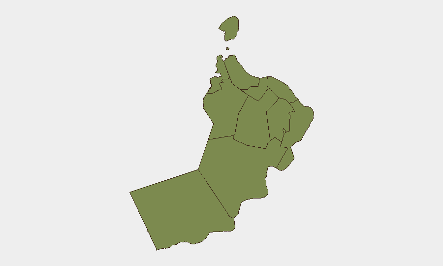
Al Wusta Governorate (composite risk 31.5) and Musandam Governorate (16.2) account for the overwhelming majority of tracked threat events, driven by maritime security incidents, proximity to the Strait of Oman, and regional geopolitical pressure. The *GFS Galaxy* strike confirms that Musandam waters remain an active hazard zone for commercial shipping. All other governorates score ≤4, with Muscat (the capital, seat of administration, and primary economic hub) at risk 4—indicating that acute security risk is heavily localized to the maritime north and remote desert interior, not the urban/diplomatic core.
How GeoBit Would Assist
Security teams should activate Maritime & Aviation tracking with persistent AOI (Area of Interest) Monitoring & Early Warning over Musandam waters and the northern Arabian Sea approaches to catch vessel strikes and third-party military activity in near-real time. Concurrent OSINT (X/Telegram, regional news feeds, port authority announcements) and Risk & Threat Assessment modules will flag escalation in state-level rhetoric or military deployments. Routing & Network Analysis capabilities enable alternative voyage planning around high-risk shipping lanes pending clearance confirmation.
7-Day Outlook
The combination of active maritime incidents, U.S.–Iran military activity, and Omani state concern suggests 7–10 days of elevated volatility in the northern Arabian Sea and Musandam approaches. Commercial shipping and offshore operations should anticipate continued constraints; search-and-rescue operations for the missing crew member may generate additional vessel activity. Diplomatic signals are stabilizing (Omani rejection of military escalation), but third-party military operations remain a variable beyond Omani direct control.
Highest-Risk Areas — Ranked
| # | State / Region | Risk |
|---|---|---|
| 1 | Al Wusta Governorate | 31.5 |
| 2 | Musandam Governorate | 16.2 |
| 3 | Muscat Governorate | 4 |
| 4 | Al Buraymi Governorate | 1.5 |
| 5 | Ad Dhahirah Governorate | 1.5 |
| 6 | Al Batinah North Governorate | 1.5 |
| 7 | Al Batinah South Governorate | 1.5 |
| 8 | Ad Dakhiliyah Governorate | 1.5 |
| 9 | Ash Sharqiyah North Governorate | 1.5 |
| 10 | Ash Sharqiyah South Governorate | 1.5 |
| 11 | Dhofar Governorate | 1.5 |
Sources
Previous Daily Briefs
A new Oman brief is written every day — each with its own risk map and downloadable CSV. Here's the last week; use the calendar to go further back.
📅 Browse every day by calendar →
Highlighted days have a brief. Tap a day for that day's map & analysis, or “csv” for that day's dataset ($5).
Atlas — our AI intelligence desk — emails them this snapshot personally. Nothing else, no list.