Situation Summary
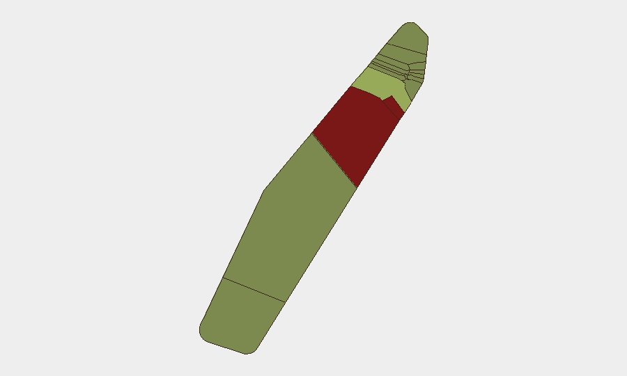
Palau remains in a low-threat security environment with no verified incidents, crime spikes, civil unrest, or infrastructure disruptions reported in the past 24–48 hours. Recent diplomatic statements between Palau and Australia, and Palau and Indonesia (both dated 26 July), have not escalated to operational security events or travel restrictions. The overall composite threat score reflects minimal near-term risk to corporate operations and personnel, though sub-national variation persists across the 16 states.
Key Developments
- Nationwide, 26 July: Palau issued public statements in diplomatic exchanges with Australia and Indonesia; no escalation, security incident, or travel advisory issued by either party as of 29 July.
- Koror (state capital), last 24–48 hours: No confirmed security events, crime incidents, or infrastructure disruptions. Routine commercial and government activity continues uninterrupted.
- Peleliu and Angaur, last 24–48 hours: Despite elevated baseline risk rankings (92 and 88 respectively), no new incidents, protests, or security deterioration reported during this period.
- Palau-flagged maritime assets: No new attacks on Palau-flagged vessels reported in the past 24–48 hours. (Historical context: a Palau-flagged cargo vessel was struck by a Russian drone off Ukraine in an earlier incident unrelated to Palau's territorial waters.)
- Local media cross-check: No security, conflict, major crime, or civil-unrest reporting in Palau's primary news outlets dated within the past 1–2 days.
Highest-Risk Areas
Peleliu (risk score 92) and Angaur (risk score 88) drive the sub-national risk ranking and warrant monitoring by teams with assets or personnel in those states, though no current incidents justify elevated duty-of-care actions. Koror (score 45), the commercial and administrative hub, remains the third-highest but retains very-low aggregate threat. The elevated baseline scores in Peleliu and Angaur likely reflect historical factors, demographic patterns, or infrastructure vulnerabilities rather than imminent operational threats; security teams should treat these as persistent structural risks requiring routine monitoring rather than acute crisis indicators.
How GeoBit Would Assist
Security and risk teams operating in Palau should employ AOI Monitoring & Early Warning (Area-of-Interest watch on Peleliu, Angaur, and Koror with real-time alerting for civil unrest, crime clusters, or infrastructure failure) and OSINT Fusion & Corroboration (daily cross-check of local media, government statements, and regional security feeds to detect nascent threats before escalation). Routing & Network Analysis can support contingency planning for personnel in high-risk states, identifying alternative transport and secure zones in lower-risk regions, while conflict and maritime tracking provides early warning of regional disputes affecting sea routes or port operations.
7-Day Outlook
Palau's security posture is expected to remain stable over the next seven days absent escalation of the recent diplomatic statements or emergence of new regional geopolitical friction. Routine monitoring of Peleliu and Angaur baseline indicators and continued OSINT surveillance of diplomatic and maritime developments involving Australia, Indonesia, and regional powers will provide sufficient early warning of material change. Personnel and asset protection protocols in place at present do not require elevation.
Highest-Risk Areas — Ranked
| # | State / Region | Risk |
|---|---|---|
| 1 | Peleliu | 92 |
| 2 | Angaur | 88 |
| 3 | Koror | 45 |
| 4 | Melekeok | 35 |
| 5 | Airai | 32 |
| 6 | Ngatpang | 28 |
| 7 | Ngeremlengui | 26 |
| 8 | Ngaraard | 25 |
| 9 | Ngardmau | 24 |
| 10 | Aimeliik | 23 |
| 11 | Ngiwal | 22 |
| 12 | Ngchesar | 21 |
Sources
Previous Daily Briefs
A new Palau brief is written every day — each with its own risk map and downloadable CSV. Here's the last week; use the calendar to go further back.
📅 Browse every day by calendar →
Highlighted days have a brief. Tap a day for that day's map & analysis, or “csv” for that day's dataset ($5).
Atlas — our AI intelligence desk — emails them this snapshot personally. Nothing else, no list.