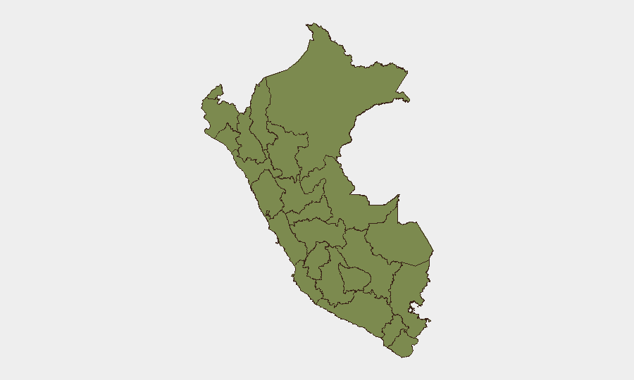
Situation Summary
Peru remains at moderate composite risk (global rank #55, score 25) with 146 tracked threat events, driven primarily by concentrated urban security challenges in Lima and gang/narcotics activity in Huánuco. The last 24–48 hours show no major incident escalation, though recent policy developments—including the July 11 Cusco Declaration on transnational crime by 30 hemisphere defense ministers—underscore regional concern about organized crime and narco-terrorism affecting Peru's stability. Political tensions, peasant-indigenous land disputes, and unconventional violence signals remain active, but no specific incidents of material scale have been verified in the immediate window.
Key Developments
- Lima (July 11–13, ongoing) – Multiple public statements and expressions of disapproval by Peru's government and ecclesiastical figures (bishop) signal response to domestic political or social friction; Ministry statement on July 12 indicates executive-level engagement with unrest drivers.
- Cusco Region (July 11, 2026) – At the 17th Conference of Defense Ministers of the Americas, Peru and 30+ regional partners adopted the "Cusco Declaration" to strengthen joint operations against transnational organized crime, terrorism, and illicit economies—reflecting official acknowledgment of Peru as a key trafficking/crime corridor.
- Peru–Mexico bilateral (July 13, 2026) – Relations reduced between Peru and Mexico; cause and scale not yet detailed in accessible reporting, but flags potential diplomatic friction that may affect regional cooperation or travel/commerce routes.
- Peasant–Indigenous tensions (July 12, 2026) – Recorded rejection/conflict event between peasant and indigenous groups; location and casualty/property impact unconfirmed in current data window.
- Unconventional violence incidents (July 11–12) – Two separate "unconventional violence" signals attributed to authorities and an entity labeled "Constantine"; limited detail available, but suggests low-level confrontation or security-force response.
- Broader context (last 7 days) – Cumulative signals include demand statements, conventional military positioning in a settlement, and politician disapproval, indicating simmering governance and resource-access disputes, particularly in highland/Amazon regions.
Highest-Risk Areas
Lima dominates Peru's risk landscape (composite 31.5), reflecting concentrated urban crime, gang activity, organized-crime logistics, and political volatility. Huánuco (26.9) is the second major flashpoint, driven by narcotics trafficking, rival gang presence, and indigenous-peasant land conflicts tied to coca cultivation and resource extraction. The gap between these two and all other regions is substantial, indicating that security and duty-of-care concerns for corporate operations should prioritize Lima and Huánuco; secondary-tier regions (Loreto, La Libertad, Ayacucho) carry moderate risk but are less likely to affect national operations or major transport/supply chains unless personnel are field-deployed.
How GeoBit Would Assist
Security teams should deploy AOI Monitoring & Early Warning on Lima and Huánuco to catch emerging protests, gang activity, or infrastructure disruptions before operational impact. Multi-language OSINT fusion (X/Twitter, Telegram, local news, radio SIGINT) will surface real-time incident signals and political sentiment shifts that open web alone may not capture. Routing & Network Analysis ensures duty-of-care teams can identify alternative travel corridors and safe zones if Lima or key highways become contested.
7-Day Outlook
No imminent escalation is forecast, but the visibility of peasant-indigenous disputes, ongoing unconventional violence, and Peru–Mexico diplomatic tension suggest continued low-level friction. Monitor for protest mobilization around resource access or political grievances in Lima and Huánuco; any significant development in narco-trafficking networks or gang turf conflicts would merit rapid reassessment.
Highest-Risk Areas — Ranked
| # | State / Region | Risk |
|---|---|---|
| 1 | Lima | 31.5 |
| 2 | Huánuco | 26.9 |
| 3 | Loreto | 6.7 |
| 4 | La Libertad | 6.7 |
| 5 | Ayacucho | 2.7 |
| 6 | Lambayeque | 2.1 |
| 7 | Puno | 2.1 |
| 8 | Tumbes | 1.5 |
| 9 | Piura | 1.5 |
| 10 | Amazonas | 1.5 |
| 11 | Cajamarca | 1.5 |
| 12 | Ancash | 1.5 |
Sources
Previous Daily Briefs
A new Peru brief is written every day — each with its own risk map and downloadable CSV. Here's the last week; use the calendar to go further back.
📅 Browse every day by calendar →
Highlighted days have a brief. Tap a day for that day's map & analysis, or “csv” for that day's dataset ($5).
Atlas — our AI intelligence desk — emails them this snapshot personally. Nothing else, no list.