Situation Summary
Saint Lucia remains classified as a moderate-risk environment for corporate security and duty-of-care purposes, with a composite threat score of 2 and no tracked major incidents in the current assessment window. The country's security posture is dominated by persistent violent crime—particularly armed robbery, shootings, and gang-related homicides—concentrated in urban centers, especially Castries. No acute political instability, infrastructure disruption, or civil unrest has been documented in the last 24–48 hours; the threat environment reflects chronic rather than acute drivers.
Key Developments
No discrete, verifiable security incidents timestamped to 1–2 August 2026 are currently documented in open-source reporting (news, social media, official advisories) that meet the threshold for inclusion as a "current development."
Recent reporting accessible via web search describes crime incidents (fatal shootings in Dennery, Bexon, and Jacmel; arson attempts in Castries) and a traffic fatality in Anse La Raye (27 July), but these events predate the last 48 hours and reflect ongoing crime trends rather than new developments.
The U.S. State Department raised Saint Lucia to Level 2 travel advisory for crime in early July 2026—a significant policy signal of heightened robbery, assault, and sexual violence risk to visitors, but that decision is weeks old.
Operational law-enforcement activities (Operation Zero Hour seizures of firearms and narcotics) continue as part of ongoing counter-crime efforts but are not discrete time-bounded incidents.
Security teams should monitor the absence of reporting within the last 48 hours as a baseline of relative stability rather than assume reduced underlying crime risk; violent crime patterns in Castries and Gros Islet persist structurally.
Highest-Risk Areas
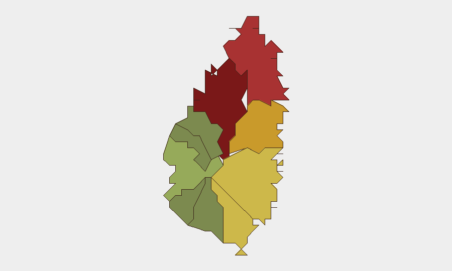
Castries (risk score 95) dominates the sub-national ranking and accounts for the majority of violent crime, armed robbery, and gang activity in the island. Gros Islet (78) and Dennery (72) follow as secondary hotspots, with Gros Islet driven by tourist-area robberies and Dennery by gang-affiliated shootings. These three districts contain the largest concentrations of population, commercial activity, and visitor exposure; risk in other districts remains notably lower. The spatial concentration of threat reflects both opportunity (foot traffic, commercial targets, tourism) and underlying gang-affiliated violence, particularly in Castries' inner neighborhoods.
How GeoBit Would Assist
Security teams with personnel or assets in Saint Lucia should employ AOI Monitoring & Early Warning to track Castries, Gros Islet, and Dennery for emerging incidents or operational changes, with alerting thresholds set for armed violence, robbery spikes, or unrest. Intel Sweep and OSINT fusion (news aggregation, social-media sentiment tracking, local radio intelligence) provide continuous baseline situational awareness and early detection of deterioration. Risk & Threat Assessment combined with GIS & Spatial Analysis enables mapping of safe movement corridors, identification of high-risk times and locations, and data-driven duty-of-care routing for staff and visitors.
7-Day Outlook
No significant escalation or de-escalation in Saint Lucia's threat environment is anticipated over the next seven days. Violent crime and robbery remain the baseline operational risk; seasonal tourism patterns and local law-enforcement operations will continue to shape day-to-day exposure. Security posture should remain static unless reporting indicates a material change in gang activity, political developments, or natural hazards.
Highest-Risk Areas — Ranked
| # | State / Region | Risk |
|---|---|---|
| 1 | Castries | 95 |
| 2 | Gros Islet | 78 |
| 3 | Dennery | 72 |
| 4 | Vieux Fort | 68 |
| 5 | Micoud | 65 |
| 6 | Soufrière | 42 |
| 7 | Laborie | 38 |
| 8 | Choiseul | 35 |
| 9 | Anse La Raye | 28 |
| 10 | Canaries | 12 |
Sources
Previous Daily Briefs
A new Saint Lucia brief is written every day — each with its own risk map and downloadable CSV. Here's the last week; use the calendar to go further back.
📅 Browse every day by calendar →
Highlighted days have a brief. Tap a day for that day's map & analysis, or “csv” for that day's dataset ($5).
Atlas — our AI intelligence desk — emails them this snapshot personally. Nothing else, no list.