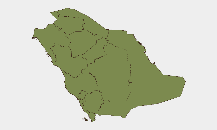
Situation Summary
Saudi Arabia faces elevated near-term security risk centered on cross-border missile and drone activity from Yemen, coupled with reciprocal Saudi military operations. Over the past 24–48 hours, multiple civil defense alerts across the Red Sea coastal belt and Eastern Province reflect active threat detection and response protocols, with no confirmed casualties or major infrastructure damage reported to date. The threat landscape remains volatile but containable within current Saudi air and civil defense posture; however, sustained Houthi-claimed strikes on maritime and energy assets indicate a persistence likely to extend risk through the near term.
Key Developments
- Yanbu Governorate (26 Jul, 06:00–09:00 local): Saudi Civil Defense issued and subsequently withdrew emergency alerts for a "potential danger"; residents were directed to shelter. No damage or casualties confirmed. Alerts correspond to reported Houthi missile activity targeting western Saudi infrastructure.
- Jazan Province (26 Jul, 06:30–10:00 local): Parallel civil defense alert and all-clear issued for southwestern province bordering Yemen. Alert timing aligns with claimed Houthi strike on Jizan city; no official damage assessment released by Saudi authorities.
- Jizan City, Red Sea coast (26 Jul, early morning): Yemen's Houthi movement claimed via social media that a "Yemeni missile strike" caused fires in the city, concurrent with civil defense alerts. Saudi authorities have not publicly confirmed impact details.
- Dammam, Eastern Province (25–26 Jul): National emergency alert system activated, with residents instructed to follow civil defense guidance. Regional assessments cite unconfirmed reports of attempted strikes against U.S. military and energy infrastructure in the Dammam–Jubail corridor; sustained air-raid system activation corroborates heightened alert status.
- Red Sea shipping lanes (within 48 hours to 27 Jul): Regional media sources report Houthi forces targeted three Saudi oil tankers and that 16 Saudi-flagged vessels have been turned back from Bab al-Mandab since 23 July, citing a claimed blockade. OSINT sources corroborate elevated maritime risk to Saudi tankers in Red Sea approaches.
- Western coastal infrastructure corridor (25–26 Jul): International outlets note that Yanbu and Jazan alerts were framed as responses to threats targeting Red Sea–adjacent oil export and refining infrastructure, following recent Saudi airstrikes on Houthi positions in Yemen.
- Military escalation signal (25–27 Jul): Event signals indicate conventional military force exchanges between Saudi Arabia and al-Hudaydah; Saudi military threats and public statements concurrent with alerts suggest sustained operational tempo.
Highest-Risk Areas
Riyadh Region (33.4) and Jazan Province (29.6) dominate the risk ranking, reflecting proximity to cross-border threat vectors and critical national infrastructure. Riyadh's elevated score reflects national command and economic concentration; Jazan's score reflects direct exposure to Houthi missile and drone capability and hosting of refinery and petrochemical assets. Medina Province (12.9) ranks third, likely due to pilgrimage-season security considerations and historical targeting patterns. All other provinces register substantially lower composite scores (3.4–3.6), indicating that current threat concentration is geographically constrained to the southwestern and central-capital corridors.
How GeoBit Would Assist
Security teams should employ AOI Monitoring & Early Warning on Yanbu, Jazan, Dammam, and Jubail to detect civil defense alert activation and maritime incident signals in real time. Maritime & Aviation tracking combined with OSINT fusion (Telegram, social media, and regional media monitoring) provides corroboration of Houthi strike claims and tanker targeting patterns without waiting for official Saudi statements. GIS & Spatial Analysis layered with satellite & imagery analysis enables assessment of damage to energy infrastructure and validation of alert justification, critical for duty-of-care documentation.
7-Day Outlook
Threat activity is expected to remain elevated through early August, with continued Houthi-claimed strikes on maritime assets and potential renewed civil defense alerts in coastal and Eastern Province locations. Saudi reciprocal military operations and air defense posture will likely persist. Risk to personnel and supply chains in the Yanbu–Jazan–Dammam corridor warrants sustained monitoring and contingency planning.
Highest-Risk Areas — Ranked
| # | State / Region | Risk |
|---|---|---|
| 1 | Riyadh Region | 33.4 |
| 2 | Jazan Province | 29.6 |
| 3 | Medina Province | 12.9 |
| 4 | Makkah Region | 3.6 |
| 5 | 'Asir Province | 3.6 |
| 6 | Northern Borders Province | 3.4 |
| 7 | Al-Bahah Province | 3.4 |
| 8 | Najran Region | 3.4 |
| 9 | Tabuk Province | 3.4 |
| 10 | Al Jawf Region | 3.4 |
| 11 | Ḥa'il Province | 3.4 |
| 12 | Al-Qassim Province | 3.4 |
Sources
Previous Daily Briefs
A new Saudi Arabia brief is written every day — each with its own risk map and downloadable CSV. Here's the last week; use the calendar to go further back.
📅 Browse every day by calendar →
Highlighted days have a brief. Tap a day for that day's map & analysis, or “csv” for that day's dataset ($5).
Atlas — our AI intelligence desk — emails them this snapshot personally. Nothing else, no list.