Situation Summary
Solomon Islands faces a stable but moderately elevated security environment, with composite country-level threat score of 2 and no tracked acute incidents in the past 24–48 hours. Risk is geographically concentrated in the capital region and western provinces, driven by underlying patterns of gang activity, property crime, and civil unrest rather than current acute events. Diplomatic engagement—including U.S. Coast Guard presence and Peace Corps re-establishment discussions—reflects external stabilization efforts but does not indicate new instability.
Key Developments
- Honiara, 27 July 2026: U.S. Coast Guard cutter *Harriet Lane* arrived as part of Operation Blue Pacific, a regional maritime-security and stability patrol; no security incident associated with the deployment.
- Honiara / national level, late July 2026: Solomon Islands and United States advanced bilateral discussions on Peace Corps re-establishment, reflecting ongoing diplomatic engagement but not signaling acute unrest.
- No acute incidents reported (last 24–48 hours): Open-source monitoring detected no credible reports of protests, riots, armed clashes, gang violence, port/airport disruption, or mass-casualty crime across the country.
- Travel posture stable: Australian Smartraveller advice remains "normal safety precautions" with no new warnings issued.
Highest-Risk Areas
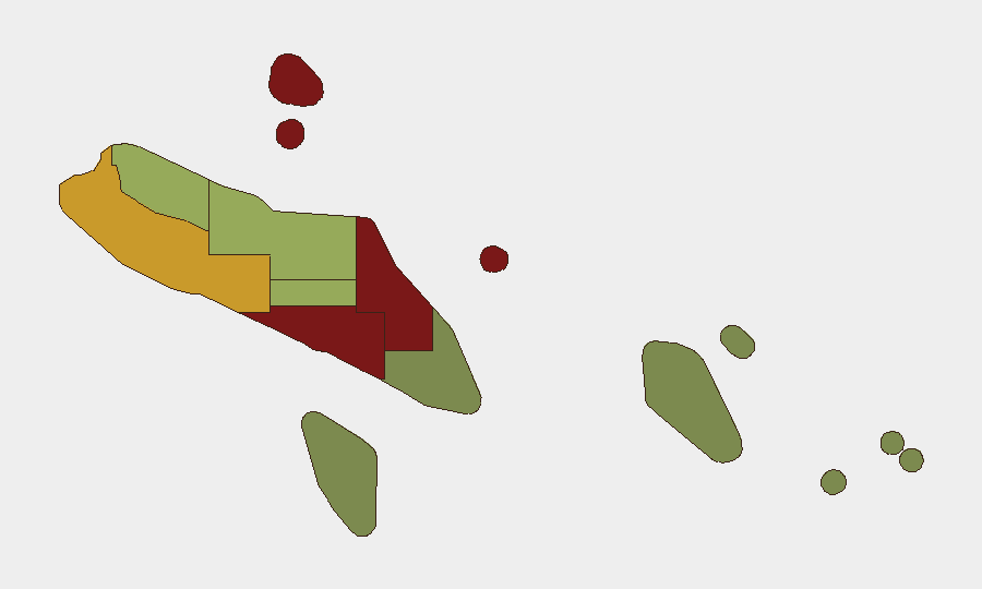
Honiara (risk 92) and Guadalcanal province (risk 88) account for the majority of tracked risk and are the primary focus for corporate security presence. Malaita (risk 85) and Western province (risk 72) represent secondary concentration zones, likely reflecting ongoing inter-community tensions and localized criminal activity documented since earlier in 2026. Risk declines sharply in eastern and southern provinces (Temotu, Rennell and Bellona under risk 25), indicating that duty-of-care and asset-protection efforts should remain concentrated in the capital and western corridor.
How GeoBit Would Assist
Organizations with personnel or assets in Solomon Islands should deploy AOI Monitoring & Early Warning on Honiara and Guadalcanal to detect emerging protests, gang activity, or civil unrest before acute events. OSINT fusion (X/Twitter, Telegram, local media) and sentiment analysis across English and Pidgin English sources would provide 48–72-hour early warning of community mobilization or security incidents. Routing & Network Analysis can identify safe transit corridors and alternative supply-chain routes around known high-risk zones, enabling continuity of operations during localized disruptions.
7-Day Outlook
No imminent acute security escalation is forecast for the next week. Underlying risk drivers—gang competition, property crime, and community tensions in Honiara and surrounding provinces—remain stable rather than accelerating. Continued U.S. and Australian diplomatic presence and maritime patrol activity is likely to sustain current baseline stabilization.
Highest-Risk Areas — Ranked
| # | State / Region | Risk |
|---|---|---|
| 1 | Honiara | 92 |
| 2 | Guadalcanal | 88 |
| 3 | Malaita | 85 |
| 4 | Western | 72 |
| 5 | Choiseul | 58 |
| 6 | Isabel | 52 |
| 7 | Central Province | 48 |
| 8 | Makira-Ulawa | 38 |
| 9 | Rennell and Bellona | 22 |
| 10 | Temotu | 18 |
Sources
Previous Daily Briefs
A new Solomon Islands brief is written every day — each with its own risk map and downloadable CSV. Here's the last week; use the calendar to go further back.
📅 Browse every day by calendar →
Highlighted days have a brief. Tap a day for that day's map & analysis, or “csv” for that day's dataset ($5).
Atlas — our AI intelligence desk — emails them this snapshot personally. Nothing else, no list.