Situation Summary
Somalia remains the 11th highest-threat country globally (composite threat score 99), driven primarily by persistent al-Shabaab insurgency and fragmented state capacity. No independently verified security incidents were corroborated across multiple sources in the last 24–48 hours; broader regional tensions involving Kenya, Ethiopia, Yemen, and diplomatic demands from multiple African states create an elevated baseline of instability. The security environment continues to be characterized by recurring asymmetric violence, clan-based tensions, and weak institutional control outside major urban centers.
Key Developments
No discrete, independently corroborated incidents meeting verification standards (multiple sources + clear Somalia location + 24–48h window) were identified in live open-source research as of 12 July 2026.
The most recent event signals tracked by GeoBit span 9–11 July and include:
- 7–11 July: Multiple regional actor demands and military posturing (Ethiopia, DRC, Nigeria, Zimbabwe, Yemen) directed at Somalia, reflecting broader geopolitical pressure rather than localized internal incidents.
- 9–10 July: Domestic law-enforcement events (police arrests, property seizure, small-arms engagement with criminal elements) indicate routine security operations in urban areas, not escalation.
- 10–11 July: Cross-border physical assaults linked to Kenya and one insurgency-attributed assault; details and specific locations require further corroboration.
Background context: Since mid-2026, al-Shabaab has maintained active cells in Mudug, Lower Shabelle, and Middle Shebelle, with episodic attacks on government and civilian targets. AU transition operations and U.S. policy shifts (reported weeks ago) have created uncertainty in counterinsurgency posture.
Highest-Risk Areas
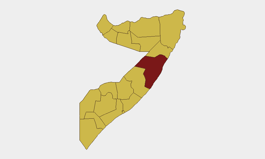
Mudug state stands alone as the critical danger zone (risk score 99.1), significantly outpacing all other regions (69.1). This reflects al-Shabaab's operational stronghold in the Galkacyo corridor and surrounding rural areas, where insurgent cells retain freedom of movement and logistics networks. A second tier of elevated risk (69.1) spans Awdal, Woqooyi Galbeed, Gedo, Bakool, Bay, Middle and Lower Juba, Lower Shabelle, Sahil, Togdheer, Hiiraan, and Middle Shebelle—a broad band indicating either active insurgent presence, weak state authority, or both. Mudug's isolation at the top suggests concentrated targeting risk for personnel and assets; the wider tier reflects distributed but lower-intensity threats.
How GeoBit Would Assist
AOI Monitoring & Early Warning with persistent watch on Mudug and secondary-risk states would enable corporate teams to receive real-time alerts on insurgent activity, movement, or security-force operations affecting asset locations or personnel routes. OSINT Fusion & Corroboration (multi-language feeds, social media, news aggregation) closes the verification gap evident in current open sources, allowing duty-of-care teams to distinguish signal from noise when evaluating incident reports. Routing & Network Analysis supports alternative journey planning and supply-chain resilience by modeling risk-aware transit corridors away from high-threat zones, particularly critical in Mudug and Lower Shabelle.
7-Day Outlook
No imminent escalation is evident from available open sources, but the absence of reported incidents does not indicate reduced threat—rather, typical al-Shabaab operational tempo and state fragmentation will likely persist. Regional diplomatic tensions (multiple African states issuing demands) may intensify political instability without direct security impact on international operations. Continued reliance on real-time area-of-interest monitoring and corroborated intelligence is essential for organizations with personnel or assets in Mudug and secondary-risk zones.
Highest-Risk Areas — Ranked
| # | State / Region | Risk |
|---|---|---|
| 1 | Mudug | 99.1 |
| 2 | Awdal | 69.1 |
| 3 | Woqooyi Galbeed | 69.1 |
| 4 | Gedo | 69.1 |
| 5 | Bakool | 69.1 |
| 6 | Bay | 69.1 |
| 7 | Middle Juba | 69.1 |
| 8 | Lower Shabelle | 69.1 |
| 9 | Sahil | 69.1 |
| 10 | Togdheer | 69.1 |
| 11 | Hiiraan | 69.1 |
| 12 | Middle Shebelle | 69.1 |
Sources
Previous Daily Briefs
A new Somalia brief is written every day — each with its own risk map and downloadable CSV. Here's the last week; use the calendar to go further back.
📅 Browse every day by calendar →
Highlighted days have a brief. Tap a day for that day's map & analysis, or “csv” for that day's dataset ($5).
Atlas — our AI intelligence desk — emails them this snapshot personally. Nothing else, no list.