Situation Summary
South Sudan remains at moderate composite risk (rank #36 globally, threat score 61) with volatile subnational pockets, particularly Unity and Central Equatoria states. The past 48 hours have seen two significant incidents—coordinated attacks on government facilities in Warrap State on July 8–9 leaving 15 dead, and a public protocol dispute between senior officials at Jubek Day ceremonies in Juba on July 12—both tied to Independence Day tensions. These events underscore fragility around state-level governance, elite cohesion, and the potential for sporadic violence during politically sensitive periods.
Key Developments
- Warrap State – July 8–9, 2026 (reported July 12)
Coordinated attacks on government facilities during South Sudan's 15th Independence anniversary killed at least 15 people and injured 12. Motive and perpetrators remain unclear; security forces have intensified presence around administrative buildings with concern over possible follow-on clashes.
- Warrap State – July 9–12 aftermath
Heightened security operations and local tension persist in affected areas following the lethal attacks. Travel to government compounds and administrative centers in Warrap carries elevated near-term risk of sporadic violence.
- Juba, Jubek State – July 12, 2026
A public confrontation between political figure Napwon and the Jubek Deputy Governor over protocol at Jubek Day celebrations signaled intra-elite friction. No violence reported, but incident reflects deeper governance and factional tensions.
- Social media / Online space – July 12, 2026
South Sudanese social media and community forums circulated discussion of both the Warrap casualty toll and the Juba protocol incident, amplifying public anxiety about political stability and local governance around the anniversary period.
- Regional political-risk signal
The combination of lethal attacks and visible elite discord during a major anniversary period indicates vulnerability to opportunistic violence and potential reputational/factional fallout among senior officials in coming days.
Highest-Risk Areas
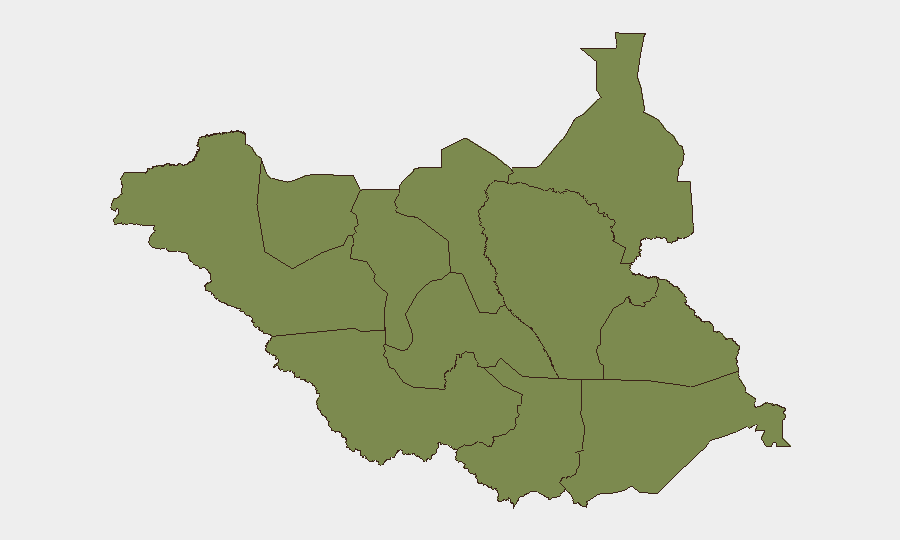
Unity State (risk score 34.8) and Central Equatoria (24.8) remain the primary drivers of South Sudan's overall threat profile, reflecting persistent intercommunal violence, resource competition, and weak state capacity in the north-central region. The Warrap State incidents of July 8–9, though not the highest-ranked state, demonstrate that risk extends beyond the top-ranked zones and can spike rapidly around political events. Eastern and Western Equatoria, along with Greater Pibor Administrative Area, maintain moderate underlying volatility related to pastoral conflict and militia activity. Juba's recent elite tensions signal that even the capital carries political-risk exposure during ceremonial and anniversary periods.
How GeoBit Would Assist
Security teams should deploy AOI Monitoring & Early Warning on Unity, Warrap, and Central Equatoria to detect triggering events in real time and enable rapid duty-of-care response. Intel Sweep and OSINT fusion (social media, regional feeds, radio SIGINT) will track post-anniversary political fallout and any escalation signals from elite disputes or security force repositioning. Risk & Threat Assessment tied to GIS & Spatial Analysis allows teams to plot personnel/asset locations against incident clusters and update movement authorization protocols accordingly.
7-Day Outlook
Short-term risk is elevated but likely to remain below mass-violence threshold. Warrap State will require continuous monitoring for secondary clashes; Juba political tensions may manifest in localized protests or elite maneuvering rather than broad unrest. By mid-to-late July, if no further incidents occur, ambient threat levels may stabilize, but the Independence Day period has demonstrated the environment's susceptibility to sudden, coordinated incidents.
Highest-Risk Areas — Ranked
| # | State / Region | Risk |
|---|---|---|
| 1 | Unity | 34.8 |
| 2 | Central Equatoria | 24.8 |
| 3 | Upper Nile | 4.8 |
| 4 | Northern Bahr el Ghazal | 4.8 |
| 5 | Western Bahr el Ghazal State | 4.8 |
| 6 | Ruweng Administrative Area | 4.8 |
| 7 | Warrap | 4.8 |
| 8 | Lakes | 4.8 |
| 9 | Jonglei | 4.8 |
| 10 | Greater Pibor Administrative Area | 4.8 |
| 11 | Western Equatoria | 4.8 |
| 12 | Eastern Equatoria | 4.8 |
Sources
Previous Daily Briefs
A new South Sudan brief is written every day — each with its own risk map and downloadable CSV. Here's the last week; use the calendar to go further back.
📅 Browse every day by calendar →
Highlighted days have a brief. Tap a day for that day's map & analysis, or “csv” for that day's dataset ($5).
Atlas — our AI intelligence desk — emails them this snapshot personally. Nothing else, no list.