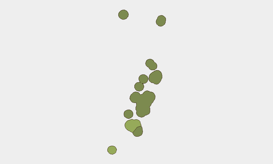
Situation Summary
Tonga remains a low-threat environment with no major security incidents, civil unrest, crime spikes, or infrastructure disruptions reported in the past 24–48 hours. The nation continues to operate under baseline risk conditions typical of a stable Pacific island state. Sub-national variation exists, with Tongatapu (the capital region) assessed at significantly higher risk than outer island groups, though even that elevation reflects routine governance, crime, and public-health management rather than acute threats.
Key Developments
No verifiably new security, civil-unrest, crime, political, infrastructure, or travel-risk incidents have been reported in Tonga during the past 24–48 hours. Open-source monitoring across news feeds, social media, and regional advisories confirms no qualifying events in that window.
Background context (outside 24–48h window, provided for operational awareness):
- Mataika shooting (27 July): Armed homicide and subsequent arrests; no new developments in the past week.
- Offshore seismic activity (early August, dates unspecified): Moderate earthquakes (M 4.3–5.1) recorded in waters surrounding Tonga; no tsunami alerts or land-based damage reported.
- Ongoing domestic issues (pre-August 5): Drug enforcement operations, anti-corruption investigations, and parliamentary debates on capital punishment remain active policy areas but have generated no timestamped new announcements in the last 1–2 days.
Highest-Risk Areas
Tongatapu (composite risk 45) dominates the sub-national picture and accounts for the bulk of Tonga's tracked risk profile. As the seat of government, primary commercial hub, and most densely populated island, it naturally concentrates crime, traffic, and governance activity. Vavaʻu (risk 28) and Haʻapai (risk 22) represent secondary risk nodes, likely reflecting smaller populations, more limited reporting infrastructure, and lower operational visibility rather than acute instability. Outer island groups (ʻEua, Ongo Niua) remain relatively contained. Risk variation is gradational rather than polarized; no region is assessed as high-threat in absolute terms.
How GeoBit Would Assist
AOI Monitoring & Early Warning would establish persistent watch on Tongatapu and key secondary islands, triggering alerts on protest activity, civil unrest, or crime clusters that could affect expatriate populations or corporate operations. Intel Sweep and multi-language OSINT (including social media and local news feeds) enable 24/7 environmental scanning to catch emerging incidents ahead of mainstream media lag. Risk & Threat Assessment with GIS & Spatial Analysis would allow security teams to map facility locations against subnational risk zones and model duty-of-care requirements by region and sector.
7-Day Outlook
No acute deterioration is forecast. Tonga's political calendar, economic activity, and weather patterns show no indicators of imminent disruption. Monitoring should remain routine, with focus on standard corporate security hygiene (staff check-ins, facility assessments, contingency updating) rather than crisis posture. Seasonal maritime activity and minor seismic events may continue but are unlikely to create material security impacts on land.
Next brief: 2026-08-06 (or upon significant event alert).
Highest-Risk Areas — Ranked
| # | State / Region | Risk |
|---|---|---|
| 1 | Tongatapu | 45 |
| 2 | Vavaʻu | 28 |
| 3 | Haʻapai | 22 |
| 4 | ʻEua | 18 |
| 5 | Ongo Niua | 12 |
Sources
Previous Daily Briefs
A new Tonga brief is written every day — each with its own risk map and downloadable CSV. Here's the last week; use the calendar to go further back.
📅 Browse every day by calendar →
Highlighted days have a brief. Tap a day for that day's map & analysis, or “csv” for that day's dataset ($5).
Atlas — our AI intelligence desk — emails them this snapshot personally. Nothing else, no list.