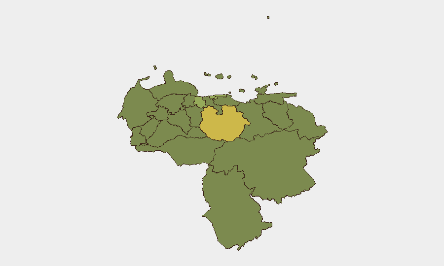
Situation Summary
Venezuela remains in acute crisis following a June 24 earthquake that has compounded pre-existing instability, infrastructure collapse, and humanitarian breakdown. Security forces are actively restricting civilian movement and aid access in damaged zones; concurrent civil unrest (road blockages, looting, protests) and elevated street crime in blackout-affected neighborhoods signal deteriorating state capacity and rising opportunistic violence. The national threat composite score of 57 and #39 global ranking reflects both chronic organized crime and acute disaster-driven instability; trajectory remains downward absent rapid stabilization.
Key Developments
- La Guaira, Vargas State (June 30): Looting reported at supermarkets and warehouses as residents seek food, water, and fuel post-earthquake; security forces deployed tear gas to disperse crowds, indicating early breakdown in relief coordination and civilian-security friction.
- Caracas—multiple neighborhoods (June 30–July 1): Organized road blockades and *cacerolazos* (pot-banging protests) erupted over prolonged power and water outages and absence of disaster aid; National Guard and police visible on major arteries, suggesting resource strain and protest escalation.
- Caracas–La Guaira Airport Corridor (June 30): Military and police checkpoints established along Highway to Simón Bolívar International Airport; authorities restricting civilian access to quake zones and turning back private supply convoys, impeding independent aid efforts.
- Northern coastal states—Vargas, Carabobo, Aragua (June 30–July 1): Collapsed bridges, debris-blocked secondary roads, and road blockages severely restrict relief convoy movement and elevate travel risk for private vehicles due to both infrastructure damage and opportunistic crime.
- Urban centers—Caracas, Maracay (June 30–July 1): Night-time armed robberies and carjackings escalating in blackout-affected neighborhoods; citizen reports indicate reduced police response capacity tied to fuel shortages and infrastructure failures.
- Simón Bolívar International Airport (June 30–July 1): Airport remains closed or severely limited; commercial flights suspended, emergency and relief operations only, significantly constraining evacuation and supply routes.
- Regional military posture (June 30–July 1): U.S. Southern Command assets (C-17 Globemaster, search-and-rescue teams) en route for humanitarian relief; increased foreign military presence in Venezuelan airspace noted as minor regional sensitivity factor despite humanitarian framing.
Highest-Risk Areas
Guarico State (67.4), Federal District/Caracas (57.9), and Vargas State (50.3) dominate the sub-national ranking, with Guarico's elevated score likely reflecting inland criminal networks and militia activity separate from earthquake impact. Vargas's third-place position directly correlates with post-earthquake looting, confrontations, infrastructure collapse, and checkpoint proliferation documented in the past 48 hours. Carabobo, Aragua, and Anzoategui complete the higher-risk tier, all characterized by broken supply chains, security-force presence, and road network disruption. Coastal and northern corridor regions face compounded risk from earthquake damage, aid-access restrictions, and organized crime exploitation of chaos.
How GeoBit Would Assist
Organizations with personnel or assets in Venezuela should employ Area-of-Interest (AOI) Monitoring & Early Warning on Guarico, Federal District, and Vargas to track checkpoint proliferation, looting events, and protest activity in near real-time. Routing & Network Analysis capabilities would support dynamic re-planning of supply chains and staff movement around collapsed bridges and police cordons. OSINT fusion (social media, citizen journalism, radio SIGINT) paired with Sentiment & Temporal Analysis enables identification of neighborhood-level crime spikes and unrest escalation before they affect operations.
7-Day Outlook
Road access to Caracas, the airport, and northern zones will likely remain severely constrained by infrastructure damage and military checkpoints through mid-July. Civil unrest may escalate if power and water outages persist and aid distribution remains uncoordinated; security-force deployments will probably increase in central Caracas and along supply corridors, raising friction risk. Opportunistic crime (robbery, carjacking) will remain elevated in darkness-affected zones absent rapid power restoration.
Highest-Risk Areas — Ranked
| # | State / Region | Risk |
|---|---|---|
| 1 | Guarico State | 67.4 |
| 2 | Federal District | 57.9 |
| 3 | Vargas State | 50.3 |
| 4 | Carabobo State | 43.9 |
| 5 | Anzoategui State | 39.6 |
| 6 | Miranda State | 39.5 |
| 7 | Zulia State | 38 |
| 8 | Barinas State | 38 |
| 9 | Apure State | 37.7 |
| 10 | Falcon State | 37.6 |
| 11 | Aragua State | 37.6 |
| 12 | Amazonas State | 37.6 |
Sources
Previous Daily Briefs
A new Venezuela brief is written every day — each with its own risk map and downloadable CSV. Here's the last week; use the calendar to go further back.
📅 Browse every day by calendar →
Highlighted days have a brief. Tap a day for that day's map & analysis, or “csv” for that day's dataset ($5).