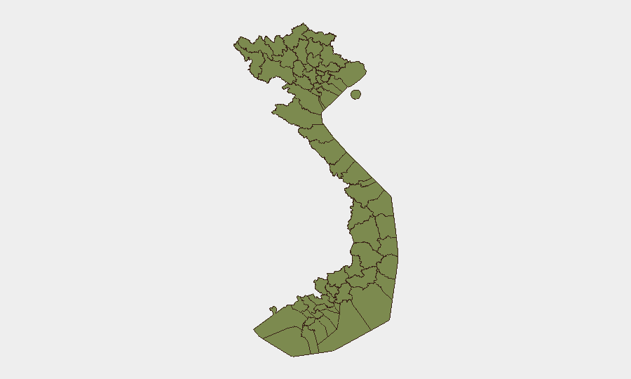
Situation Summary
Vietnam's security environment remains at moderate overall risk (composite rank #156 globally) with no large-scale civil unrest, infrastructure crises, or major conflict indicators in the past 48 hours. The threat landscape is dominated by localized crime, fatal transport accidents on key highways, youth-related public-order incidents, and isolated legal/administrative cases rather than systemic instability. Regional risk concentration in Lai Châu, Huế, and the capital corridors reflects border-zone sensitivities and urbanization pressures, but does not signal imminent escalation.
Key Developments
- Dong Nai Province (National Highway 1), 21 July early morning: A 24-berth sleeper bus caught fire following a crash, killing seven people including three children and injuring five others—a major fatal transport accident on the north–south artery critical to supply chains and personnel movement.
- An Giang Province, 21 July: Police detained two suspects (father and son) on murder charges following a violent dispute; simultaneously, 32 youth suspects were prosecuted after an organized street fight involving improvised weapons left one person with 59% bodily harm, signaling concentrated youth-gang violence in the Mekong region.
- Gia Lai Province (Gia Lai City), 21 July: Six individuals were temporarily detained in connection with a fatal motorcycle crash on Nguyễn Chí Thanh Street that killed three teenagers; police are investigating criminal elements in the incident.
- Cà Mau City, 21 July (announced): Authorities issued arrest warrants for two minors (ages 18 and 19) for causing public disorder in a youth-related disturbance.
- Phú Thọ Province, 21 July: Police arrested a resident of Lào Cai on robbery charges; 17 related suspects face prosecution for disturbing public order, indicating multi-suspect property-crime networks.
- Tuyên Quang Province, ~21 July: Authorities executed an emergency detention order against a teacher (Nguyễn Hà Duy); details are limited, but the case has attracted BBC Vietnamese coverage and carries potential civil-liberties sensitivities.
Highest-Risk Areas
Lai Châu Province (risk 31.8) and Huế (24.2) drive the highest composite risk scores—Lai Châu reflects border-zone volatility and remote-area governance challenges, while Huế's score likely reflects regional political sensitivities and historical protest activity. Ho Chi Minh City and Hà Nội (both 9.2) carry urban crime and administrative tension. The northern tier provinces (Lào Cai, Hà Giang, Cao Bằng, Điện Biên) remain elevated due to proximity to China, cross-border smuggling networks, and ethnic-minority governance dynamics, though individual risk scores remain modest. The recent events cluster in An Giang, Gia Lai, Cà Mau, and Phú Thọ (not top-ranked) suggests localized crime spikes rather than systemic regional breakdown.
How GeoBit Would Assist
Security teams would use Intel Sweep and multi-language OSINT (including Vietnamese-language media feeds and social-media monitoring) to detect emerging youth-violence trends and organized-crime networks before they scale. AOI Monitoring with alerting on Lai Châu, Huế, and key transport corridors (such as National Highway 1) would provide early warning of transport incidents, border-zone activity, and administrative crises. Network & Actor Analysis applied to the recurring youth-gang suspects and cross-province robbery rings would map criminal-network structure and predict downstream incidents.
7-Day Outlook
No indicators point to imminent large-scale unrest or regime instability over the next week. Transport-accident frequency and youth-gang violence will likely persist at current levels absent significant policy intervention or triggering events. Close monitoring of Tuyên Quang's teacher-detention case and any international diplomatic response (Australia, Japan public statements noted in event signals) may yield secondary political friction, but escalation risk remains low.
Highest-Risk Areas — Ranked
| # | State / Region | Risk |
|---|---|---|
| 1 | Lai Châu Province | 31.8 |
| 2 | Huế | 24.2 |
| 3 | Ho Chi Minh City | 9.2 |
| 4 | Hà Nội | 9.2 |
| 5 | Hòa Bình Province | 6.7 |
| 6 | Lào Cai Province | 1.8 |
| 7 | Hà Giang Province | 1.8 |
| 8 | Tuyên Quang Province | 1.8 |
| 9 | Cao Bằng Province | 1.8 |
| 10 | Bắc Kạn Province | 1.8 |
| 11 | Điện Biên Province | 1.8 |
| 12 | Yên Bái Province | 1.8 |
Sources
Previous Daily Briefs
A new Vietnam brief is written every day — each with its own risk map and downloadable CSV. Here's the last week; use the calendar to go further back.
📅 Browse every day by calendar →
Highlighted days have a brief. Tap a day for that day's map & analysis, or “csv” for that day's dataset ($5).
Atlas — our AI intelligence desk — emails them this snapshot personally. Nothing else, no list.