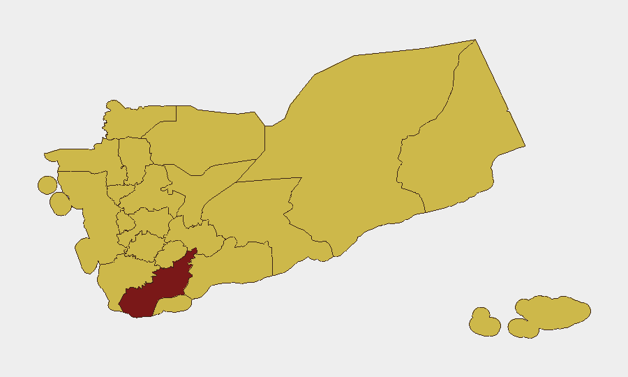
Situation Summary
Yemen remains in a state of protracted fragmentation and armed contestation, with composite threat levels holding steady at #18 globally (92/100). Sub-national risk is heavily concentrated in southern and western governorates, particularly Lahij (94.1), where localized armed clashes and state collapse dynamics persist. Over the past 48 hours, small arms combat has been recorded in multiple locations, though the scale and specific territorial implications remain under assessment. The underlying drivers—governance vacuum, armed group competition, and resource scarcity—show no sign of abatement.
Key Developments
- 2026-06-29 · Small Arms Combat · Yemen (location unspecified). Tactical clashes reported without immediate casualty or displacement data.
- 2026-06-29 · Small Arms Combat · Yemen vs ABDULLAH (location unspecified). Armed engagement involving named antagonist; context and scale pending corroboration.
- 2026-06-28 · Rejection Event · Yemeni actor(s). Nature of rejection (political, operational, or institutional) requires further investigation.
*Note: Open-source coverage in the last 24–48 hours has not yet yielded additional location-specific, verifiable incidents. Ongoing monitoring for Houthi Red Sea operations, southern separatist activity, and inter-tribal conflicts continues; broader regional maritime and Iran–US tensions are being tracked separately.*
Highest-Risk Areas
Lahij Governorate (94.1) stands as Yemen's single highest-risk sub-national zone, driven by a combination of armed group presence, weak state authority, and proximity to critical transport corridors. The northern and western cluster—Sa'dah, Hajjah, Al Hudaydah, 'Amran, and Sana'a—all register at 64.1 and reflect persistent Houthi influence, inter-militia friction, and humanitarian access constraints. Amanat Al Asimah (Sana'a city, 69.1) and Marib (66.6) are secondary focal points for political/military competition and economic activity. Teams with personnel or supply chains in these zones face elevated exposure to armed violence, movement restriction, and administrative harassment.
How GeoBit Would Assist
Intel Sweep and multi-language OSINT fusion enable continuous monitoring of Telegram, X, and Houthi media channels for emerging tactical changes and cadence shifts. Battle mapping and force-structure tracking pinpoint armed-group dispositions and territorial claims in real time, feeding AOI Monitoring & Early Warning for specific facilities, routes, or governorates requiring persistent watch. Routing & Network Analysis supports alternative journey planning for personnel and convoys to bypass hotspots, while satellite & imagery analysis can validate reported incidents and assess access corridors. Together, these capabilities allow security teams to move beyond backward-looking threat reports and gain forward-looking decision advantage.
7-Day Outlook
No major shift in armed-group activity or state-level intervention is anticipated over the next week. Localized small-arms clashes are likely to continue at current tempo, particularly in Lahij and the northern governorates where militia competition for resources and territory remains unresolved. Maritime incidents around the Red Sea and Bab al-Mandab should be monitored independently; humanitarian access degradation is probable if inter-factional tensions escalate.
Highest-Risk Areas — Ranked
| # | State / Region | Risk |
|---|---|---|
| 1 | Lahij Governorate | 94.1 |
| 2 | Amanat Al Asimah | 69.1 |
| 3 | Marib Governorate | 66.6 |
| 4 | Sa'dah Governorate | 64.1 |
| 5 | Hajjah Governorate | 64.1 |
| 6 | Al Mahwit Governorate | 64.1 |
| 7 | Al Hudaydah Governorate | 64.1 |
| 8 | 'Amran Governorate | 64.1 |
| 9 | Sana'a Governorate | 64.1 |
| 10 | Raymah Governorate | 64.1 |
| 11 | Dhamar Governorate | 64.1 |
| 12 | Ibb Governorate | 64.1 |
Sources
Previous Daily Briefs
A new Yemen brief is written every day — each with its own risk map and downloadable CSV. Here's the last week; use the calendar to go further back.
📅 Browse every day by calendar →
Highlighted days have a brief. Tap a day for that day's map & analysis, or “csv” for that day's dataset ($5).