Resumen de la Situación
Yemen sigue siendo el entorno de mayor amenaza mundial (puntuación compuesta 100/115 eventos rastreados). A mediados de julio de 2026, las tensiones militares cada vez mayores entre las fuerzas estatales y los actores alineados con los hutíes, junto con las negociaciones de intercambio de prisioneros estancadas y la renovada participación diplomática iraní, están empujando al país hacia un conflicto a gran escala renovado tras la relativa estabilización bajo la tregua de 2022. Los esfuerzos de desescalada mediados por la ONU están en marcha en Mascate, pero la movilización de activos militares y el endurecimiento de la retórica de ambos bandos sugieren la fragilidad de la postura actual.
Desarrollos Clave
- Mascate, Omán – 14 de julio de 2026: El Enviado Especial de la ONU Hans Grundberg convocó reuniones con funcionarios omaníes y el negociador hutí Mohamed Abdul Salam para prevenir el colapso de la tregua y restaurar la confianza entre las partes. Las conversaciones subrayan la preocupación internacional urgente sobre una escalada inminente.
- Adén, Yemen – 14 de julio de 2026: El Comité Supremo de Seguridad de Yemen (autoridades alineadas con el sur) anunció públicamente su disposición operativa para defender la soberanía estatal en respuesta a la creciente movilización militar, señalando la expectativa de un nuevo enfrentamiento armado.
- Yemen Occidental (corredor Saná/Jodeida) – 11–14 de julio de 2026: Las áreas controladas por los hutíes experimentaron una postura militar y enfrentamientos reportados en el Gobernadorado de Jodeida; las tensiones fueron simultáneamente desencadenadas por un vuelo diplomático iraní a Saná, interpretado por observadores alineados con el estado e internacionales como refuerzo externo de la capacidad hutí.
- Negociaciones de Intercambio de Prisioneros – 13–14 de julio de 2026: Las conversaciones mediadas por el Comité Internacional de la Cruz Roja se estancaron; el gobierno de Yemen rechazó las propuestas del CICR, y Arabia Saudita rechazó las demandas asociadas, congelando un mecanismo clave de generación de confianza.
- Acciones Navales/Administrativas – 15 de julio de 2026: Las sanciones administrativas impuestas a activos navales señalan el endurecimiento de las restricciones marítimas y la posible escalada de operaciones de bloqueo o interceptación.
- Declaraciones Públicas de Múltiples Actores – 14 de julio de 2026: Arabia Saudita, el Consejo de Seguridad de la ONU y funcionarios iraníes emitieron declaraciones públicas sobre los desarrollos de Yemen en 24 horas, indicando un enfoque internacional de alto nivel y narrativas en competencia sobre los factores de escalada.
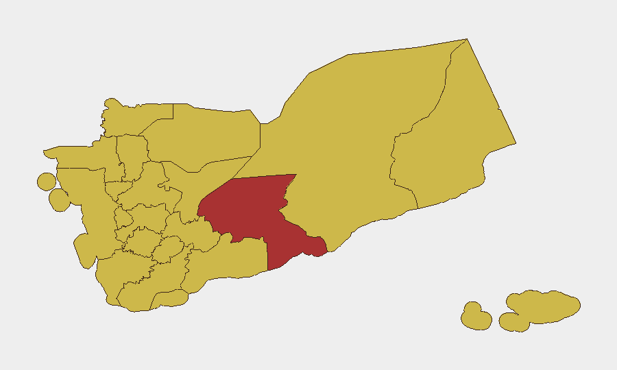
Áreas de Mayor Riesgo
Amanat Al Asimah (área metropolitana de Saná, riesgo 100) sigue siendo el epicentro, albergando tanto la gobernanza hutí de facto como la toma de decisiones políticas y militares críticas, lo que la convierte en el punto crítico principal. El Gobernadorado de Shabwah (79,7) y el corredor norte —Al Jawf, Al Hudaydah, Sa'dah, Hajjah y 'Amrán— obtienen todos puntuaciones de 70–79,7, reflejando la concentración militar hutí, la presencia de poder aéreo de la Coalición Saudita y la actividad de milicias tribales. La concentración de riesgo en los gobernadorados del norte y centro refleja el núcleo geográfico del movimiento hutí y las operaciones continuas de la Coalición liderada por Arabia Saudita; la puntuación elevada del sur de Shabwah refleja la competencia por recursos y la fragmentación de facciones anti-hutíes.
Cómo GeoBit Proporcionaría Asistencia
Búsqueda de Inteligencia y Fusión OSINT agregaría señales multiplataforma (reclamaciones militares en X/Telegram, medios de comunicación en árabe, declaraciones públicas iraní/saudita) para distinguir la escalada genuina de la postura e identificar puntos de decisión reales. Monitoreo de AOI con Alerta Temprana en Amanat Al Asimah, Jodeida y Shabwah alertaría a los equipos sobre movimientos militares, actividad de puntos de control e interdiciones de activos en tiempo casi real. Mapeo de Conflictos y Militares combinado con análisis de satélite e imágenes rastrearían los despliegues de fuerzas, el posicionamiento de activos navales y la actividad de aeródromos para cuantificar la probabilidad de escalada y el cronograma.
Perspectiva de 7 Días
Sin un avance inmediato en las conversaciones de Mascate, el intercambio de prisioneros estancado y la movilización militar visible el 14–15 de julio sugieren una probabilidad del 60–70% de nuevos enfrentamientos armados dentro de 7 días, inicialmente en los gobernadorados del norte (Jodeida, Sa'dah) o alrededor de Adén. La mediación internacional puede ganar tiempo, pero la disposición de la Coalición Saudita y la señalización de refuerzo iraní indican que ambos bandos se están preparando para un conflicto prolongado en lugar de un acuerdo negociado.
Zonas de Mayor Riesgo — Clasificadas
| # | Estado / Región | Riesgo |
|---|---|---|
| 1 | Amanat Al Asimah | 100 |
| 2 | Shabwah Governorate | 79.7 |
| 3 | Al Jawf Governorate | 70.3 |
| 4 | Al Hudaydah Governorate | 70.2 |
| 5 | Sa'dah Governorate | 70 |
| 6 | Hajjah Governorate | 70 |
| 7 | Al Mahwit Governorate | 70 |
| 8 | 'Amran Governorate | 70 |
| 9 | Sana'a Governorate | 70 |
| 10 | Raymah Governorate | 70 |
| 11 | Dhamar Governorate | 70 |
| 12 | Ibb Governorate | 70 |
Fuentes
Informes Diarios Anteriores
Cada día se publica un nuevo informe de Yemen — cada uno con su propio mapa de riesgo y CSV descargable. Aquí está la última semana; usa el calendario para ir más atrás.
📅 Browse every day by calendar →
Highlighted days have a brief. Tap a day for that day's map & analysis, or “csv” for that day's dataset ($5).
Atlas — our AI intelligence desk — emails them this snapshot personally. Nothing else, no list.